

Hurricane Sandy NYC Pictures: Facts And Photos For Fourth Anniversary The Devastating Storm In New York, New Jersey


Four years ago Saturday, Hurricane Sandy smashed into the eastern seaboard of the United States, destroying homes and businesses with massive flooding and waves and leaving major portions of the area without electricity. The impact was devastating from New York down to Maryland and killed 159 people in the U.S., Haiti, Cuba, the Dominican Republic, Bahamas and elsewhere, according to the National Oceanic and Atmospheric Administration.
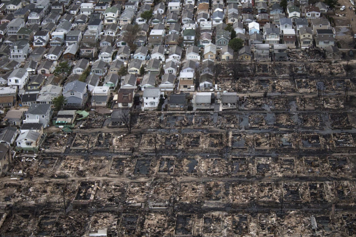
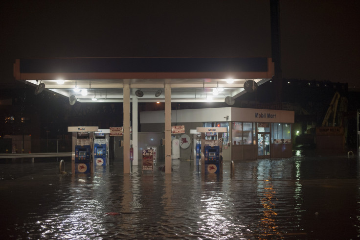
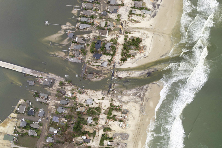
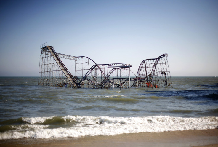
The storm, which made landfall in New York City and New Jersey Oct. 29, 2012 with wind speeds as high as 80 mph, ripped boardwalks apart and cut power for more than 8.5 million people in 15 states. Houses were destroyed all over including more than 80 homes from one fire in the Queens borough of New York City.
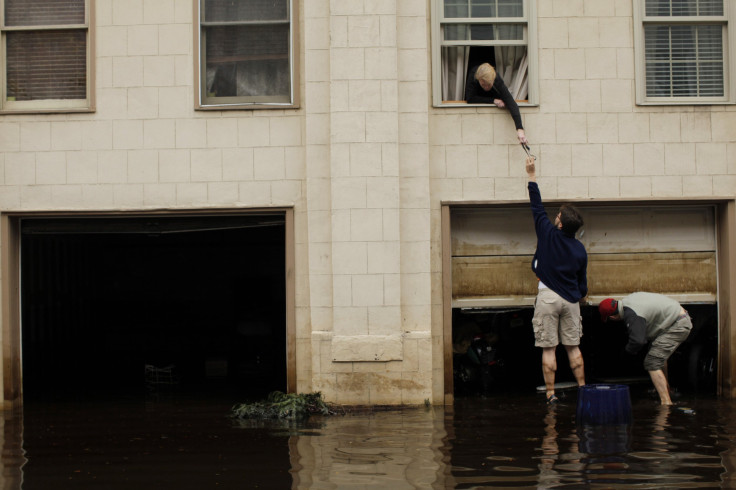
The storm ultimately racked up $65 billion in damages, making it the second most expensive weather disaster in U.S. history behind Hurricane Katrina. Those damages occurred in the form of burnt or flooded homes in the afflicted areas. But public infrastructure was also affected in places like New York City’s subway system, which was inundated with water, causing damage that still has not been completely repaired in some places. Many homeowners whose homes were flooded or damaged in the region also continue to struggle with repairs after lengthy delays in disaster relief money disbursements.
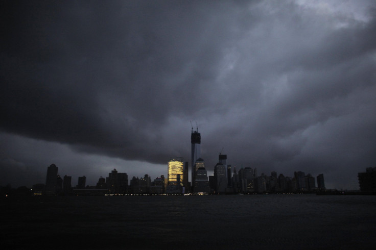
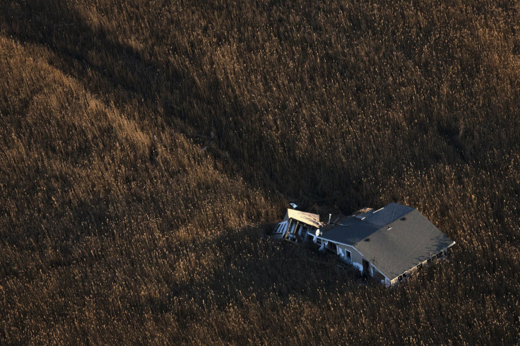
The devastating storm left behind some rather iconic photographs of the toll Sandy had on communities. From the photograph taken off the southern tip of Manhattan at night showing the large swath of the borough without power that made it onto the cover of New York Magazine, to the images of homes teetering on the brink of collapse after their walls were ripped away during the storm, the images tell a heartbreaking story about the impact of the hurricane.
this week's @NYMag cover of Manhattan after Hurricane Sandy, what a powerful and sobering image. pic.twitter.com/lCRkT3SZ
— kelly behun (@KellyBehun) November 4, 2012

© Copyright IBTimes 2025. All rights reserved.
- MOST POPULAR IN National


