

Kansas Storm Damage: Several Injured As Tornado Destroys Homes, Airport Closed [Photos]
Several people were injured and major structural damage was reported after a large tornado moved through eastern Kansas on Tuesday evening.
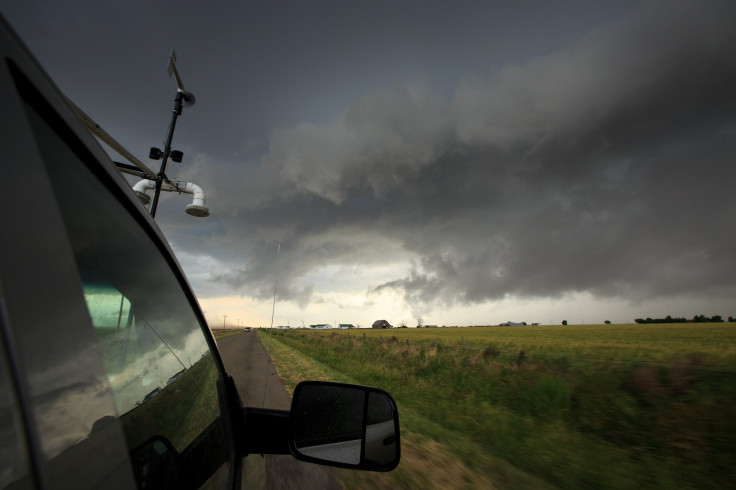
The National Weather Service (NWS) declared a "tornado emergency" for several counties after a tornado touched down in Lawrence shortly after 6 p.m. local time (7 p.m. EDT). The majority of damage occurred outside the Lawrence city limits, especially in the neighboring city of Linwood. Damaged trees and downed power lines were spotted on roads, some of which were impassable, and over 13,000 homes were without power.
“Debris is falling from the sky from this tornado along I-70, north-northeast of Edwardsville, KS Take shelter now if you are in the path of this tornado!” NWS tweeted.
NW Consolidated Fire Chief sent me these photos from Leavenworth Co Rd 1 and Alexander. (@kmbc) pic.twitter.com/7IUsjtybnW
— William Joy (@WilliamJoy) May 29, 2019
The Douglas County Sheriff's Department spokeswoman confirmed that at least 12 people suffered injuries during the storm and one of them was seriously injured.
Lots of damage in south Lawrence, KS after the tornado touched down here.
— Brian Johnson (@BrianKMBC) May 29, 2019
Watch live coverage on @kmbc pic.twitter.com/KBPG889F54
The NWS canceled the tornado warning for the Kansas City metro but said, "Although the warning has been (canceled), don't let your guard down. Hail and strong winds are still possible, so stay inside and be prepared to take shelter if necessary."
Douglas County Emergency Management said buses were arranged to take displaced residents to shelters and an American Red Cross shelter set up at a church had to relocate because of the power outage. The Kansas City International Airport was also closed and flights were temporarily suspended due to storm debris and the passengers were sent into the parking tunnels for their safety.
HOUSES DESTROYED: Several houses were damaged south of Lawrence. A "Large and Destructive" tornado that went through near Eudora, Douglas Co. Emergency Management says. pic.twitter.com/eca5zbiqMd
— WIBW Weather (@WIBWweather) May 28, 2019
Tornado damage in Lawrence, KS: This was a two-story home where the Harrell family lived. They drove to a parking garage to seek shelter. When they returned this is what they found.
— Brian Johnson (@BrianKMBC) May 29, 2019
More on @kmbc pic.twitter.com/sEPwDdrsgf
Speaking to the Lawrence Journal-World, Misty Stofer, a resident of Lawrence, said, “When we thought it (tornado) was over my husband went out and immediately came back and said water is coming in the basement because our roof is gone. I thought the house was going to collapse. I said we had to get out of there. We tried to get to his car, but there was a tree on it.”
Apart from the tornadoes, the NWS said parts of Kansas could also witness flash flooding at night.
“Flash Flooding is also a BIG concern tonight! Up to 2 inches of rain has already fallen in most of these areas, with 1-2 more inches possible. If you come across a flooded roadway or barricade, turn around and find another route!" NWS tweeted.
— Fox 4 Weather KC (@fox4wx) May 29, 2019
Tornado is ongoing best Lucas Kansas #kswx pic.twitter.com/Qem70edkWl
— Devin Pitts (@DevinWxChase) May 28, 2019
© Copyright IBTimes 2024. All rights reserved.
-

Romney Says Biden Made 'Enormous Error' By Not Pardoning Trump In Hush Money Case
-

Hunter Biden's Imminent Trial Raises White House Concerns
-

Monetary Metals Yield: Ushering In A Golden Era, One Ounce At A Time
-

'Ready To Rumble' - Biden, Trump Agree To Two Election Debates
-

Hong Kong's Financial Empire Faces Critical Turning Point As Chinese Power Increases
-

Top UN Court Hears S. Africa Calls To Stop Israel Rafah Offensive
-

Qatar Eyes More Long-term Gas Supply Deals This Year
-

Barge Collision In Texas Causes Oil Spill, Shuts Down Pelican Island Bridge
-

Pro-Turkey Syria Mercenaries Head To Niger To Earn Cash
-

A Gloomy Season For Ethiopia's 'Green Gold' At The Khat Market


