

Nigeria Launches Satellites for Crop Monitoring, Urban Planning

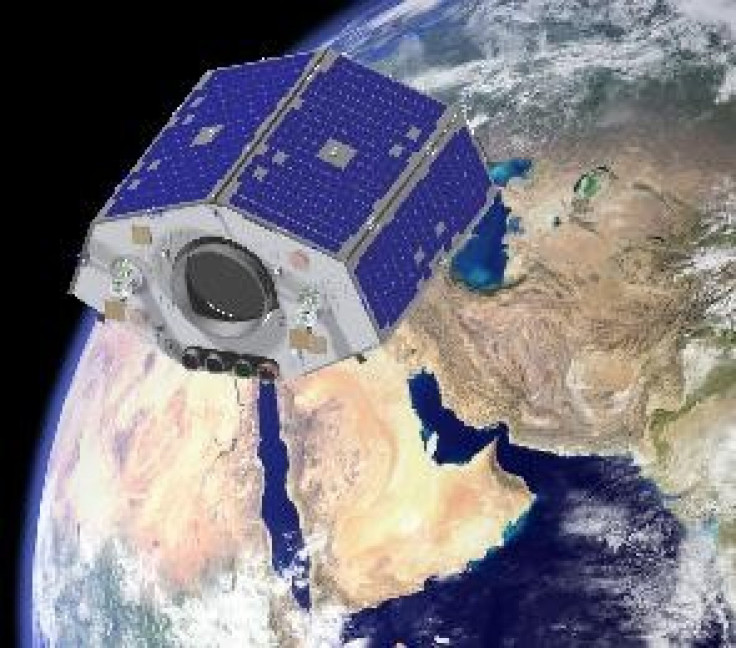
Two satellites launched on Wednesday by Nigeria will help the African nation monitor weather patterns and resource management.
The launch happened in Yasny, in Southern Russia.
The NigeriaSat-2 launched with NigeriaSat-X, which was built by a group of 26 Nigerian engineers in a Surrey Satellite Technology Ltd. (SSTL) training program at the company's facilities in Guildford, England. The spacecraft will supplement NigeriaSat-2 data with 22-meter resolution across a 600-km swath, according to aviationweek.com
In collaboration with UK engineers, the SSTL's NigeriaSat-2 and NigeriaSat-X satellites are being monitored from control stations in Guildford and Abuja, Nigeria.
"NigeriaSat-2 is defining new standards in Earth observation and avionics, providing a highly capable and flexible multi-mode operation," said Matt Perkins, SSTL CEO, in a pre-launch announcement, as reported by aviationweek.com. "SSTL provides unique training and development programs. Teaming up with Nigerian engineers in this latest program will ensure that NASRDA ground controllers are able to oversee both of these advanced-technology satellites and make full use of the image data."
The launch of these two Earth observation satellites will enhance Nigeria's capabilities, along with the rest of Africa, in natural resource management and could help with disaster relief. This is so because the country is now enable to conduct monthly crop monitoring and help with increasing urban planning demands through the development of engineering skill. Moreover, Nigerians will be able to advance the growth of new technologies in the country.
NigeriaSat 2, weighed about 600 pounds at launch and will provide high-resolution maps of Nigerian territory and monitor crops to ensure the nation's food supply I secured. It resolution is sharp enough to capture roads, homes, fields and keep track of floods, droughts, earthquakes and other natural disasters, according to reports. These images will also help with the urban planning.
"The completion of this significant engineering project is testament to the success of the rapidly growing UK space industry," said David Willetts, the UK science minister. "Not only are we producing technology and services that are in global demand but we are also helping more countries use satellite imagery to tackle important issues, including urban development and disaster relief."
© Copyright IBTimes 2024. All rights reserved.
-

Panama Papers Law Firm Boss Ramon Fonseca Dead
-

Pandemic Agreement Talks Go To The Wire
-

Low-cost MRI Paired With AI Produces High-quality Results
-

School's Out: How Climate Change Threatens Education
-

Hong Kong Demands Online Platforms Remove Banned Protest Song
-

2023 'Year Of Record Climatic Hazards' In Latin America: UN
-

Crypto Community Buzzes As Grayscale Withdraws Ethereum Futures ETF Application
-

Mongolia's Wildlife At Risk From Overgrazing
-
Milking Venom From Australia's Deadly Marine Animals
-

TikTok Challenges Potential US Ban In Court


