

‘Polar Bear Capital Of The World’ Now On Google Maps; New Photos ‘Connect People To The Arctic’

There might not be many streets in the “Polar Bear Capital of the World,” but Google Maps users can now get an unprecedented look at the tundra that some polar bears call home.
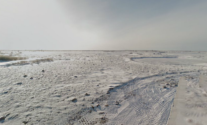
Launched on Feb. 27 as part of Polar Bear Day, the town of Churchill, Manitoba, and nearby Cape Churchill and Wapusk National Park can be seen using Google Street View. Located on the west shore of Hudson Bay, the town and surrounding wildlife give users located elsewhere a taste of Arctic life.
"I think the whole thing is going to be really exciting," Krista Wright, executive director of the conservation group Polar Bears International, which partnered with Google on the project, told the Canadian Broadcast Corporation. "You have the opportunity to see polar bears in natural habitat. There's imagery of sparring bears -- this behavior that we see with male bears where they stand up on their hind legs and kind of play-fight. There's images of a mom nursing a cub."
While Churchill is one of the few human settlements where polar bears feel safe enough to come out and show themselves, finding them on the Google Map Street View will take some searching since the vast majority of the new images are of the tundra landscape, coastal views and the town.
"You get a sense of how these animals interact with one another, and you also have the opportunity to see their size and the power," Wright said. "It connects people to the Arctic, the imagery is really spectacular, and so there's this opportunity for people to become connected to the ... polar bears and the unique ecosystem that very few people get to actually go see."
Aaron Brindle, a spokesperson for Google, who co-led the project, explains that spotting the polar bears might be difficult.
"Sometimes they'll be hard to spot, sometimes they'll be closer up," he said. "Just to be clear, you're not going to be seeing the polar bear through telescopic lens of a professional photographer."
The images were captured using a Google Maps Trekker mounted on a tundra buggy. In collaboration with the touring company, Frontiers North Adventures, Google was able to capture more than 25 miles' worth of photos.
Wright adds the footage may help scientists understand the impact of climate change on one of the southernmost regions to house polar bears.
"It's one of the most southern [polar bear] populations -- that and the Southern Hudson Bay -- and because of that we're seeing climate change impact on that population due to this ice-free period of time," she told CTV News. "The break-up is happening earlier in the midsummer ... and essentially the less time bears spend on the ice the less time they have for feeding primarily."
© Copyright IBTimes 2025. All rights reserved.
- MOST POPULAR IN Science


