

Tornado In Laramie, Wyoming: Thunderstorm, Flash Flood Warning For Multiple Counties [Photos]

A powerful tornado was seen moving just north of Laramie, Wyoming, on Wednesday.
The National Weather Service (NWS) in Cheyenne, Wyoming, issued the first tornado warning at 5:58 p.m. local time (7:58 p.m. EDT) for Albany County, Wyoming. “A confirmed tornado was located 7 miles southwest of Baldy Peak, or 9 miles north of Laramie, moving southeast at 10 mph,” the warning stated.
The tornado touched down at Laramie at 6:15 p.m. local time (8:15 p.m. EDT) and brought half dollar-sized hail along with it. The NWS warned people to seek shelter as the tornado was powerful enough to destroy mobile homes, trees, rooftops, windows and vehicles.
“To repeat, a tornado is on the ground. TAKE COVER NOW! Move to a basement or an interior room on the lowest floor of a sturdy building. Avoid windows. If you are outdoors, in a mobile home, or in a vehicle, move to the closest substantial shelter and protect yourself from flying debris,” the warning stated.
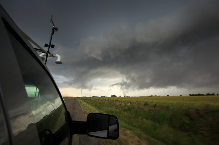
Soon, social media was abuzz with people in Laramie posting photos of the tornado in the area:
HUGE stovepipe tornado touches down in Laramie, WY. pic.twitter.com/caiAKVsYzd
— WeatherNation (@WeatherNation) June 7, 2018
Incredible photos of this evening's tornado near Laramie, Wyoming. Storm spotters report this twister was on the ground for about an hour! Photo 1 courtesy Lucky Doo Adventures, Photo 2 coutesy Matt Makens. Photo 3 courtesy Reed Timmer. #wywx #KUTV2News @KUTV2News pic.twitter.com/pTSo51tAOP
— Lindsay Storrs (@lindsay_storrs) June 7, 2018
Tornado directly west of our house. 8 miles N of Laramie @JessicaLebelWX pic.twitter.com/uwytWJRO5P
— Aaron Voos (@atvoos) June 6, 2018
Tornado north of Laramie #wywx pic.twitter.com/g89LzlvS9X
— Coltin Grasmick (@Codagras) June 6, 2018
Laramie tornado. View from the front yard. Be safe everyone. pic.twitter.com/CgOWZPlZv4
— Bryan Shuman | Promote democracy, condemn violence (@WyClimate) June 6, 2018
Tornado north of Laramie #wywx pic.twitter.com/g89LzlvS9X
— Coltin Grasmick (@Codagras) June 6, 2018
Tornado in Laramie, WY right now pic.twitter.com/eDJha4tfcm
— Brian (@Brian___H) June 6, 2018
@JimCantore anvil with a tornado on the ground north of Laramie, WY. pic.twitter.com/ZrXS2rUjkg
— Paul Hesco (@paulhesco) June 7, 2018
A severe weather warning was issued at 6:08 p.m. local time (8:08 p.m. EDT), which excluded Laramie from the areas that can expect severe damage from the tornado. “This tornadic thunderstorm will remain over mainly rural areas of east central Albany County,” added the warning which was supposed to stay in effect till 6:30 p.m. local time (8:30 p.m. EDT).
A second tornado warning was issued at 6:29 p.m. local time (8:29 p.m. EDT), wherein the duration of the warning was extended till 7 p.m. local time (9 p.m. EDT). The most recent warning also included Western Laramie County in southeastern Wyoming, apart from the already existing Albany County.
In addition to this, the NWS of Cheyenne also issued severe thunderstorm warnings for Pine Bluffs, Burns and Carpenter in Wyoming; and Kimball, Hemingford and Berea in Nebraska. Also, flash floods were expected in Sidney, Lodgepole and Gurley in Nebraska.
“A line of strong thunderstorms is moving slowly northward towards the I-80 corridor in eastern Laramie County, WY and Kimball, County, NE. A strong thunderstorm moving northward across Box Butte and Dawes Counties in Nebraska,” the NWS added in a tweet.
© Copyright IBTimes 2024. All rights reserved.
- MOST POPULAR IN National


