Tropical Storm Emily Strengthens, Nearing Puerto Rico, Haiti
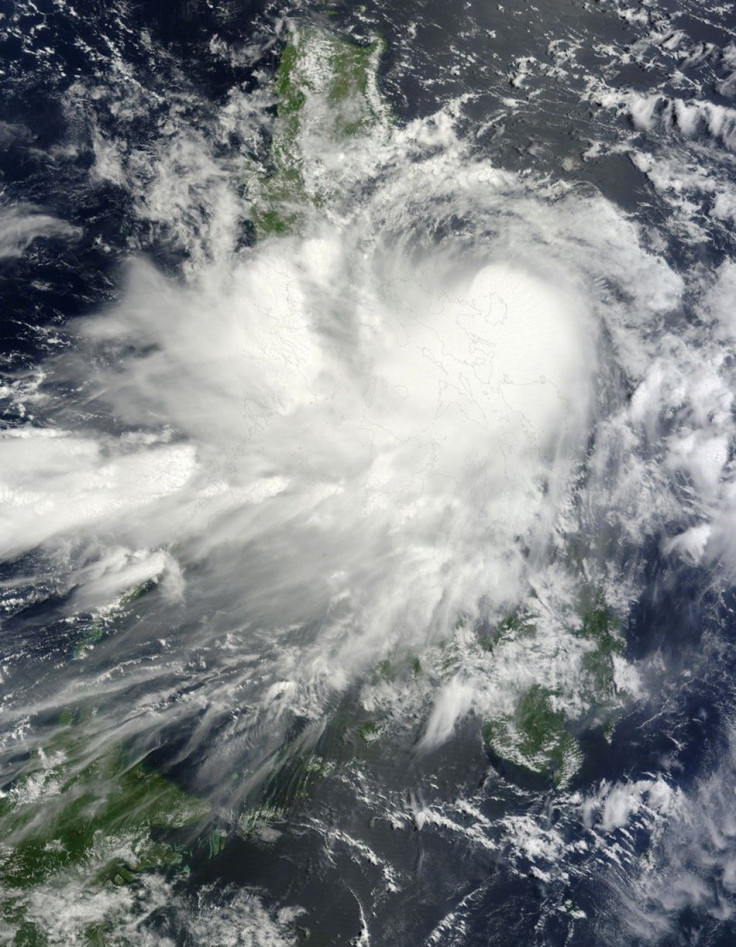
Tropical storm Emily is gaining strength and is expected to approach Hispaniola Tuesday night and Wednesday. Meanwhile, tropical storm conditions are expected in Puerto Rico, Culebra and Vieques later Tuesday and in the Dominican Republic by Tuesday night, according to National Hurricane Center (NHC).
Forecasters say tropical storm conditions are possible in the U.S. Virgin Islands later Tuesday morning and in Haiti by Wednesday.
In addition, the center of Emily will move across the northeastern Caribbean Sea Tuesday and approach Hispaniola by night and Wednesday.
Maximum sustained winds are expected to remain near 40 mph with higher gusts. Some slow strengthening is possible over the next day or so before Emily interacts with land, the NHC said.
The agency, which said tropical storm force winds extend outward up to 70 miles from the center, also warned that Emily is expected to produce total rain accumulations of 2 to 4 inches in the northern Windward Islands and Leeward Islands.
Total rain accumulations of 4 to 6 inches are expected in Puerto Rico and the Dominican Republic, with isolated maximum amounts of 10 inches possible. These rains could cause life-threatening flash floods and mud slides in areas of mountainous terrain, according to the NHC.
In addition, a storm surge will raise water levels by 1 to 2 feet above normal tide levels in the tropical storm warning area. Near the coast, the surge will be accompanied by large and dangerous waves.
Emily is about 265 miles southeast of San Juan, Puerto Rico and is traveling west at 14 miles per hour.
© Copyright IBTimes 2026. All rights reserved.
- MOST POPULAR IN Society