

Zealandia: Scientists Drilling Into ‘Lost Continent,' See Exploration Map

Scientists are learning more about Zealandia, the submerged “lost continent” that lies beneath the ocean surrounding New Zealand, after drilling deep into the landmass during a research expedition.
One of their main discoveries is that Zealandia, which currently lies about two-thirds of a mile below the ocean surface, was not always that far down, according to the National Science Foundation, which supported the expedition. The scientists know that because of the fossils that came up with the sediment they had drilled — certain marine creatures will live only at specific depths, so the existence of their remains speaks to how far beneath the surface the landmass was at the time the creatures lived.
“More than 8,000 specimens were studied, and several hundred fossil species were identified,” co-chief scientist Jerry Dickens, from Rice University, said in the NSF statement. “The discovery of microscopic shells of organisms that lived in warm shallow seas, and of spores and pollen from land plants, reveal that the geography and climate of Zealandia were dramatically different in the past.”
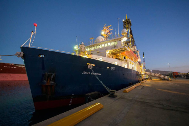
The scientists aboard the ship JOIDES Resolution drilled thousands of feet of sediment cores — samples whose vertically stacked layers represent deeper and deeper dives into the history of the planet and thus can show experts how conditions like climate and volcanic activity evolved over time. The drilling went deep enough to reach 70 million years into the past, shortly after Zealandia separated from Antarctica and then Australia. With the exception of the islands of New Zealand, it is now underwater and covered in mud.
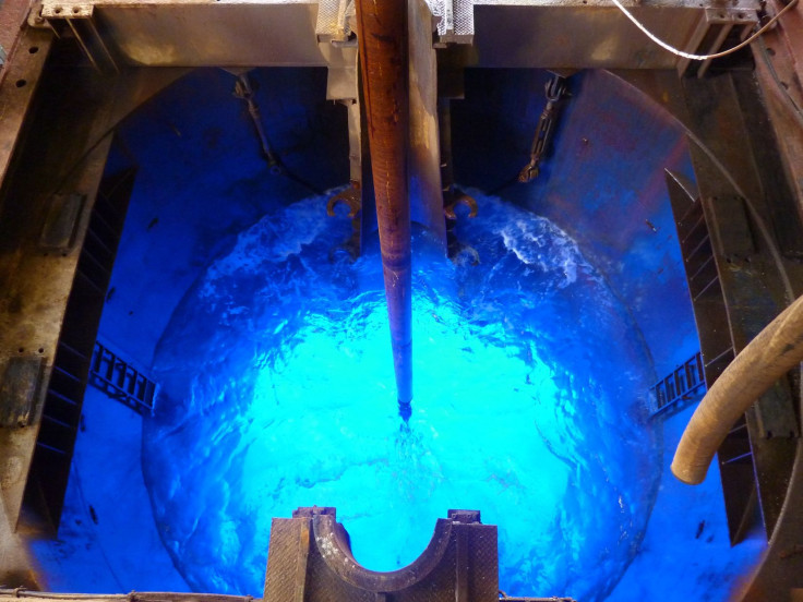
Their work was done through International Ocean Discovery Program, in which scientists from multiple countries explore the seafloor, drilling down and sampling sediment in an effort to learn more about Earth’s history. The team hopes to learn more about the past movement of tectonic plates and changes in climate. According to the NSF, Zealandia could provide more climate data that could be used in computer models to predict how climates will change in the future, since those models rely on historical patterns for their forecasts.
“The Earth is a big place and there are big parts of the Earth which have never really been studied, and Zealandia is an opportunity to study a very significant part of the Earth that has had very little information from it,” co-chief scientist Rupert Sutherland said in a video from the JOIDES Resolution YouTube channel. He is from New Zealand’s Victoria University of Wellington.
Although it may be that Zealandia was already underwater when it broke off from its neighboring continents, it could still paint a detailed picture of what the world was like before humans came along, millions of years ago.
“Dramatic later events shaped the continent we explored on this voyage,” Sutherland said in the NSF statement, noting volcanic activity and changes in ocean depth. “Big geographic changes across northern Zealandia, which is about the same size as India, have implications for understanding questions such as how plants and animals dispersed and evolved in the South Pacific.”
It’s the finding of this lost continent that was once dry land and of how it was previously closer to the ocean surface than it is today that offers scientists answers about how the plant and animal dispersal occurred: “There were pathways for animals and plants to move along,” Sutherland said.
© Copyright IBTimes 2024. All rights reserved.
-

Eiffel Tower Loses Sparkle For Parisians Ahead Of Olympics
-

Former Number One Momota Retires From International Badminton At 29
-

Why Insurance Prices Have Skyrocketed
-

World Bank Aiming To Connect 250 Mn Africans To Energy Grid By 2030
-

IMF Says Global Debt Levels Face 'Great Election Year' Risk
-

Divisions Among Colombia's FARC Dissidents Complicate Peace Talks
-

French Far Right Gets Youthful Vibe With 28-year-old Leader
-

US Fed's Powell Says Inflation Fight May Take 'Longer Than Expected'
-

Mideast-related Oil Price Spike Threatens 'Relatively Good' Economic Outlook: IMF Chief Economist
-

Wine Growers 'On Tip Of Africa' Race To Adapt To Climate Change


