

Extreme Weather: Thunderstorms In Midwest, Record High Heat Expected In Northeast This Week

KEY POINTS
- Severe thunderstorms are expected in the Midwest within the next couple of days
- In the High Plains and Northeast, record-high temperatures are expected Thursday
- Washington is under a Fire Weather Watch through Wednesday evening
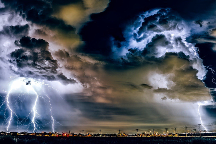
Forecasters are expecting severe thunderstorms to affect the Midwest and Great Lakes areas within the next few days, while record-high temperatures are expected over parts of the Northeast on Thursday. Heavy rain and excessive heat “will continue to be a threat,” forecasts indicated.
In its Short Range Forecast report, the Weather Prediction Center (WPC) noted that severe thunderstorms will “move across the Great Lakes/Midwest during the next couple of days.” The agency added that while the Northwest will see some relief from the extended heatwave that is battering western nations, “record high temperatures are possible on Thursday over the northern High Plains and parts of the Northeast.”
A severe thunderstorm watch has been issued for parts of Wisconsin until 2 AM CDT pic.twitter.com/4AV1Rp3HK6
— NWS Severe Tstorm (@NWSSevereTstorm) August 3, 2022
In Wisconsin, rain showers are expected in southern areas from Wednesday morning through the afternoon, WMTV reported. A severe thunderstorm warning will end at 2 a.m. CDT for some parts of Wisconsin after it was initially extended through early Wednesday morning.
Rainfall is expected to continue in much of the Intermountain West and the Desert Southwest before the week ends. There is a threat of heavy rain in the Ohio Valley on Wednesday evening, the WPC said. Heavy showers are forecasted in some parts of the Great Lakes and the Midwest through Thursday.
According to the WPC, going into the weekend, heavy rain is expected in the following areas:
- Mid-Atlantic
- New England
- Central Great Basin
- Eastern California
- Tennessee Valley
- Ohio Valley
- Appalachians
- Upper Midwest
The agency also warned of potential flooding in the following areas:
- Southern California
- Parts of the Southwest
- Central and Southern Rockies
- Southern Great Basin
Record-breaking heat is forecast to build into the northeast by this Thursday, as high temperatures will be 10°F or more above normal for this time of the year.
— National Weather Service (@NWS) August 2, 2022
Heat is the leading cause of weather-related deaths most years. https://t.co/Ynl3VCdFFD has tips on how to stay safe. pic.twitter.com/lor2hQj6Nu
While some parts of the U.S. are getting relief from a heatwave that has also hit Europe, some areas are expected to continue suffering through high temperatures. Record-breaking heat is expected in several areas. The following locations are under a heat advisory:
From 10 a.m. CDT to 8 p.m. EDT Wednesday:
- Chicago, Illinois
From Wednesday noon to 8 p.m. Thursday:
- Fort Worth, Texas
- North central, northeast and south central Texas
From noon to 8 p.m. EDT Wednesday
- Southeast Ohio
- Northeast Kentucky
- Western West Virginia
From 1 p.m. to 6 p.m. EDT Wednesday
- Southwest Michigan
- South central Michigan
Meanwhile, a Fire Weather Watch remains in place for some parts of Washington State through Wednesday evening. The National Weather Service (NWS) noted that a Fire Weather Watch “means that critical fire weather conditions are forecast to occur.” The NWS said residents should expect temperatures to reach the 90s by Wednesday afternoon.
© Copyright IBTimes 2026. All rights reserved.
- MOST READ


