Nearly 30 Flood Alerts Up In California Amid ‘Intense Rain’ And Strong Winds

KEY POINTS
- 'Considerable flooding impacts' are possible through Thursday
- Wednesday evening commute is expected to be affected by the weather
- Some areas may get up to five inches of rainfall
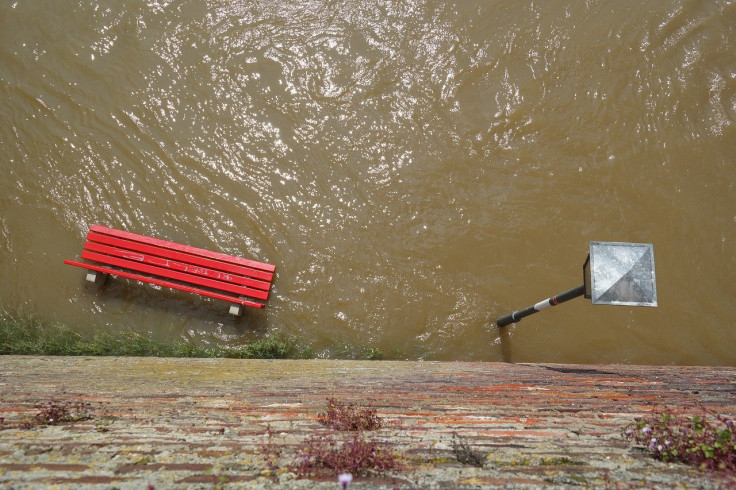
Nearly 30 flood-related alerts and warnings have been issued across California as heavy mountain snow, "intense rain" and strong winds hit the state. Flooding is expected in various parts of the state, with the heaviest precipitation expected in California's coastal areas.
"A powerful hurricane force low pressure system located over the eastern Pacific is set to surge a plume of moisture and damaging winds into the West Coast beginning tonight. The greatest impacts, which include damaging winds, excessive rainfall, and extremely heavy snow, is forecast to occur over much of California" through Thursday, the National Weather Service (NWS) said in a report Wednesday.
The Weather Prediction Center (WPC) said "considerable flooding impacts are likely" from Wednesday evening through Thursday, with Sacramento Valley and coastal California "most at risk."
Conditions will deteriorate in California today into tonight with heavy precipitation rates and gusty winds. Expect dangerous wintry mountain travel and considerable flooding impacts at lower elevations.
— NWS Weather Prediction Center (@NWSWPC) January 4, 2023
Additional rounds of heavy precipitation arrive Saturday, and again Monday. pic.twitter.com/DkN7pL1vaj
Due to "above normal precipitation" on the West Coast this week, there is an increased risk for shallow landslides in some areas. High winds are also forecasted to potentially lead to coastal erosion that will further increase the risk of localized flooding, the NWS Climate Prediction Center said in a Wednesday report.
Officials at the NWS in the San Francisco Bay Area warned against unnecessary travel as the cold front Wednesday will bring "intense" rainfall and is expected to affect the evening commute.
Here's what we're seeing for the cold front coming into the area during the evening commute and into the night. This cold front will bring strong winds and intense rain. Avoid all unnecessary travel! #CAwx pic.twitter.com/XroRdhS8wT
— NWS Bay Area 🌉 (@NWSBayArea) January 4, 2023
Many parts of California are expected to see up to two inches of rainfall, but several areas could get up to five inches by Thursday morning, the NWS in San Diego noted.
The parade of storms marches on! 🧵incoming!
— NWS San Diego (@NWSSanDiego) January 4, 2023
🌧️☔️ Heavy rain still on tap to move in late tonight, with rain becoming heavier and more widespread after 6 AM Thu.
⛈️⛈️ Thunderstorms will also be possible Thursday afternoon and evening.#CAwx (1/5) pic.twitter.com/cnX8jfRP2a
Flood Warnings effective through 10:30 p.m. Wednesday:
- Contra Costa, Napa, Sonoma, San Francisco and Marin (up to three inches of rainfall possible)
- San Benito and Santa Clara
- San Mateo
Flood Warning effective through 11 p.m. Thursday:
- Mendocino (Russian River near Hopland expected to rise above flood stage to 15.4 feet)
Flood Warnings effective until further notice:
- Sonoma (Russian River at Johnsons Beach near Guerneville expected to rise to 30 feet early Thursday afternoon)
Flash Flood Warnings effective through 12:15 a.m. Thursday:
- Monterey (considerable flash flood damage threat)
- San Benito
Coastal Flood Warning effective through 11 a.m. Thursday:
- Southwestern Humboldt, Mendocino Coast, Coastal Del Norte and Northern Humboldt Coast
Coastal Flood Advisories effective from 6 a.m. Thursday through 10 a.m. Friday:
- San Luis Obispo County Beaches and Santa Barbara County Central Coast Beaches (ocean drowning and beach erosion possible)
- Santa Barbara County Southeastern and Southwestern Coast (waves of up to 12 feet possible)
- Ventura County Beaches
Flood Watch effective through 5 p.m. Thursday:
- Bakersfield, Coalinga – Avenal, Buena Vista, Caruthers – San Joaquin – Selma, Delano – Wasco – Shafter, Buttonwillow – Lost Hills – I5, Fresno – Clovis, Frazier Mountain Committees, Fresno – Tulare Foothills, Fresno – Tulare Lower Sierra
- Los Banos – Dos Palos, Grapevine, Hanford – Corcoran – Lemoore, Merced – Madera Lower Sierra, Mariposa Madera Foothills, South End of the Lower Sierra, Mojave Desert Slopes, Planada – Le Grand – Snelling, Merced – Madera – Mendota, South End San Joaquin Valley, Visalia – Porterville – Reedley, West Side of Fresno and Kings, Yosemite NP outside the valley, West Side Mountains South of 198
Flood Watch effective through 11 a.m. Thursday:
- Mendocino Coast
Flood Watches effective through 10 p.m. Thursday:
- West Side Mountains north of 198
- Southern Trinity, Southwestern Mendocino Interior, Southern Lake County, Southeastern Mendocino Interior, Northwestern Mendocino Interior and Southern Humboldt Interior
Flood Watch effective through 10 a.m. Thursday:
- San Miguel and Santa Rosa Islands
Flood Watch effective through Thursday afternoon:
- San Francisco Bay Shoreline, Sonoma Coastal Range, Santa Cruz Mountains, San Francisco Peninsula Coast, National Monument, Northern Monterey Bay, Big Sur Coast, Marin Coastal Range, North Bay Interior Mountains, East Bay Interior Valleys, East Bay Hills, Northern Salinas Valley, Carmel Valley, Hollister Valley, Arroyo Seco, Lake San Antonio, Los Padres National Forest, Santa Lucia Mountains
Flood Watch effective through noon Thursday:
- Riverside County Valleys, The Inland Empire, Orange County Inland, San Bernardino County Valley
Flood Watch effective through 6 a.m. Friday:
- Yosemite Valley, Kern River Valley, South End of the Upper Sierra, Upper San Joaquin River, Piute Walker Basin, Grant Grove Area, Sequoia NP, Tehachapi, Kaiser to Rodgers Ridge, San Joaquin River Canyon
Flash Flood Watches effective through 7 a.m. Thursday:
- Western Plumas County, Lassen Park, Eastern Shasta County and Burney Basin
- Mountains Southwestern Shasta County to Western Colusa County
- Central Sacramento Valley
- Motherlode
- West Slope Northern Sierra Nevada
Flash Flood Watches effective through 4 p.m. Thursday:
- Northern Trinity
- Northeastern Mendocino Interior and Northern Lake County
- Northern Humboldt Interior
Other coastal and surf advisories can be found here.
© Copyright IBTimes 2026. All rights reserved.
- MOST READ