

Global Warming 'Anomaly' in 2010 Triggered 100 Billion Tons of Ice Loss, Rise in Sea Level in Greenland: Study
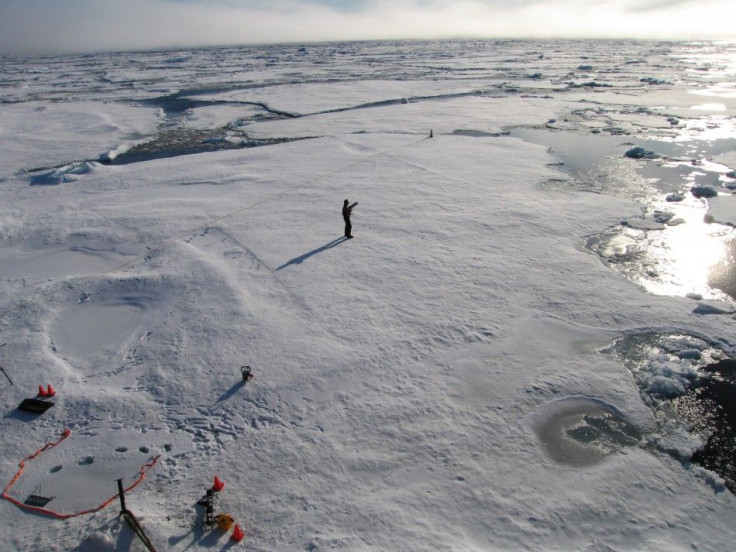
Data obtained from approximately 50 Global Positioning Systems (GPS) in Greenland indicates massive quantities of ice loss in the country's southern region, which researchers suggest is the result of unusual warming patterns in 2010.
The report states that in 2010 the southern half of Greenland lost 100 billion tons of ice, as a result of atypically hot temperatures and the consequent rise of bedrock, beneath the island, by an additional quarter of an inch.
The exact amount of rise in bedrock recorded was different at each station, depending on their distance from one another. However, according to GPS Network (GNET) measurements, the temperature spike caused an increase of nearly 15mm (0.59 inches) at some locations and 20mm (0.79 inches) at others, all over a short five-month period.
Michael Bevis, of the Ohio State University, who led the study and used GPS to measure the vertical motion of rocky margins around Greenland, Iceland and other nearby regions, noted that the melting and the resulting rise in sea levels were a result of global warming.
Really, there is no other explanation. The uplift anomaly correlates with maps of the 2010 melting day anomaly, Bevis said, in a State Column report. The research team found that In locations where there were many extra days of melting in 2010, the uplift anomaly is highest.
The report also quotes the researchers as saying that the findings have implications on the question of rising sea levels across the world.
Pulses of extra melting and uplift imply that we'll experience pulses of extra sea level rise... and the process is not really a steady one, Bevis added.
The influence was so significant that stations located furthest away recorded an average uplift of at least 5mm (0.2 inches) during the 2010 hot melting season.
© Copyright IBTimes 2024. All rights reserved.
-

Microsoft Expands Its AI Empire Abroad
-

Oil: 'Mother Of Corruption' In Venezuela
-

'Extreme' Climate Blamed For World's Worst Wine Harvest In 62 Years
-

Macron Warns 'Mortal' Europe Needs Credible Defence
-

Bitcoin And Crypto Price Review - Another Myth Gets Busted?
-

Mass Cancellations Loom Despite French Air Union Cancelling Strike
-

Mired In Crisis, Boeing Reports Another Loss
-

Recycled 'Zombie' Misinformation Targets US Voters
-

Hackers Leak Part Of Source Code Of El Salvador's Bitcoin Wallet
-

Azerbaijan Says 'Closer Than Ever' To Armenia Peace Deal Amid Border Talks


