Hurricane Irene 2011: Storm to Affect Entire East Coast [MAPS]
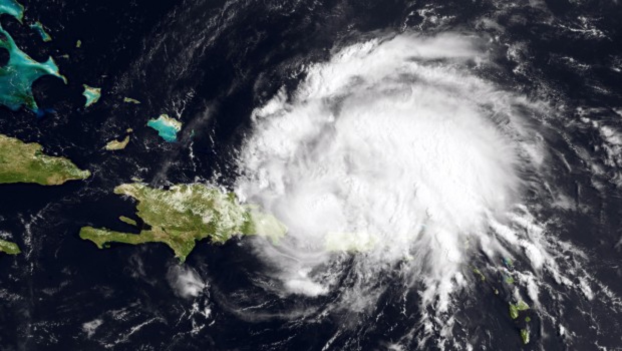
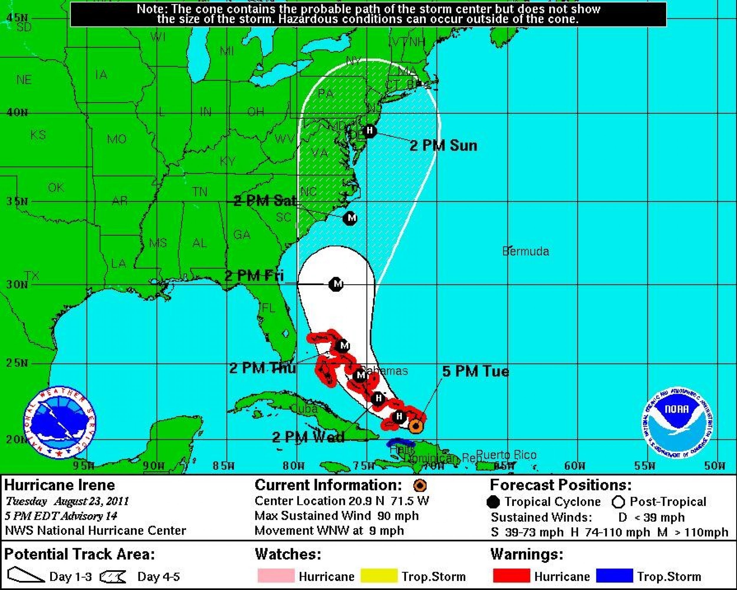
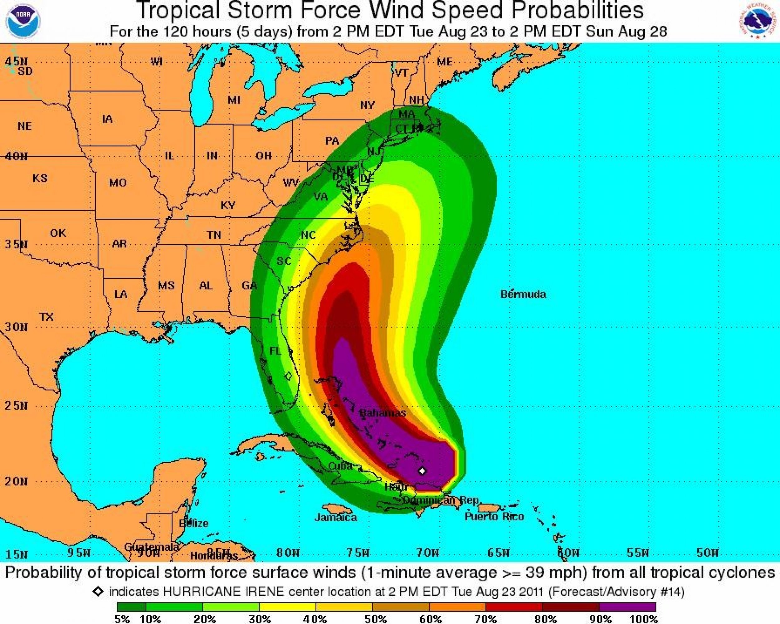
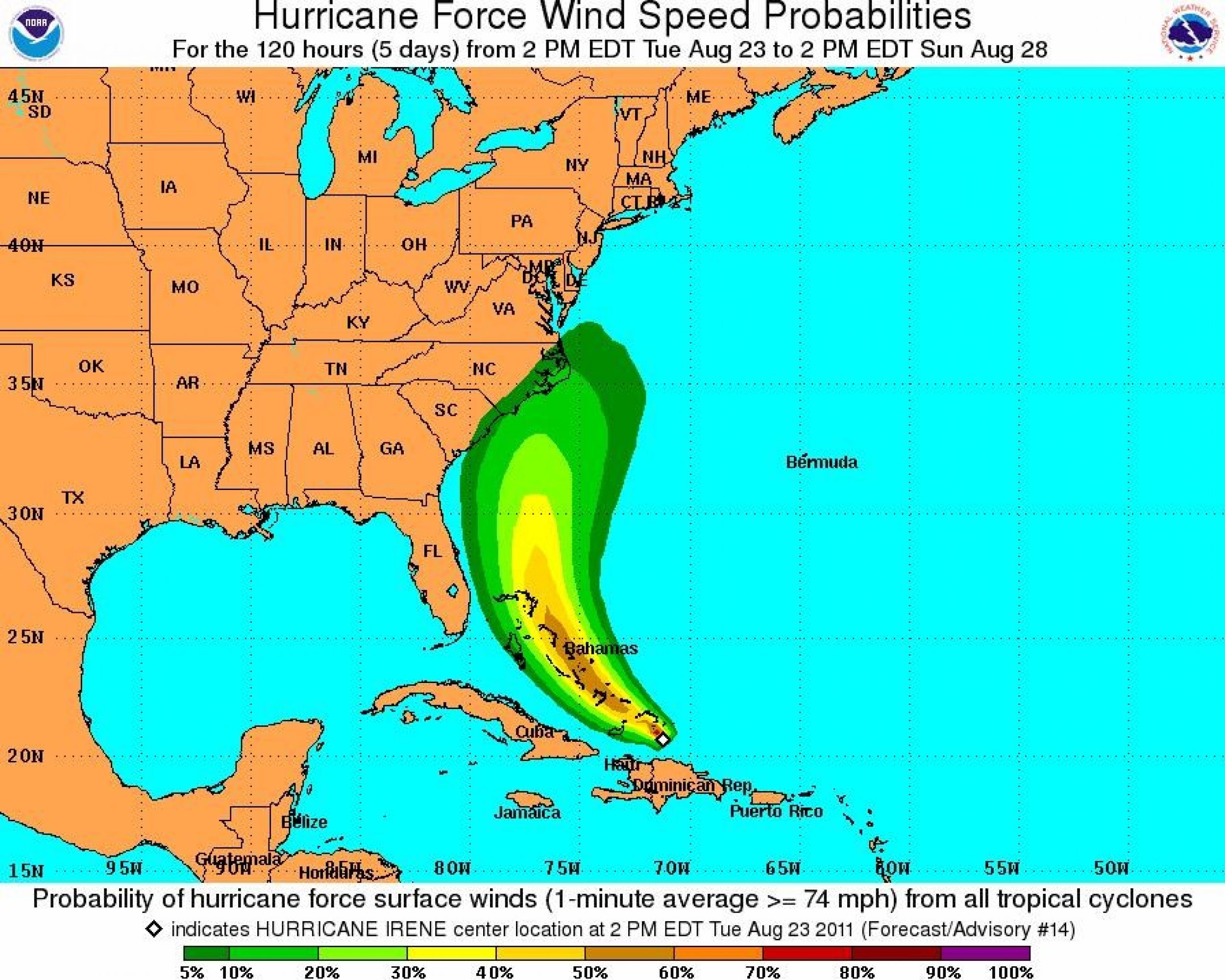
A slightly weaker Hurricane Irene remains on track to race through the Bahamas on its way towards the Carolinas, threatening to cause major problems along the entire East Coast of the United States up to New York City by Sunday evening.
Irene's projected path was adjusted again Tuesday afternoon, bringing it further away from Florida and Georgia. While this is good news for the South, it's bad news for the Mid-Atlantic States.
U.S. Federal Emergency Management Agency (FEMA) Administrator Craig Fugate said Tuesday that the entire East Coast should be on alert.
As of 5:00 p.m. the storm center was located 50 miles south-southwest of Grand Turk Island and about 110 miles east of Grand Inagua Island, Bahamas.
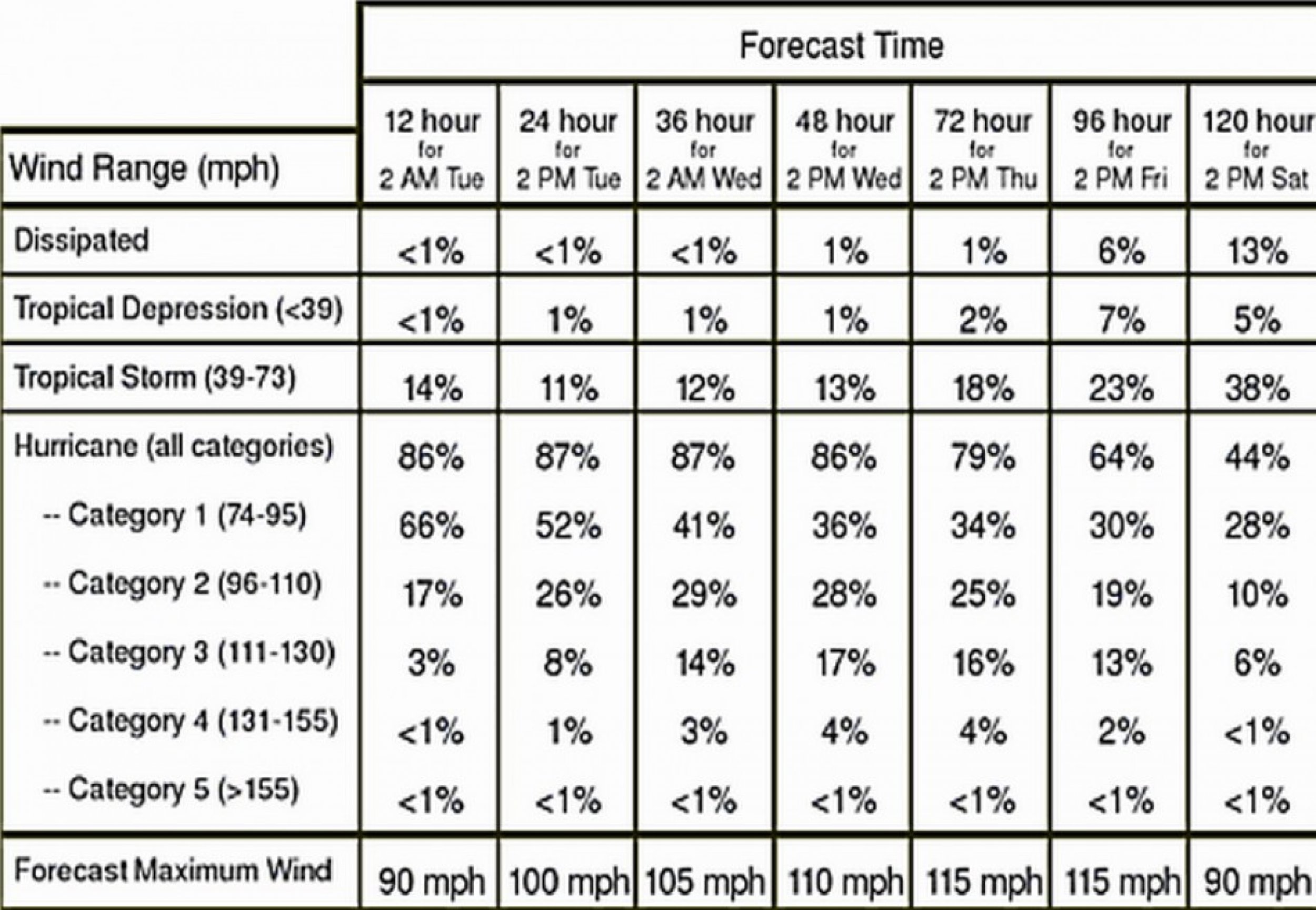
Maximum sustained winds have dropped slightly to 90 mph, making Irene a category one storm on the Saffir-Simpson Hurricane Wind Scale.
Irene has remained a large storm with hurricane-force winds extending outward some 40 miles from the center and tropical-storm-force winds extending outward some 205 miles.
The hurricane is headed west-northwest at 9 mph but is expected to take a more northerly track as winds increase on Wednesday, making Irene a major hurricane.
A hurricane warning is in effect for Turks and Caicos Islands and the entire Bahamas chain.
A tropical storm warning remains in effect for the north coast of Haiti.
Hurricane Irene is expected to move over the Turks and Caicos Islands and Southeastern Bahamas Tuesday night, be near or over the central Bahamas early Wednesday, and near or over the northwestern Bahamas on Thursday.
On Monday, Irene inched away from the northwestern Caribbean, leaving nearly one million people in the dark in Puerto Rico, a billionaire's mansion torched by lightning in the British Virgin Islands, and fears of flooding across Hispaniola.
Have a look at the maps below for the latest on Irene's path:
© Copyright IBTimes 2024. All rights reserved.


