

Hurricane Irene Path: Massachusetts Prepares for Potentially ‘Catastrophic’ Storm
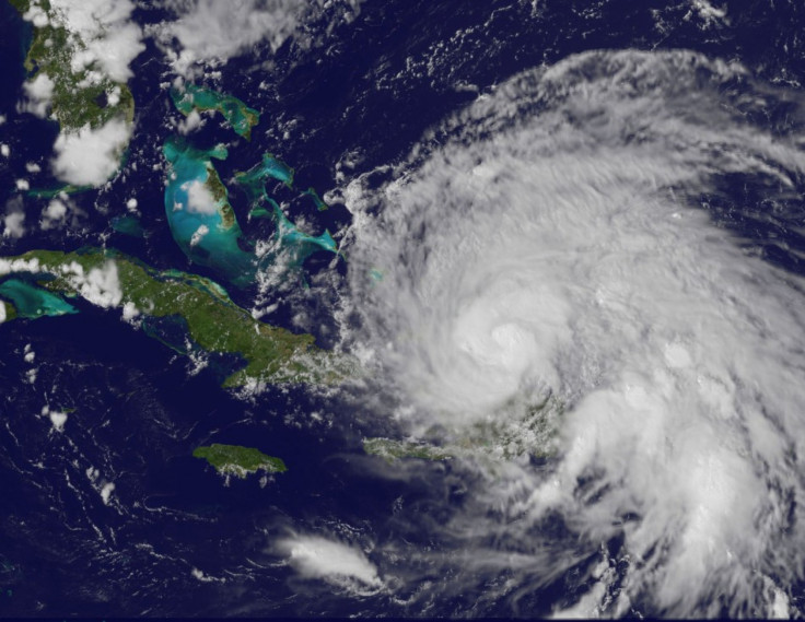
Officials at the Massachusetts Emergency Management (MEMA) are preparing for a possible ‘catastrophic’ storm as Category-3 Hurricane Irene inexorably moves up the eastern seaboard from the Caribbean.
“The good thing about hurricanes is they give you time to take steps,” Peter Judge, MEMA spokesman, told the Boston Herald. “As the week progresses, we’re going to have a better sense of where we’re at.”
With expected winds of up to 115 miles per hour, officials at the Federal Emergency Management Agency (FEMA) and the National Hurricane Center (NHC) have also issued warnings about the magnitude of destruction that Irene may bring to New England.
“We’re very concerned about what’s going to happen in New England,” said Bill Read, director of the NHC.
Read believes the storm surge may be “catastrophic” for New England, including torrential rains, dangerous flash flooding and falling trees.
“We have a lot of time for people to get ready, but we don’t have forever,” said FEMA administrator Craig Fugate. “They need to get prepared now. They need to be ready for it.”
According to NHC, Irene is likely to hit Boston by Sunday afternoon or early evening, and move onto Maine by Monday morning.
Meteorologist Alan Dunham told the Boston Globe that if the storm’s center moves just east of Nantucket and Cape Cod, the Cape and islands could be hit with some wind and storm surges, while Central and Eastern Massachusetts could be pelted with 8 to 10 inches of rain.
However, if it tracks more to the west, then southeastern Massachusetts, the Cape would see strong wings, but the heaviest rain would fall in the western part of the state.
“This storm could produce anywhere from 6 to 10 inches of rain, depending on how fast it will move through,” he said.
“A 30-mile difference in track is going to make a huge difference in what people experience.”
© Copyright IBTimes 2026. All rights reserved.
- MOST POPULAR IN World


