

Hurricane Irene Path: Obama Urges Residents to 'Take Precautions,' Calls Irene a 'Historic Hurricane'
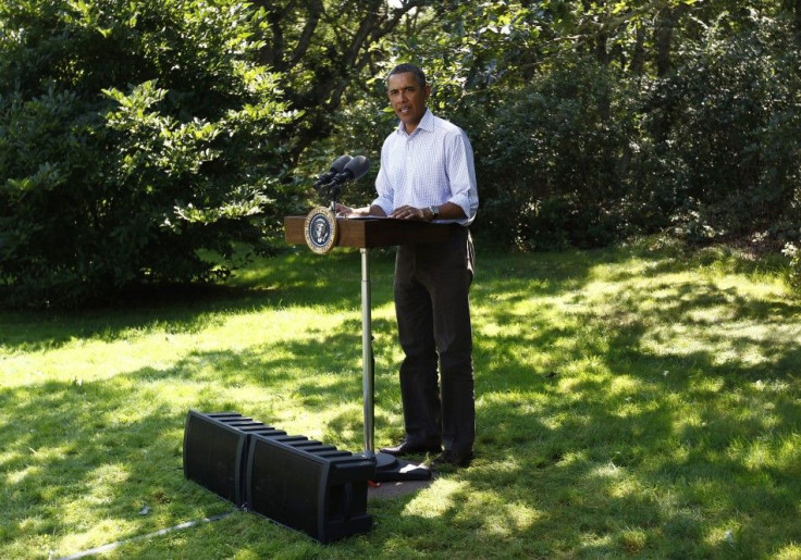
President Barack Obama is urging Americans in the path of powerful Hurricane Irene to listen to warning and evacuation instructions from state and local officials. He said from his vacation rental on Martha's Vineyard Friday that citizens urged to evacuate should not hesitate.
Don't wait, don't delay, Obama said. I cannot stress this highly enough, if you are in the projected path of this hurricane you have to take precautions now.
Obama is planning to leave Martha's Vineyard on Saturday, before the storm is expected to hit the area, but already he has been in contact with White House staffers and the Federal Emergency Management agency as virtually the entire upper two-thirds of the U.S. east coastal region is in the path of Irene, a strong Category 2 hurricane.
The last hurricane to make U.S. landfall was Ike in 2008. Forecasters are saying that Irene holds potential for extraordinary impact up the east coast's I-95 corridor, impacting residents from North Carolina to New York and Boston with flooding, power outages, high wind and heavy rain.
Obama said FEMA is already deploying teams throughout the East Coast region along Irene's projected path. He said the agency has 10 million liters of water, millions of meals and thousands of cots and blankets positioned along the Eastern Seaboard, according to The Associated Press.
All indications point to this being a historic hurricane, Obama said.
By early afternoon Friday, rain bands are already beginning to hit North Carolina. Dangerous surge, wind and widespread destruction are likely from that point northward. Residents urged to evacuate are warned to do so immediately.
The Weather Channel forecasters said Friday Irene posed an extraordinary threat and is one that no one has yet experienced from North Carolina to the Mid-Atlantic to the Northeast to New England.
The center of Irene is expected to make landfall as a Category 2 or Category 3 storm Saturday morning in eastern North Carolina, most likely between Morehead City and Hatteras. Hurricane conditions are expected for much of Saturday in the area, before the storm moves up the east coast, likely striking or having direct impact in major U.S. cities including Boston, Hartford, New York, Philadelphia and Washington, D.C.
Forecasts often change as time progresses with such storms, but the path of Hurricane Irene has become clearer in the past 24 hours and steering forces to push the storm out to sea are not in place at the moment -- thus, the powerful storm seems a likely threat to punish the U.S. East Coast through the end of the weekend.
© Copyright IBTimes 2024. All rights reserved.
-

Senate Prevents Potential Air Travel Chaos, Reauthorizes FAA For Five-Years
-

Panama Papers Law Firm Boss Ramon Fonseca Dead
-

Pandemic Agreement Talks Go To The Wire
-

Low-cost MRI Paired With AI Produces High-quality Results
-

School's Out: How Climate Change Threatens Education
-

Hong Kong Demands Online Platforms Remove Banned Protest Song
-

2023 'Year Of Record Climatic Hazards' In Latin America: UN
-

Crypto Community Buzzes As Grayscale Withdraws Ethereum Futures ETF Application
-

Mongolia's Wildlife At Risk From Overgrazing
-

Milking Venom From Australia's Deadly Marine Animals


