

Hurricane Irene Warning Issued
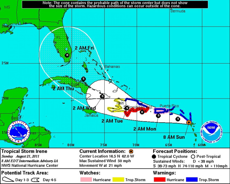
A hurricane warning for Tropical Storm Irene was issued for the southern coast of the Dominican Republic as well as Puerto Rico, according to the National Hurricane Center in Miami.
Irene was moving with maximum sustained winds of 50 miles per hour and headed west at 33 mph as of 5 a.m. ET. The hurricane center forecast strengthening of the storm during the next 48 hours, and that it could become a hurricane by Monday.
The center also predicts some 4 to 7 inches of rain in Puerto Rico, the Leeward Islands, and the Virgin Islands.
A projection map indicates that Irene could reach the United States by Thursday evening, after possibly hitting the Dominican Republic and Cuba.
© Copyright IBTimes 2025. All rights reserved.
Join the Discussion
- MOST READ


