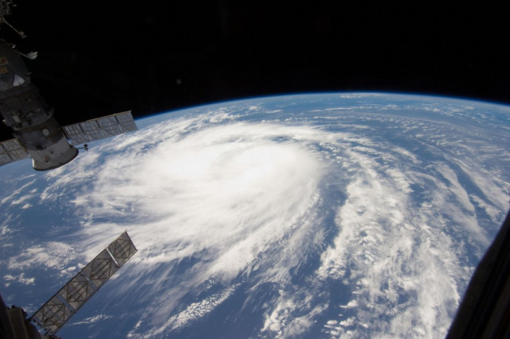
Hurricane Katia Reaches Category 4 But Expected to Stay at Sea

Katia strengthened to a Category 4 hurricane Monday night but is unlikely to hit the U.S. East Coast, the National Hurricane Center said.
At 11:00 p.m. ET (0300 GMT), Katia was about 450 miles south of Bermuda with winds of 135 miles per hour (215 km/h), the center said. Some fluctuations in strength are possible during the next 24 hours, followed by slow weakening, its statement added.
The hurricane was moving northwest near 10 miles per hour (17 km/h) and was expected to maintain that motion through Wednesday.
Forecasters expect the hurricane to veer away from North America later this week and head northeastwards out to the open sea.
The National Hurricane Center warned, however, that East Coast beaches should still watch out for large swells generated by Katia that could cause life-threatening coastal surf and rip currents.
NHC hurricane specialist Robbie Berg told Reuters the greatest threat from Katia for the coast was likely to be the large swells and resulting dangerous coastal surf and currents the storm generated on its path.
Even though these storms may stay offshore, they still can be a deadly threat, especially to people going to the beach, Berg said. It may be a beautiful nice day out and you may just not know that there are rip currents there that can pull you out to sea.
Forecasters and residents of the U.S. Atlantic seaboard have been keeping an anxious eye on Katia after Hurricane Irene raked up the East Coast from the Carolinas to Maine last weekend. It killed more than 40 people and caused extensive flooding, especially in New Jersey and Vermont.
Katia, the second hurricane of the June-through-November Atlantic season, has kept forecasters guessing for days about its potential threat to the United States.
Berg said the latest five-day forecast predicted the hurricane would swing north and then northeastward from Thursday in between Bermuda and the U.S. mainland, pushed away from the East Coast by a developing low pressure trough.
That would guide the storm around a ridge of high pressure in the central Atlantic known as the Bermuda High.
The steering flow right now is pushing the storm to the northwest, but once it gets closer to the East Coast, it'll start feeling the effects of that trough a little bit more, and it's going to make that sharp turn around the Bermuda High and head out northeastward over the open Atlantic, Berg said.
Berg said there was still a one in 10 chance parts of the East Coast could experience tropical storm-force winds when Katia passed well offshore later this week, especially jutting coastal areas like North Carolina's Outer Banks and Cape Cod in Massachusetts. Bermuda could also experience such winds.
© Copyright Thomson Reuters {{Year}}. All rights reserved.


