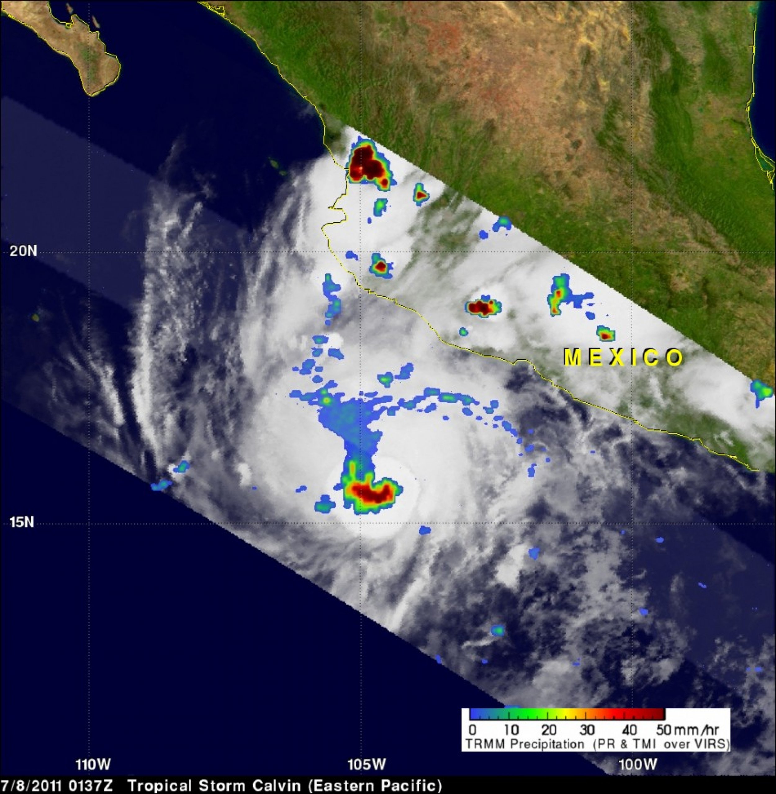
Tropical Storm Calvin Grew Stronger on the Verge of Hurricane-Strength
Tropical Storm Calvin grew stronger during the day on Friday, July 8, and by early afternoon he was on the verge of hurricane-strength. The TRMM satellite provided a look under the hood of the storm and noticed the heavy rainfall at the center of its heat engine.
The Tropical Rainfall Measuring Mission (TRMM) satellite can measure rainfall from space, and rainfall rates can be a gauge for the strengthening or weakening of a tropical cyclone.
TRMM's Microwave Imager (TMI) data provided good coverage of recently formed tropical storm Calvin as it passed above on July 8, 2011 at 0137 UTC (July 7 at 9:37 p.m. EDT). A TRMM pass showed that Calvin had become very well organized and the TMI rainfall analysis showed that rain was falling at a rate of over 50 mm/hr (~2 inches) in powerful thunderstorms near Calvin's center of circulation. Some heavy thunderstorms were also seen over southwestern Mexico.
At 11 a.m. EDT on July 8, Tropical Storm Calvin's maximum sustained winds had already grown to 70 mph. That's just 4 mph under hurricane strength. The National Hurricane Center said that Calvin could become a hurricane today, but some weakening should begin on Saturday, July 9. The center of Tropical Storm Calvin was located about 290 miles (470 kilometers) southwest of Manzanillo, Mexico near near latitude 16.2 north and longitude 107.6 west. Calvin is moving toward the west near 17 mph (28 km/h).
Calvin is then forecast to weaken as it passes over slightly cooler water and dissipate to a remnant low on Monday, July 11, 2011.
Credit:Hal Pierce/Rob Gutro, SSAI/NASA Goddard Space Flight Center, Greenbelt, Md.

© Copyright IBTimes 2025. All rights reserved.


