

Tropical Storm Maria Path Similar to Hurricane Irene Path; U.S. Strike Possible
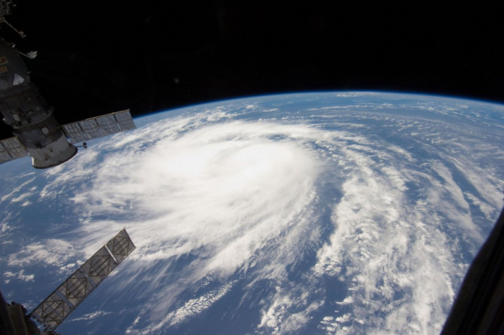
Maria formed farther south than Katia and is moving in a steering upper level wind flow that is expected to take the storm near the Leeward Islands, British and U.S. Virgin Islands, Puerto Rico and Hispaniola by the weekend. That path is very similar to the Hurricane Irene's path, and that storm made a run up the East Coast from North Carolina to Massachusetts and Vermont.
It's likely Maria will intensify to Category 1 hurricane strength, but at the moment those same steering winds that are driving the storm west are sheering intensification. But forecasters say the storm could go up and down in strength over the next days. Maria's path, according to current models has the storm making an eventual northward turn to open waters of the western Atlantic or close to the Atlantic seaboard, with a direct strike a distinct possibility.
Tropical Storm Maria became the 13th named system of the 2011 season on Wednesday.
Also, another system is showing signs of organizing in the Gulf of Mexico that may become a tropical depression in the next few days and perhaps also threaten the U.S. But at the moment, as Hurricane Katia weakens and prepares to shift away from the U.S. East Coast, Tropical Storm Maria gained headlines as the latest named storm.
We've got the 13th named storm of the season and it's in an environment that isn't conducive to explosive strengthening, Dennis Feltgen, a spokesman for the hurricane center, told Bloomberg. In fact, we have it as a tropical storm through the end of the five-day forecast period.
The other developing, still-unnamed system developing in the Gulf of Mexico has similarities to Tropical Storm Lee, which drenched the eastern U.S. in the past week and sparked wildfires in Texas with increased winds amid drought conditions. That developing system could move northeasterly by the weekend and into next week, threatening the U.S. at about the same time Maria moves in.
Between that system and Tropical Storm Maria, the U.S. could get either a single or double dose of trouble by mid-September.
One or both of the systems has a window of opportunity to reach the Eastern U.S., Accuweather Hurricane and Tropical Weather Coordinator Dan Kottlowski said in a report at the weather service's website.
The risk of both storms possibly impacting the U.S. at once after drenching rains from Hurricane Irene and Tropical Storm Lee poses risk for new flooding in saturated areas. Both systems could make direct hits on the U.S., becoming significant rainmakers, forecasters say.
© Copyright IBTimes 2024. All rights reserved.
-

Microsoft Expands Its AI Empire Abroad
-

Oil: 'Mother Of Corruption' In Venezuela
-

'Extreme' Climate Blamed For World's Worst Wine Harvest In 62 Years
-

Macron Warns 'Mortal' Europe Needs Credible Defence
-

Bitcoin And Crypto Price Review - Another Myth Gets Busted?
-

Mass Cancellations Loom Despite French Air Union Cancelling Strike
-

Mired In Crisis, Boeing Reports Another Loss
-

Recycled 'Zombie' Misinformation Targets US Voters
-

Hackers Leak Part Of Source Code Of El Salvador's Bitcoin Wallet
-

Azerbaijan Says 'Closer Than Ever' To Armenia Peace Deal Amid Border Talks


