

Two Worsening Tropical Storms Expected to Hit Mexico Coast Next Week
Two worsening tropical storms threaten to hit Mexico's Pacific coast early next week, while a category one hurricane in the Atlantic Ocean is expected to fizzle out before it hits the east coast.
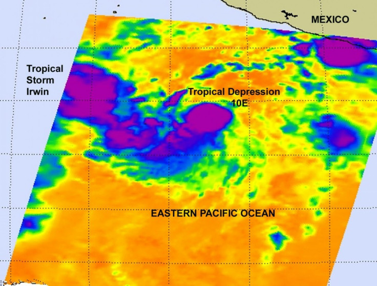
U.S. officials reclassified Tropical Storm Irwin to category one hurricane status Friday, the eighth eastern Pacific hurricane of the season, according to the U.S. National Hurricane Center.
Additional strengthening is forecast during the next couple of days, the center warned of Irwin in an advisory released Friday.
Hurricane Irwin reached maximum sustained winds of 80 miles per hour (130 kilometers per hour) by Friday. The hurricane is forecast to become a category two hurricane reaching 100 mph winds and strike near Puerto Vallarta on Oct. 10-11.
Meanwhile, Irwin was joined Thursday by Tropical Storm Jova that had sustained winds reaching 50 mph (85 kilometers per hour).
Additional strengthening is forecast during the next 48 hours, the hurricane center released in an advisory issued 2 a.m. PST Friday. Jova could become a hurricane by Saturday.
The third storm, Hurricane Phillipe in the Atlantic Ocean, gained speed in its move towards the U.S., forecaster expected the storm to weaken before it reached the eastern U.S. coast.
As of Friday, the hurricane center issued no coastal watches or warnings.
© Copyright IBTimes 2024. All rights reserved.
- MOST POPULAR IN Science


