Arizona’s Massive Wallow Fire Expands Unchecked, Quickly
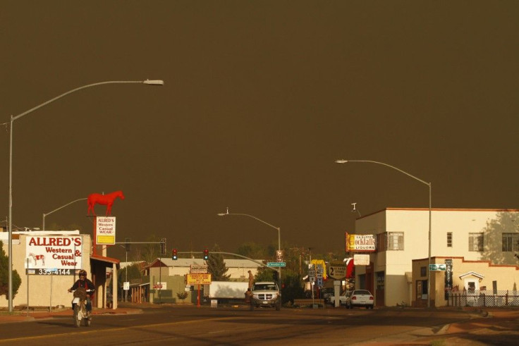
The Wallow Fire along Arizona's eastern border forests has grown quickly and unchecked on Wednesday as the latest official area measurements show fast expansion of what is currently the 2nd largest fire in the state's history.
More than 5,000 people have been evacuated in the sparsely populated area surrounding Apache National Forest, which is now closed. Pre-evacuation plans are in place for several areas.
The National Weather Service said on Wednesday that the fire has grown to 607 square miles (389,000 acres) as of Wednesday. On Tuesday, the Arizona Emergency Information Network said the fire was 486 square miles (311,000 acres).
The weather is not helping as high winds and low humidity have created the potential for extreme fire behavior, AZEIN reported.
Those conditions are also taking place in several bordering states, according to a 'Red Flag Warning' from NWS. That status is in place in much of eastern and southwest Arizona, a large portion of New Mexico, some southern parts of Colorado and relatively smaller parts of northern Texas and Eastern Oklahoma.
Locally, communities are experiencing rolling blackouts due to testing of the power grid.
Fire officials said Tuesday morning that four structures had been destroyed and 384 structures were in harm's way. More than 2,000 responders are attending to the fire.
The Arizona National Guard said Tuesday three 2,500 gallon fuel tankers were supporting firefighting operations for an indefinite time, according to KVOA.
On Wednesday, evacuations are in place for all areas south of Highway 260 and east of Greer, including South Fork and portions of Eagar. The highway will be closed immediately after evacuation. Evacuations are also in place for Sunrise, Greer, Blue River, Alpine, Nutrioso. Other areas evacuated include subdivisions along Highway 180/191 of Escudilla Mountain Estates, Bonita, White Mountain, Acres and H-V Ranch.
Pre-evacuation alerts are in place in Apache County's Springerville, and Luna in New Mexico's Catron County.
The Apache National Forest is closed.
Second Major Fire
Nearly 900 responders are taking on the smaller but still significant fire known as the Horseshoe Two Fire, located about 60 miles south of the Wallows Fire.
Authorities will be on watch for extreme fire behavior on Wednesday amid expectations of strong, erratic winds blowing up to 30 to 40 miles per hour and low humidity between 5 and 10 percent.
The fire has charred an area of 162 square miles (106,661 acres) as of late Tuesday. Winds pushed the fire to the north and northeast.
Crews on Wednesday are working to minimize the spread of the fire. Cantainment lines along the north and northeast held overnight as firefighters burned out to slow to slow the fire's progress towards pre-constructed containment lines. The lines were being improved in the morning ahead of the afternoon winds expected.
Crews are also working to reduce fuel around historical buildings at Chiricahua National Monument - which is closed to the public until further notice - and private structures in the Whitetail Canyon area. Crews are also working to reduce fire intensity in critical habitat areas.
Meanwhile, the community of Paradise is no longer under evacuation order.
The following road closures and evacuations are in place:
- The community of Whitetail and East Whitetail Canyon Road
- Forest Road 42B west of Portal
- Forest Road 42 at the junction of Herb Martyr Road
- Pinery Canyon Road (Forest Road 42) at the west Coronado National Forest boundary
- Paradise Road at the junction of Foothills Road and Nolan Road
A bulletin report from the AZEIN says the same conditions yesterday caused a sport fire outside of containment line in the vicinity of West Turkey Creek. That fire has grown to an estimated 1,000 acres from 100 acres late Wednesday.
© Copyright IBTimes 2026. All rights reserved.
- MOST POPULAR IN World