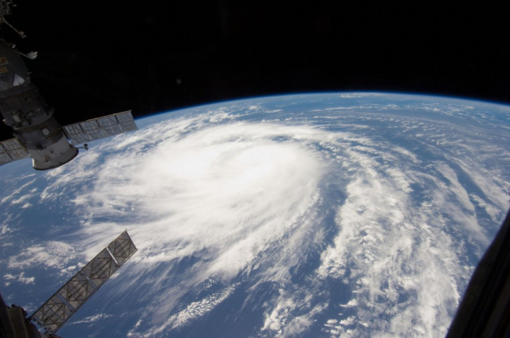
Hurricane Katia's Path Likely To Miss U.S. East Coast; Ireland, UK May Get Eventual Impact

Hurricane Katia is a Category 2 storm with winds of 105 miles per hour, and further strengthening is expected in the next two days, but models show Katia's path may take it out to sea without a direct strike on the U.S. East Coast.
The latest forecasts show Katia could come close to the U.S., bringing large swells, rough surf and dangerous rip current to the U.S. East Coast, particularly North Carolina's Outer Banks, but that that models are trending to show that Katia will eventually turn north and east before playing out over sea in cold waters.
On Monday morning, Katia was located about 400 miles north of the northern Leeward Islands, or 605 miles south-southeast of Bermuda. The storm, which strengthened throughout the day Sunday, is moving slowly at 12 miles per hour, and expected to reach Category 3 strength later today.
The period of rapid intensification may have levelled off a bit, but environmental conditions still appear favourable for additional strengthening, said Robbie Berg, a hurricane specialist at the U.S. National Hurricane Center (NHC). The only apparent negative factors for this are relatively warm upper-tropospheric temperatures and lower oceanic heat content values along the forecast path, especially from days 3 through 5.
Katia's path is similar to Earl, which sent high waves to the East Coast in 2010 but didn't make a direct strike on U.S. land.
There is still potential for Katia to come very close to the U.S., forecasters say, so it is still too early to completely rule out a direct strike, though the odds are increasingly very low. The storm does pose an eventual threat to Ireland and the United Kingdom, however, with wind and heavy rains.
Katia became the 11th named storm of the Atlantic hurricane season which runs from June 1 to Nov. 30. Irene became the first to reach hurricane strength, before ravaging a path up the East Coast last week, and power remains out in some areas and the cleanup may take weeks, if not months for some.
But even though the U.S. might get spared a hit from Katia's path, figures released last month from NOAA's Climate Prediction Center suggest an above-normal hurricane season in the Atlantic this year. The outlook calls for 14 to 19 named storms, with seven to ten becoming hurricanes and three to five expected to become a major hurricane (category 3 or higher).
© Copyright IBTimes 2025. All rights reserved.


