

Israel Is Building An Earthen Barrier Across Gaza. It Is Over 14 Miles Long
The barrier follows much of the "yellow line," the area where Israeli troops withdrew under the October ceasefire agreement.

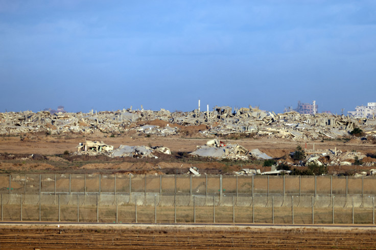
Israel has constructed more than 14 miles of earthen barriers across the Gaza Strip, creating a vast physical separation through territory under its military control and raising concerns that what was intended as a temporary ceasefire line is becoming a lasting border.
The Israeli military confirmed the construction to The Associated Press after being presented with recent satellite imagery showing extensive earthworks running across more than half the length of the enclave.
The barrier follows much of the so-called "yellow line," the area where Israeli troops withdrew under the October ceasefire agreement with Hamas. While the deal envisioned the line as a temporary military boundary pending a broader Israeli withdrawal, months of stalled negotiations have fueled fears that Israel is solidifying its hold over the territory.
According to AP's analysis of satellite images provided by Planet Labs PBC, more than 23 kilometers, or about 14 miles, of earthen berms have already been built. The structures cut through demolished Palestinian communities in a territory that stretches roughly 25 miles from north to south and is home to more than 2 million people.
In a statement to the outlet, the Israeli military said it had established a physical barrier and a broader "security zone" equipped with intelligence and technological systems designed to prevent infiltration, protect Israeli troops and safeguard nearby Israeli communities. Officials declined to disclose the barrier's final route or whether construction would continue beyond its current footprint.
Satellite imagery suggests the project is advancing rapidly. In southern Gaza, a section of the berm separating the ruins of Rafah from the densely populated tent camps in Muwasi expanded from approximately 500 meters on July 1 to about 2.4 kilometers by July 15.
If work continues at the same pace, the southern section could eventually connect with the barrier's longest uninterrupted stretch, which extends nearly 17 kilometers from Khan Younis toward Gaza City.
Construction on that central section began in February. Satellite images also indicate the military added more than a kilometer of new barrier between late June and early July near an Israeli military base built on the remains of Bani Suheila, outside Khan Younis. Additional disconnected berms have appeared near the devastated northern town of Beit Lahia.
Much of the area east of the yellow line has been heavily transformed during the war. Satellite imagery reviewed by AP shows that Israeli forces have flattened large portions of Rafah and several surrounding communities using bulldozers and explosives, while also building new military installations and road networks. Israel says these operations target Hamas infrastructure and military capabilities.
The exact location of the yellow line has never been formally defined in the ceasefire agreement or publicly detailed by Israeli or U.S. officials. The Israeli military said it is working to mark the route more clearly in an effort to reduce confusion and prevent civilians from inadvertently entering military areas.
Violence has continued despite the ceasefire framework. According to AP, Israeli forces have killed more than 1,100 Palestinians since the truce began, primarily through airstrikes and drone attacks, while militant attacks have killed five Israeli soldiers during the same period.
The broader ceasefire agreement originally called for Israeli forces to eventually withdraw to Gaza's outer edges, where an international security force would assume responsibility. Those plans remain frozen as negotiations over Hamas' disarmament continue without significant progress.
© Copyright IBTimes 2026. All rights reserved.