Is Mount Everest Getting Taller? Height Change Explained
KEY POINTS
- Total height revised higher by about 3 feet
- China and Nepal had differed over points of measurement
- The summit increases in height at a rate of 1.6 feet every 100 years
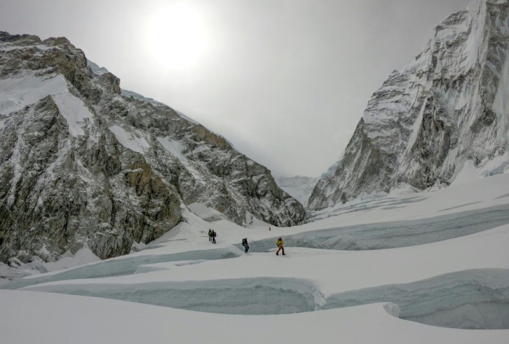
Mount Everest is growing to new heights. Settling a dispute over points of measurements, Chinese and Nepalese officials announced on Tuesday they’ve revised the official height of Mount Everest.
Dubbed Mount Qomolangma in China and Nepal, the new official height of the world’s tallest peak is 29031.7 feet (8,848.86 meters) above average sea level, which makes it almost 3 feet taller than before.
According to BBC, while the mountain does rise about 1.6 feet per century, the new calculation comes after both sides had disputed the terminal point of the measurement. China argued for an end at the rock height and Nepal advocated for the inclusion of the snowpack at the summit.
China’s original estimate was about 13 feet lower than Nepal’s.
In a letter to his Nepalese counterpart Bidya Devi Bhandari, Chinese President Xi Jinping called the mountain “an important symbol of the China-Nepal traditional friendship,” China’s official Xinhua News Agency reported Tuesday.
Teams from both countries worked for more than a year on the survey. The new measurement, Xi added, was the result of a determination of the snow surface height according to the International Height Reference System.
According to the Nepalese Foreign Minister, the occasion was marked by the joint pressing of crystal balls from the Chinese and Nepalese sides of the mountain range straddling their borders. For Nepal, this is its first independent survey since India measured the peak in 1954.
The BBC reported that in 2012, Nepal said it was pressured by the Chinese to accept their height, so they decided to conduct a new measurement “to set the record straight once and for all.” Four Nepalese mountaineers spent two years training for the survey. Surveyors used a dozen measurement points along the way to record the height, using a mean average sea level to determine ground zero.
Khimlal Gautam, who led the survey for Nepal, said the feat was one of national pride. “For summiteers, scaling the highest peak means a great accomplishment,” he told the British media service.
Gautam lost his toe due to frostbite on the summit last year while installing measuring equipment for the new survey.
The Chinese team completed their summit in May, the only team to reach the peak in 2020 because of restrictions in place for the pandemic.
© Copyright IBTimes 2026. All rights reserved.
- MOST POPULAR IN World