

NASA Reveals Heartbreaking Photos Of Amazon Rainforest Fire From Space
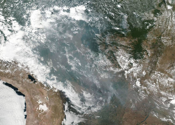
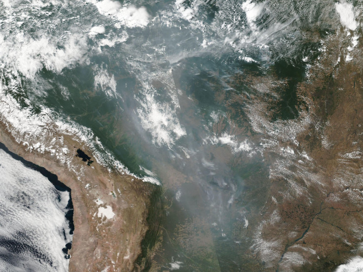
NASA’s latest satellite images show just how massive the wildfires are in the Amazon rainforest. Based on the images, the wildfires have already reached several areas in Brazil.
The fires have been raging in Amazon for three weeks now. Although it has been attributed by the local government to the current weather season, the scale of the wildfires has become very alarming.
Recently, NASA released images of Brazil captured by its satellite. According to the space agency, the satellite images showed smoke and fires breaking out in several states including Rondonia, Mato Grosso and Amazonas.
The agency noted that wildfires usually occur during this time of the year. However, it is not yet clear if this year’s wildfires can still be considered normal.
“It is not unusual to see fires in Brazil at this time of year due to high temperatures and low humidity,” NASA said in a statement. “Time will tell if this year is a record-breaking or just within normal limits.”
For most of the year, the Amazon is wet due to the rainy season. The dry season usually begins in July and August, which farmers take advantage of by using fires to clear out or deforest lands. This usually extends until September.
In the #AmazonRainforest, fire season has arrived.
— NASA Goddard (@NASAGoddard) August 21, 2019
The MODIS instrument on NASA’s Aqua satellite captured this images of several fires burning in the Brazilian states of Rondônia, Amazonas, Pará, and Mato Grosso on August 11, 2019. pic.twitter.com/btulI01v5n
Despite being viewed as a common yearly occurrence, this year’s wildfires are unusual due to their scale. According to Brazil’s National Institute for Space Research, around 72,843 fires have been detected in the country. This figure marks an 83% increase compared to last year’s wildfire records, Reuters reported.
President Jair Bolsonaro, the right-wing leader of Brazil, has been criticized by the public due to his lack of action regarding the incident. There is also growing concern for his stance regarding the Amazon rainforest, which he aims to develop for mining and farming through deforestation.
When questioned regarding the wildfires destroying the forest, Bolsonaro simply attributed it to the time of the year when farmers use fires to clear lands, which is known as “queimada”.
“I used to be called Captain Chainsaw,” Bolsonaro said according to Reuters. “Now I am Nero, setting the Amazon aflame. But it is the season of the quiemada.”
© Copyright IBTimes 2026. All rights reserved.
- MOST POPULAR IN Science


