

Is The Polar Vortex Over? Arctic Blast Expected To Hit US Next Week

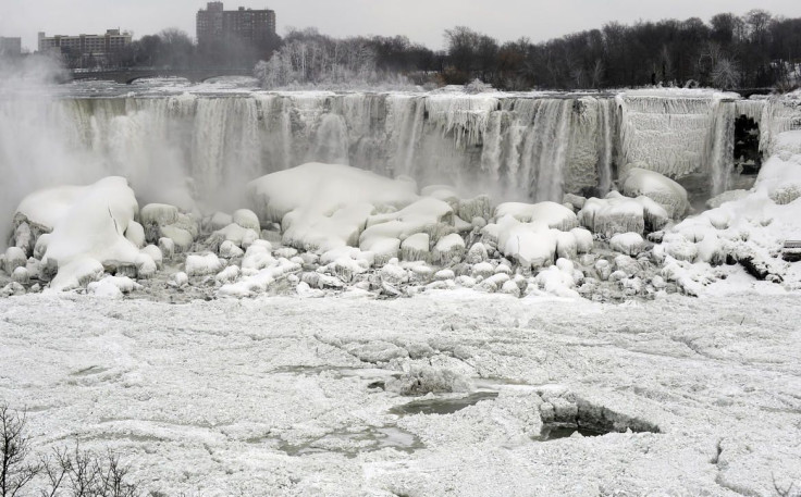
The relatively warm winter temperatures in the Midwest and Northeast stayed around long enough to thaw most of the ice off the frozen ground. But once again, a blast of cold from the dreaded polar vortex is threatening to bring subzero temperatures to parts of North America.
The arctic blast is expected to hit southern Canada first on Monday, and then move down to the northern plains of the U.S. before hitting the Midwest and Northeast -- just days after those areas experienced a break from the abnormal frigid temperatures.
“Following the retreat of arctic air this weekend, waves of progressively colder air will move southward over Canada next week,” AccuWeather.com Lead Long-Range Forecaster Paul Pastelok told AOL.com. The cold air will reportedly make its way to the Northeast by Thursday.
“We will likely see a piece of the polar vortex break off and set up just north of the Great Lakes spanning Jan. 16 to 20,” Pastelok explained. “This next main arctic blast will not rival, nor will be as extensive, as the event this past week,” Pastelok added.
Not all areas have exactly recovered from the previous icy encounter. The extreme cold created an ice dam that blocked the Delaware River in New Jersey, which forced many roads to close and put areas around the natural ice dam at risk for flooding. However, breaking the dam does create a catch-22, Qareeb Bashir, of Trenton Emergency Management, told ABC News.
If the ice melts, flash flooding is possible in some areas. “If in fact the ice jam breaks then we'll have a rush of water which could cause flash flooding,” he said. Several regions have been put at risk for flash flooding after the region experienced almost nonstop rainfall following the bitter cold.
Weather experts are likely to have more information about the cold during the week.
Follow me on Twitter @mariamzzarella
© Copyright IBTimes 2025. All rights reserved.
- MOST POPULAR IN Science


