

South Dakota Fire Advisories Upgraded Amid 'Bad Combination' Of High Winds, Dry Conditions

KEY POINTS
- Dry and windy conditions in South Dakota are expected to result in critical fire weather conditions
- Wind gusts of up to 55 mph are expected in some parts of the state
- Four other states have been placed under Fire Weather Watches
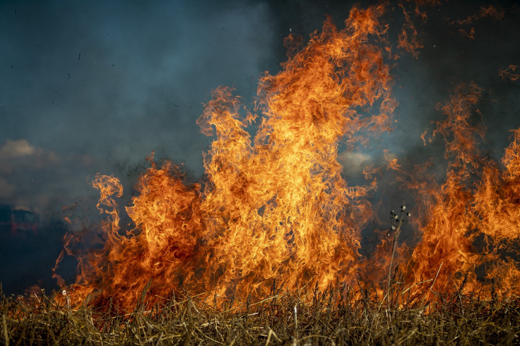
Authorities have upgraded some of the Fire Weather Watches issued in South Dakota on Tuesday into Red Flag Warnings, as forecasters expect "critical fire weather conditions" to continue through Wednesday.
Fire Weather Watches have also been issued in North Dakota, Nebraska, Iowa and Kansas.
The officials have "elevated Fire Danger for portions of the Central and Northern Plains through Wednesday," the National Weather Service (NWS) said in its Short Range Public Discussion report late Tuesday. Some of the fire-related watches issued Tuesday in South Dakota have been upgraded into Red Flag Warnings, which are higher levels of fire alerts.
Dry and windy conditions will result in critical fire weather conditions Wednesday. Thus, a Red Flag Warning has been issued for portions of our area and will be in effect from 12 PM to 7 PM! pic.twitter.com/WkY0XL0mir
— NWS Sioux Falls (@NWSSiouxFalls) October 12, 2022
The NWS in Sioux Falls, South Dakota, also noted "dry and windy conditions will result in critical fire weather conditions Wednesday."
The South Dakota Department of Public Safety (SD DPS) reiterated high winds and dry conditions "are a bad combination," urging residents to "be careful with all open burns."
A Red Flag Warning continues to exist throughout South Dakota this afternoon. Dry conditions and high winds are a bad combination! Be careful with all open burns. #keepSDsafe pic.twitter.com/77O9RAX0zQ
— SDPublicSafety (@SDPublicSafety) October 11, 2022
Wind gusts are expected to reach up to 55 mph in portions of northeast and central South Dakota, which could contribute to rapid spreading of flames in areas where fires start, officials said.
Red Flag Warnings in South Dakota:
Brown – effective through 8 p.m. Wednesday:
- Including Corson, Campbell, McPherson, Marshall, Walworth, Edmunds, Day, Dewey, Potter, Faulk, Spink, Clark, Stanley, Sully, Hughes, Hyde, Hand, Jones, Lyman, Buffalo
Beadle – effective from Wednesday noon through 7 p.m. Wednesday:
- Including Kingsbury, Gregory, Jerauld, Sanborn, Miner, Lake, Brule, Aurora, Davison, Hanson, McCook, Minnehaha, Charles Mix, Douglas, Hutchinson, Turner, Lincoln, Bon Homme, Yankton, Clay and Union
Badlands Area– effective from 10 a.m. to 6 p.m. Wednesday:
- Including Northern Foot Hills, Eastern Foot Hills, Custer County Plains, Pine Ridge Area, Butte County, Perkins County, West Central Plains, Ziebach County, Haakon County, Bennett County Area, Mellette County, Todd County, Tripp County
Particularly in the Badlands Area, wind gusts are projected to reach up to 60 mph.
Meanwhile, Fire Weather Watches have also been issued in four of South Dakota's neighboring states.
Fire Weather Watches effective from Wednesday afternoon through Wednesday evening:
In North Dakota:
- Adams, Billings, Bottineau, Bowman, Burke, Burleigh, Divide, Dunn, Emmons, Golden Valley, Grant, Hettinger, McHenry, McKenzie, McLean, Mercer, Morton, Mountrail, Oliver, Renville, Sheridan, Sioux, Slope, Stark, Ward, Williams
In Nebraska:
- Antelope, Boone, Knox, Burt, Butler, Cass, Cedar, Colfax, Cuming, Dodge, Douglas, Gage, Jefferson, Johnson, Lancaster, Madison, Nemaha, Otoe, Pawnee, Pierce, Platte, Richardson, Saline, Sarpy, Saunders, Seward, Stanton, Thurston, Washington, Wayne
In Iowa:
- Audubon, Calhoun, Carroll, Cass, Crawford, Greene, Guthrie, Humboldt, Palo Alto, Pocahontas, Sac, Webster, Fremont, Harrison, Mills, Monona, Pottawattamie, Shelby
In Kansas:
- Jewlle, Mitchell, Osborne, Phillips, Rooks, Smith, Clay, Cloud, Marshall, Nemaha, Ottawa, Republic, Riley, Washington
The NWS in Sioux Falls described a Red Flag Warning as an alert indicating critical fire weather conditions "are either occurring now, or will shortly," while a Fire Weather Watch was described as an advisory suggesting "fire weather conditions are possible but not imminent or occurring."
© Copyright IBTimes 2025. All rights reserved.
- MOST POPULAR IN National


