

Weather: Avalanche, Blizzard Warnings Issued As 'Strong Winter Storm' Hits 11 States

KEY POINTS
- Avalanche danger in parts of Idaho is high and extreme, officials say
- Blizzard warnings are up in Nebraska and Wyoming
- Up to 30 inches of snow is possible in the mountains of California's Inyo County
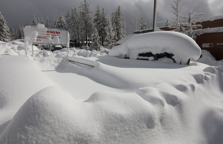
A "strong winter storm" that is affecting 11 states will continue to bring heavy snow in the Intermountain West and the Plains "with multiple hazards" starting early this week. Avalanche and blizzard warnings have been issued in some states, while others are under winter weather warnings.
"Major storm system currently bringing heavy mountain snow and coastal rain to the West will begin to shift into the Plains Monday," the National Weather Service (NWS) said in its Short Range Public Discussion report released Sunday.
Officials are expecting up to 12 inches of snowfall in the Great Basin, the Central Rockies, Arizona and southern California.
The Sawtooth Avalanche Center in Idaho warned that avalanche danger in the forecast area is "HIGH and EXTREME." Officials discouraged travel to avalanche terrain and areas that are exposed to "hazard from above."
We have issued AVALANCHE WARNINGS for our entire Forecast Area. The Avalanche Danger is HIGH and EXTREME. Avoid all avalanche terrain and terrain exposed to hazard from above, avalanches are possible on all steep slopes.
— Sawtooth Avalanche Center (@SawtoothAvy) December 11, 2022
In Nebraska, the NWS in North Platte warned of blizzard conditions expected in the northwest of the state through Thursday morning.
A major winter storm will impact the area through Thurs morning. Strong winds and heavy snow will lead to significant travel impacts, especially across northwest NE where blizzard conditions are expected. Be prepared for very difficult to impossible travel through Thursday. #NEwx pic.twitter.com/8AbvjpgOe3
— NWS North Platte (@NWSNorthPlatte) December 11, 2022
Officials with the NWS in Riverton, Wyoming are expecting up to 11 inches of snowfall in Rawlins and Kaycee, up to 12 inches in Thermopolis and Casper, and up to 14 inches in Sheridan.
A winter storm continues across the west through tomorrow, with impacts spreading east Monday Evening. Winter Storm Warnings and Winter Weather Advisories have been issued for portions of the area. Snow continues through Wednesday for eastern areas. #wywx pic.twitter.com/gkHSQzXxtM
— NWS Riverton (@NWSRiverton) December 11, 2022
Other neighboring states are also expecting heavy snow, with California, Nevada, Oregon and several other states under Winter Storm Warnings or Winter Weather Advisories.
There are currently no active alerts in Washington, but officials at the NWS in Spokane urged residents to take extra care when outdoors due to reduced visibility and slick surfaces on untreated sidewalks and roadways.
Locally dense freezing fog will continue across the Spokane area and portions of the Palouse tonight. Be prepared for visibility reductions and slick roads. https://t.co/tDiiwwxaRW
— NWS Spokane (@NWSSpokane) December 12, 2022
Winter alerts in Idaho
Avalanche Warnings effective through 6 a.m. Tuesday:
- Sawtooth Range area – Boise, Camas, Elmore and Valley
- Wood River Foothills – Big Lost Highlands, Copper Basin, Stanley Basin, Sun Valley Region
Winter Storm Warnings effective through 4 a.m. Monday:
- Lost River Valleys (up to 10 inches possible)
- Lost River Range (up to 9 inches possible)
- Sun Valley Region – Wood River Foothills (up to 15 inches possible on elevations above passes)
- Copper Basin – Big Lost Highlands (up to 12 inches)
Winter Storm Warning effective through 11 a.m. Monday:
- Lower Hells Canyon – Salmon River Region (up to 10 inches above 2,500 feet possible)
Winter Storm Warning effective through 4 p.m. Monday:
- Beaverhead – Lemhi Highlands, Centennial Mountains, Island Park (up to 16 inches possible on elevations above passes)
Winter alerts in Nebraska
Blizzard Warning effective from 5 p.m. Monday through 11 p.m. Wednesday:
- Dawes County and North Sioux County
Blizzard Warning effective from 11 p.m. Monday through 5 a.m. Thursday:
- Sheridan County and Western Cherry County
Winter Storm Watch effective through Tuesday evening:
- Dundy (up to 8 inches of snow and wind gusts of up to 60 mph possible)
Winter Storm Watches effective through Wednesday evening:
- Central and southern Nebraska panhandle – Banner, Box Butte, Cheyenne, Morrill, Scotts Bluff, South Sioux
- Portions of north-central, southwest and west-central Nebraska – Arthur, Brown, Deuel, Eastern Cherry, Garden, Kimball, Grant, Hooker, Keith, Keya Paha, Thomas, Perkins and McPherson
Winter alerts in Wyoming
Blizzard Warning effective from 5 p.m. Monday through 11 p.m. Wednesday:
- Niobrara County – Converse County Lower Elevations (up to 16 inches possible in the Pine Ridge area)
Winter Storm Warnings effective from 3 p.m. Monday through 6 a.m. Wednesday:
- Owl Creek Mountains – Bridger Mountains and Southwest Big Horn Basin (up to 12 inches in higher elevations possible)
- Northeast and Southeast Johnson County (up to 12 inches possible over eastern portions of the county)
- Casper Mountain – Natrona County Lower Elevations (up to 16 inches possible)
Winter Storm Warnings effective from 11 a.m. Monday through 5 a.m. Thursday:
- Northeast Bighorn Mountains (up to 16 inches possible)
- Sheridan Foothills (up to 16 inches possible)
Winter alerts in Nevada
Winter Storm Warning effective through 4 a.m. Monday:
- Greater Lake Tahoe Area (wind gusts of up to 70 mph possible)
Winter Storm Warning effective through 10 p.m. Monday:
- Ruby Mountains – East Humboldt Range (up to 12 inches possible)
Winter alerts in Colorado
Winter Storm Warnings effective through 11 p.m. Monday:
- Eastern San Juan Mountains above 10,000 feet (up to 14 inches possible)
- Southwest San Juan Mountains (up to 12 inches possible)
Winter Storm Watch effective through late Tuesday evening:
- Central and East Adams and Arapahoe Counties – Logan, Morgan, Philips, Sedgwick and Washington
Winter alert in Oregon
Winter Storm Warning effective through 10 a.m. Monday:
- Wallowa County (up to 10 inches possible)
Winter alerts in New Mexico
Winter Weather Advisories effective through 8 a.m. Tuesday:
- Gila Region – Black Range above 6,500 feet and New Mexico Bootheel Highlands
- Lowlands of Bootheel, Southwest Desert, Lower and Upper Gila River Valley
- Sacramento Mountains and West Slopes Sacramento Mountains above 7,500 feet
Winter alerts in Montana
Winter Storm Warnings effective from 11 a.m. Monday through 5 a.m. Thursday:
- Bighorn Canyon, Northern and Southern Bighorn and Treasure (up to 16 inches possible)
- Pryor Mountains (up to 16 inches possible)
Winter alerts in California
Winter Storm Warning effective through 4 a.m. Monday:
- White Mountains of Inyo County – Eastern Sierra Slopes of Inyo County (up to 30 inches of snow possible)
- Mariposa-Madera Lower Sierra - Upper San Joaquin River, Yosemite NP outside of the valley, Yosemite Valley, Grant Grove area, Kaiser to Rodgers Ridge, Kings Canyon NP, San Joaquin River Canyon, Sequoia NP, South End of the Upper Sierra, Mono, West Slope Northern Sierra Nevada, Western Plumas County, Lassen Park
Winter Storm Warning effective through 6 p.m. Monday:
- Ventura County Mountains – Santa Barbara County Interior Mountains and Los Angeles County Mountains
Winter Storm Warnings effective through 10 p.m. Monday:
- San Bernardino County Mountains – Riverside County Mountains
- San Diego County Mountains
Winter alerts in Utah
Winter Storm Warnings effective through 5 p.m. Tuesday:
- Wasatch Back (up to 14 inches possible in Ogden Valley)
- Wasatch mountains I-80 North and South of I-80 (up to 25 inches possible)
Winter alerts in Arizona
Winter Weather Advisories effective through 11 p.m. Monday:
- Northern Gila County – Eastern Mogollon Rim (up to 11 inches possible in the Heber-Overgaard area)
- White Mountains
© Copyright IBTimes 2025. All rights reserved.
- MOST POPULAR IN National


