

West Antarctica Glacier, Ice Sheet History Over 11,000 Years As Larsen C Ice Shelf Poised To Calve
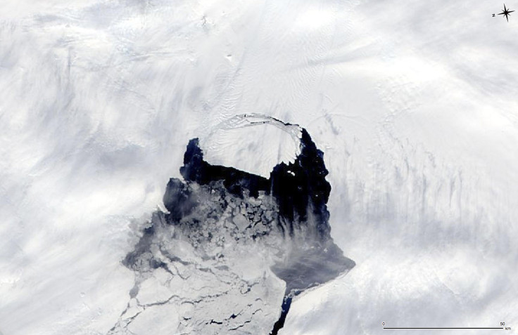
On the same day that the European Space Agency announced the Larsen C ice shelf is on the brink of calving — with only a 5-kilometer (3 miles) stretch holding a 200-kilometer long chunk of ice from collapsing into the sea — a study released Wednesday provided a look at how the ice sheet in West Antarctica has changed over the last 11,000 years.
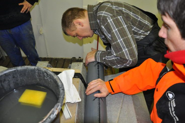
Published in the journal Nature, the study by an international team of researchers took 10 years and uses data collected over the past 20 years, including analysis of seafloor sediment cores collected in 2006 and 2010. In the study, the researchers say the region saw sustained ice loss starting 10,400 years ago, but the retreat of glaciers in the region halted about 7,500 years ago before resuming again in the 1940s.
Lead author Claus-Dieter Hillenbrand, a senior marine geologist at the British Antarctic Survey (BAS), said in a statement Wednesday: “Our reconstruction shows that warm deep water flooded Pine Island Bay at the end of the last ice age. It forced the ice to retreat but stopped at about 7,500 years ago, when the belt of westerly winds driving the deep water onto the shelf shifted northwards.”
Read: Pine Island Glacier Loses Miles-Long Chunk
Two of the largest glaciers on the West Antarctic Ice Sheet (WAIS) — Thwaites and Pine Island — are steadily draining into the sea in the present day, and contributing to rising sea levels, making this study a useful one to understand the present-day dynamics of the region. The ice loss is mainly driven by the incursion of relatively warm water from the deep ocean, which melts the floating parts of glaciers when it comes in contact with the coastline of the shallow continental shelf. This phenomenon also causes thinning of glacier ice further upstream.
James Smith, a marine geologist at BAS and a co-author of the paper, said in the statement: “Our data also reveal a more recent history of the WAIS. A shift in the wind direction during the 1940s caused renewed upwelling of warm deep water onto the shelf. This has continued ever since and is responsible for the ice loss we are observing today and over the last few decades.”
“Ice loss from this part of West Antarctica is already making a significant contribution to sea-level rise – around 1 mm per decade and is actually one of the largest uncertainties in global sea-level rise predictions. Whilst this is a small figure in actual terms, combined with the contribution from other melting glaciers around the world and expansion of the world’s oceans, it will have an impact upon society through flooding of low-lying coastal regions,” Hillenbrand added.
Read: Antarctic Sea Ice Lost 14% Cover In 100 Years
If the whole of WAIS was to collapse into the surrounding waters, it would raise global sea levels by as much as 3.5 meters (11.5 feet), according to the statement.
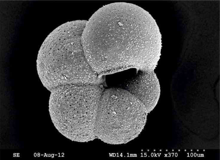
The sediment cores studied by the researchers were collected from Pine Island Bay in the Amundsen Sea. These cores contained tiny shells built by organisms that lived in the water column and on the seafloor, and the shells became embedded in the sediment. The chemical composition of these shells is very different from those that exist in warm deep waters today. Comparing the two gave researchers the time interval when warm deep water was present or absent.
The Nature paper is titled “West Antarctic Ice Sheet retreat was driven by Holocene warm water incursions.”
© Copyright IBTimes 2025. All rights reserved.
- MOST POPULAR IN World


