Hurricane Irene: Philadelphia Area May Break Monthly Rainfall Record
Rainfall this weekend dumped by Hurricane Irene is expected to set a new monthly record for rain in the Philadelphia area.
Thirteen inches of rain have already fallen in the area -- however forecasters from the National Weather Service (NWS) expect two inches in Friday morning, up to 2.5 inches more on Saturday and perhaps a little more on Sunday before Irene finally fades away.
By that point, the old monthly record of rainfall, 13.07 inches recorded in September 1999, will be shattered by a wide margin.
Such heavy rains will also prompt fears of flash flooding in the Delaware Valley.
Based on the current track, most of the Eastern Seaboard is going to receive some nasty wind and rain from this storm,” meteorologist Greg Heavener of the NWS told Philadelphia media.
Based on NWS projections, Irene could come as close as 75 miles from the coast of New Jersey, which might translate into tropical-force winds – at least 35 miles per hour - and lead to significant beach erosion and flooding.
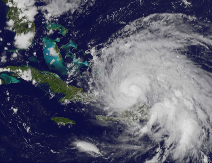
Irene, which is currently raking over the Bahamas as a Category 3 storm, is expected to cause significant damage to the Outer Banks of North Carolina, where evacuations have already commenced.
© Copyright IBTimes 2026. All rights reserved.
- MOST POPULAR IN World