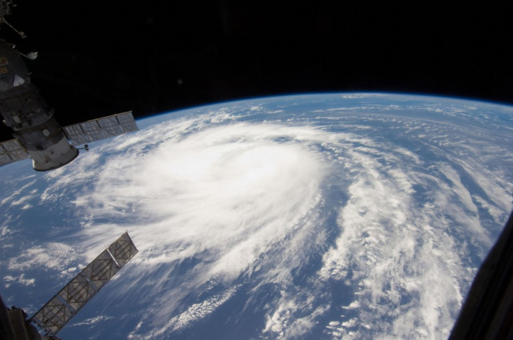
One Possible Scenario for Hurricane Katia Path Threatens U.S. East Coast

While forecasters suggest that the path of Hurricane Katia 2011 may only graze the U.S. East Coast, one weather scenario suggests a more severe impact. A Category 3 storm with winds of 125 miles per hour, Katia is moving steadily northwest in the Atlantic at 10 miles per hour, still far from land and not posing an immediate threat.
The consensus among most forecasters is that the storm will turn north as it remains a major hurricane over the next days, only possibly causing minor problems along parts of the U.S. East Coast while the storm remains at sea. The key points that will be impacted if that forecast holds true will be Cape Cod, and eventually Novia Scotia and Newfoundland.
Then, according to forecasts, Katia would curve to the northeast.
But there's one potential problem for the U.S. East Coast in the models. If Katia's anticipated northward turn is delayed, a trough may try to pull on Katia from the left, according to Alex Sosnowski, expert senior meteorologist at Accuweather, limiting a later forecast turn to the northwest, or preventing that last turn altogether.
In other words, the closer Katia gets to the U.S. East Coast before making a turn, the more difficult it will become for the storm to avoid the region as it nears land.
From a meteorological standpoint, what you don't want is for the jet stream to take a huge dip to the south into (Tropical Storm) Lee's old circulation, Sosnowki writes at Accuweather. Such a setup would open the door for Katia to take a path more westward than currently projected late in the week and this coming weekend.
Forecasters admit that such a set up is a long shot, but after the East Coast was pummeled by Hurricane Irene in August, Katia's path possibilities should be closely monitored.
On Tuesday, Katia's maximum sustained winds have decreased to near 125 miles per hour after the storm was a Category 4 storm late Monday. Some fluctuations in strength are possible during the next 24 hours, the National Hurricane Center said Tuesday, followed by slow weakening.
The NHC said Katia's hurricane force winds extend outward up to 60 miles from the center, and the the storm is expected to turn toward the north-northwest by Thursday.
© Copyright IBTimes 2024. All rights reserved.


