

Google Expands Its Exploration to Oceans: Will it Find the Mermaid for You?
Want to enjoy the Great Barrier Reef, but afraid of diving into the sea? Google seems to come for your help once again!
Google's latest information program will take you under the ocean while you sit in front of your computer monitor.
Google has inked a deal with insurance company Catlin Group Ltd and the oceanographers to launch Catlin Seaview Survey in the two-day World Oceans Summit taking place at Singapore.
According to the program, the project aims at carrying out a comprehensive study to document the composition and health of coral reefs of the sea across an unprecedented depth. Hence, users can just switch to the Internet and can enjoy the delights of the seaview of world's largest ecosystem - Great Barrier Reef - from any corner of the World, similar to the Google Streetview.
Further, Catlin Seaview Survey aims at projecting three surveys including shallow reef, deep-water and mega-fauna.
In the first, users will be able to take a reef survey into the effects of climate change on the ecosystems with a 360 degree panoramic vision using specially developed cameras (the SVII).
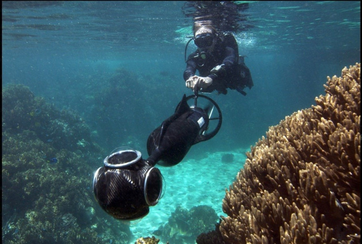
In the second, the project's cutting-edge technologies would explore the depths, beyond the range of scuba divers, creating an incredibly rich broad scale baseline for scientific analysis from locations along the entire length of the 2300km reef. Each of the robots is able to help the other one if one gets stuck between the reefs.
Talking about the third component, it is led by Emmy award winning cinematographer and shark researcher Richard Fitzpatrick.
It would involve tagging and tracking manta rays, turtles and tiger sharks using satellite tags and tracking their movements live in relation to oceanographic data. This would contribute to an important study to examine the size of distribution of animals in response to rapidly warming seas.
These images will be accessible on Google Earth and Google Maps using image recognition software.
Adding on, approximately 50,000 panoramas will be available on a new Google feature called Panoramio. A YouTube channel will also be dedicated to the project that will include live-streaming of the expedition team from the ocean floor.
The mapping exploration is expected to commence around late 2012. However, a sample of huge sea turtles swimming about amongst colorful reef fishes can be viewed and tested on the Catlin Seaview Survey's Web site.
© Copyright IBTimes 2025. All rights reserved.
- MOST POPULAR IN Technology


