

Montana And 6 Other States Under Winter Alerts Amid 'Hazardous' Conditions

KEY POINTS
- Officials expect up to 1 inch of snowfall per hour in Montana
- Up to 9 inches of snow is expected in some parts of Utah
- Nevada NWS discouraged driving on bridges and overpasses
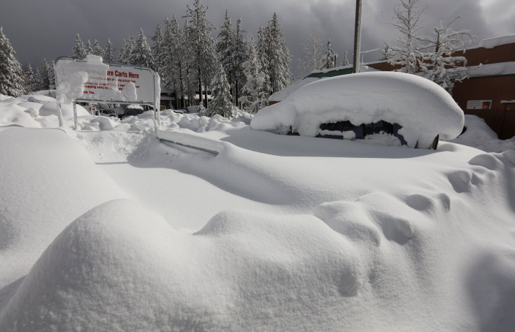
The West Coast is expected to experience "widespread snow showers" Monday through Tuesday, the National Weather Service (NWS) said late Sunday, with the most snow accumulations expected to take place in the mountain ranges of Montana, Wyoming, Utah and Colorado.
A large swathe of Montana, in particular, has been placed under Winter Weather Advisories ahead of "hazardous" conditions due to heavy snow.
More than half of western states will experience "hazardous" snowy conditions Monday through Tuesday, the NWS said in its Short Range Forecast Discussion report released late Sunday.
"The heaviest totals" of widespread snow showers "should remain localized to the Sierra Nevada and mountain ranges of the northern and central Rockies," the NWS noted.
11am. Snow is starting to spread over Southwest Montana, seen here at Monida Pass on I-15, via @mdtroadreport . Snowfall rates will increase through early evening, with impacts to travel overnight through Monday morning. #mtwx pic.twitter.com/DDfuOicK43
— NWS Great Falls (@NWSGreatFalls) December 4, 2022
The NWS in Great Falls, Montana, said snowfall rates are expected to increase overnight through Monday morning as snow has been spreading over the southwest of the state.
At 520 PM, heavy snow moving through the Bozeman area. Snowfall rates could approach 1 inch per hour. #mtwx #bozeman https://t.co/D11xVgGJhw
— NWS Great Falls (@NWSGreatFalls) December 5, 2022
The office also warned Sunday afternoon that snowfall rates "could approach 1 inch per hour."
In Utah, the NWS in Salt Lake City warned of heavy snow to hit the state through Monday, noting that some areas may see up to 10 inches of snow accumulations.
The northern mountains will see another round of snow tonight into Monday with the passage of a cold front. 5-10" accumulations are forecast with locally higher amounts. Some valley snow is also expected, but accumulations should be light. #utwx pic.twitter.com/v93UNE3D0A
— NWS Salt Lake City (@NWSSaltLakeCity) December 4, 2022
Up to 9 inches is expected in the Western Uintas as well as in Alta, while up to 7 inches is expected in Tony Grove, the office said.
The NWS in Reno, Nevada has warned against traveling to higher elevations. There are no winter weather alerts in the state, but officials released a Special Weather Statement for Southeastern Elko County that discouraged driving on bridges and overpasses due to freezing rain.
So, how are the conditions currently in the mountains? We look to the Truckee airport webcam to tell us...
— NWS Reno (@NWSReno) December 4, 2022
Prepare for winter driving conditions with significant impacts if you venture into the higher elevations today (which is not advised to begin with)! #cawx #nvwx pic.twitter.com/wI0ARTo0TG
Meanwhile, in the Golden State, the California Department of Transportation (CalTrans) District 3 office tweeted that Highway 89 around Emerald Bay has been closed "due to slides."
Not a good day to be traveling in the Sierra today. Backed up on WB I-80 after traffic recently released. HOLDING traffic on Highway 50 over Echo Summit to clear spinouts. Highway 89 around Emerald Bay is closed due to slides. @CHP_Truckee @CHPSouthLake pic.twitter.com/mwyjWlBLt3
— Caltrans District 3 (@CaltransDist3) December 5, 2022
"Not a good day to be traveling in Sierra today," the office said.
In Washington, some areas are experiencing up to 3 inches of snow as of Sunday evening.
Here are the snowfall reports we have received today. Note that duplicate reports for locations have been removed or updated with the latest report. Light rain and snow will continue to taper off through the rest of the evening with little additional accumulation. ❄️#WAwx pic.twitter.com/N1pQSzylnn
— NWS Seattle (@NWSSeattle) December 5, 2022
Meanwhile in Colorado, the NWS in Grand Junction said a storm system is expected to affect the state Sunday. "This will be a slower...drawn out storm which will bring snow to much of the area through mid-week," the office said.
Another storm system will begin to impact the northern Utah and Colorado tonight. This will be a slower...drawn out storm which will bring snow to much of the area through mid-week. Expect travel impacts at times before a short break later in the week. #utwx #cowx pic.twitter.com/BkRTvRGjUw
— NWS Grand Junction (@NWSGJT) December 5, 2022
The Vail area is expected to see the highest snow totals, with up to 10 inches possible. Steamboat Springs trails behind with up to 9 inches expected.
In some parts of Wyoming, the NWS in Riverton is expecting travel to be difficult, as per a notice released Sunday. "The hazardous conditions will impact the evening and morning commute," the office noted.
Winter Weather Advisories in Montana effective through noon Monday:
- South Central Montana – Beartooth Foothills, Livingston Area, Melville Foothills, Northern Carbon, Northern Park, Northern Stillwater, Northern Sweet Grass, Paradise Valley, Red Lodge Foothills
- Snowy and Judith Mountains – Fergus County below 4,500 feet and Southern Rocky Mountain Front
- Parts of central and north central Montana – Cascade County below 5,000 feet, Gates of the Mountains, Judith Basin County, Judith Gap, Little Belt Mountains, Highwood Mountains, Southern High Plains, Upper Blackfoot, MacDonald Pass
- Missoula Valley – Bitterroot Valley, Butte, Blackfoot Region, Potomac, Seeley Lake Region, Flathead Valley, Mission Valley, Lower Clark Fork Region, Sapphire Mountains, Bitterroot Mountains
Winter Weather Advisories in Montana effective through 3 p.m. Monday:
- Southeast Montana – Bighorn Canyon, Golden Valley, Judith Gap, Musselshell, Northeastern Yellowstone, Northern Big Horn, Northern Rosebud, Powder River, Southern Big Horn, Southern Rosebud, Southern Wheatland, Treasure
Winter Weather Advisory in Montana effective from 5 p.m. Monday through 5 p.m. Tuesday:
- Parts of north central Montana – Eastern Glacier, Western Toole, Central Pondera, Eastern Pondera, Eastern Teton, Liberty, Hill County, Eastern Toole, Northern High Plains, Western and Central Chouteau County, Cascade County below 5,000 feet, Gates of the Mountains, Southern High Plains, Judith Basin County
Winter Weather Advisories in Montana effective from 5 p.m. Monday through 11 p.m. Tuesday:
- Southern Blaine – Bears Paw Mountains, East Glacier Park Region and Northern Blaine County
- Snowy Mountains – Judith Mountains, Fergus County below 4,500 feet and Southern Rocky Mountain Front
Winter Weather Advisory in Utah effective through 8 a.m. Monday:
- Wasatch Mountains – I-80 North
Winter Weather Advisory in Utah effective through 9 p.m. Monday:
- Wasatch Mountains South of I-80 – Western Uinta Mountains
Winter Weather Advisories in California effective through 1 p.m. Monday:
- Trinity – Southern and Northern Trinity
- Siskiyou County – Western, South Central, North Central and Southeast
Winter Weather Advisory in California effective through 2 p.m. Monday:
- Burney Basin – Eastern Shasta County Mountains, Southwestern Shasta County to Western Colusa County, Shasta Lake Area, Northern Shasta County
Winter Weather Advisory in California effective from 7 a.m. through 7 p.m. Monday:
- Yosemite NP – outside of the Yosemite valley
Winter Weather Advisories in Washington effective through noon Monday:
- Lower Garflied and Asotin Counties – Lewiston, Clarkston, Alpowa Summit, Lapwai, Peck, Lewiston Grade, Pomeroy, Gifford, Culdesac
- Washington Palouse – Genesee, Tekoa, Potlatch, Oakesdale, Pullman, Rosalia, La Crosse, Uniontown, Moscow, Plummer
Winter Weather Advisories in Colorado effective through 11 a.m. Tuesday:
- Rabbit Ears Pass – West Jackson County and West Grand County above 9,000 feet
- Flat Tops – Elkhead and Park Mountains
Winter Weather Advisories in Wyoming effective through 11 a.m. Monday:
© Copyright IBTimes 2025. All rights reserved.
- MOST POPULAR IN National


