

Strong Winter Storm Affects Large Swath Of Nebraska And Neighbor States; Power Outages Possible

KEY POINTS
- Power outages are possible in areas where gusty winds are expected
- Up to 17 inches of snow totals are possible in portions of Nebraska
- Several mountain ranges in Colorado may get up to 24 inches of snow accumulations
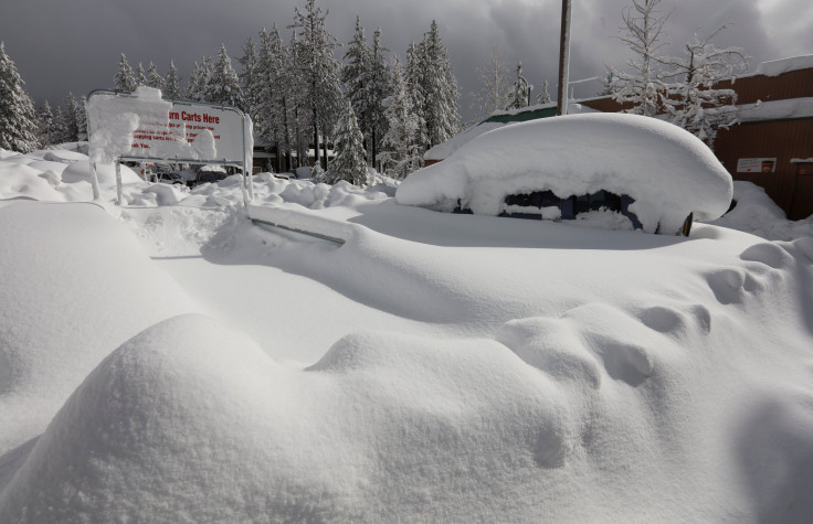
A storm system that started in the Four Corners region Tuesday afternoon will bring heavy snow in the central High Plains through Wednesday, with strong wind gusts that could cause tree damage and power outages in some affected areas.
A strong storm system that passed through the Four Corners region Tuesday is expected to spread heavy snow in the central High Plains Tuesday evening through Wednesday, the National Weather Service's Weather Prediction Center (WPC) said.
"Areas of heavy snow with snowfall rates of 1 to 2 inches per hour will be possible within the heaviest snow bands from northeastern Colorado into Nebraska and northwestern Iowa," the agency added.
The winter storm is also expected to make travel difficult due to the possibility of freezing rain and reduced visibility.
Power outages are possible in areas where strong wind gusts could damage tree branches, the agency warned.
In Nebraska, weather officials are expecting a wintry mix Wednesday morning before conditions transition to heavy, wet snow from the afternoon through Wednesday evening, KETV reported.
Some areas are expected to get smaller snow totals of up to 10 inches, but other locations such as Ogallala, North Platte and Ainsworth may see snow accumulations between 12 and 17 inches, the NWS North Platte said.
(3/4) When all is said and done, we'll likely see a large swath of significant snowfall amounts with many locations likely exceeding 12" and potentially approaching 16-17"! Combined with breezy north winds, expected blowing and drifting across the area. #NEwx pic.twitter.com/o11qCMkCsU
— NWS North Platte (@NWSNorthPlatte) January 17, 2023
The greatest impacts of the storm are expected to occur in Nebraska between noon and 9 p.m. Wednesday.
In Colorado, commuters and drivers are expected to feel the highest impact of the winter storm throughout Tuesday evening, with the following interstates possibly getting the heaviest impact: Interstate 70 from Denver to Kansas, Interstate 25 from Colorado Springs to Wyoming and Interstate 76 from Denver to Nebraska, KMGH-TV reported.
Up to 12 inches of snow accumulations are expected through Wednesday morning in Julesburg, Holyoke and Akron before conditions taper off Wednesday afternoon, the NWS Boulder said.
Forecast confidence continues to increase with the upcoming storm system with 8 to 12 inches across northeast Colorado, #cowx pic.twitter.com/WEA9JxjP0e
— NWS Boulder (@NWSBoulder) January 17, 2023
Meanwhile in Iowa, the storm system is expected to affect the state starting Wednesday afternoon through Thursday morning.
The heaviest snow is expected to fall in areas roughly north of Highway 20 in eastern Iowa, KCRG-TV reported.
Hazardous travel conditions are likely during the Wednesday evening commute, the NWS Des Moines said.
Alerts in Nebraska:
Winter storm warnings effective through 5 p.m. Wednesday:
- Box Butte County
- Scotts Buff, Cheyenne, Banner, Kimball and Morrill (up to 12 inches of snow accumulations possible)
Winter storm warning effective through 12 a.m. Thursday:
- Adams, Clay, Fillmore, Buffalo, Dawson, Gosper, Furnas, Greeley, Franklin, Harlan, Kearney, Hall, Merrick, Howard, Hamilton, York, Nuckolls, Nance, Webster, Sherman, Polk and Valley (up to 15 inches of snow accumulations possible)
Winter storm warnings effective through 6 a.m. Thursday:
- Antelope, Boone, Burt, Butler, Cedar, Colfax, Cuming, Dodge, Douglas, Knox, Lancaster, Madison, Pierce, Platte, Sarpy, Saunders, Seward, Stanton, Thurston, Washington and Wayne (up to 14 inches of snow accumulations possible)
- Red Willow, Dundy and Hitchcock (up to 13 inches of snow accumulations possible)
- Sheridan and western Cherry (up to 12 inches of snow accumulations possible)
- Eastern Cherry (up to 15 inches of snow accumulations possible)
- Arthur, Chase, Deuel, Frontier, Garden, Grant, Hayes, Hooker, Keith, Lincoln, Logan, McPherson, Perkins and Thomas (up to 17 inches of snow accumulations possible)
- Rock, Keya Paha, Blaine, Garfield, Boyd, Brown, Holt, Custer, Wheeler and Loup (wind gusts of up to 35 miles per hour possible)
Alerts in Colorado
Winter storm warning effective through 2 a.m. Wednesday:
- Eastern San Juan Mountains above 10,000 feet (up to 20 inches of snow accumulations possible)
Winter storm warnings effective through 11 a.m. Wednesday:
- Grand Mesa, Battlement Mesa, Uncompahgre Plateau, Dallas Divide, Sawatch Mountains and West Elk Mountains (up to 24 inches of snow accumulations possible)
- Southwest San Juan Mountains (wind gusts of up to 35 miles per hour possible)
Winter storm warnings effective through 5 p.m. Wednesday:
- Boulder and Jefferson Counties below 6,000 feet, central and East Adams, Arapahoe, East and West Broomfield, Morgan, Logan, Elbert, central and East Douglas above 6,000 feet, Larimer County below 6,000 feet, northwest and northeast Weld County, Denver, North Douglas County below 6,000 feet, Washington, Sedgwick and Phillips (up to 15 inches of snow accumulations possible)
- Monument Ridge, Rampart Range below 7,500 feet and northern El Paso (wind gusts of up to 45 miles per hour possible)
Winter storm warning effective through 11 p.m. Wednesday:
- Yuma and Kit Carson (up to 13 inches of snow accumulations possible)
Alerts in Iowa
Winter storm warnings effective through 6 a.m. Thursday:
- Shelby, Harrison, Monona and Pottawattamie (up to 14 inches of snow accumulations possible)
- Woodbury, Ida, Dickinson, Osceola and Lyon
- Sioux, Clay, Plymouth, O'Brien, Buena Vista and Cherokee
Winter storm warnings effective through 9 a.m. Thursday:
- Audubon, Boone, Calhoun, Carroll, Cass, Crawford, Greene, Guthrie, Hamilton, Hardin, Sac, Story and Webster
- Bremer, Butler, Cerro Gordo, Worth, Pocahontas, Wright, Palo Alto, Emmet, Humboldt, Franklin, Hancock, Winnebago and Kossuth (up to 9 inches of snow accumulations possible)
© Copyright IBTimes 2025. All rights reserved.
- MOST POPULAR IN National


