Tropical Storm Fred Path: Florida Panhandle Could See Heavy Rains After Landfall

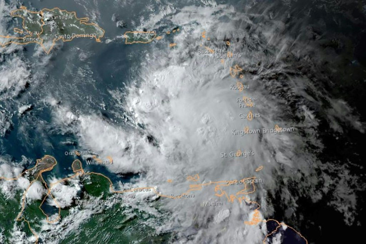
Tropical Storm Fred is expected to make landfall on the northern Gulf Coast this week as it continues to strengthen amid its path to the Florida Panhandle.
On Sunday, Fred re-formed back into a tropical storm after maintaining winds of 40 mph. Its re-strengthening has resulted in the Florida Panhandle receiving a tropical storm warning.
Meanwhile, a tropical storm watch remains in effect for the area as well as the Alabama-Florida border, including Panama City and inland areas of southern Alabama.
Meteorologists expect Tropical Storm Fred to make landfall in the western part of the Florida Panhandle on either Monday afternoon or evening. The arrival of the storm could result in some flash flooding.
The National Hurricane Center expects four to eight inches of rainfall along the Florida Panhandle and Big Bend, and up to 12 inches locally.
Meanwhile, parts of Georgia, the western Carolinas, and areas from southeast and south-central Alabama could get three to six inches of rainfall and up to 9 inches locally.
A storm surge warning has also been issued along the coast of the Florida Panhandle from Indian Pass to Steinhatchee River. Fred is expected to cause turbulent winds along with isolated tornadoes and periods of heavy rain in south Florida and the Keys.
Windy conditions and rainy weather are expected to continue in the upcoming week in Georgia, the Carolinas, and Alabama.
Forecasts for Fred come amid the tracking of Tropical Storm Grace, which is headed toward Haiti after the country was struck by a 7.2-magnitude earthquake Saturday.
© Copyright IBTimes 2026. All rights reserved.
- MOST POPULAR IN World