

'Very Large' Winter Storm In Northern Plains And Upper Midwest, 24 Inches Snow Possible

KEY POINTS
- 'Near zero visibility' is possible in affected states
- Travel will either be difficult or impossible in Nebraska
- Wind gusts of up to 50 mph is possible in South Dakota
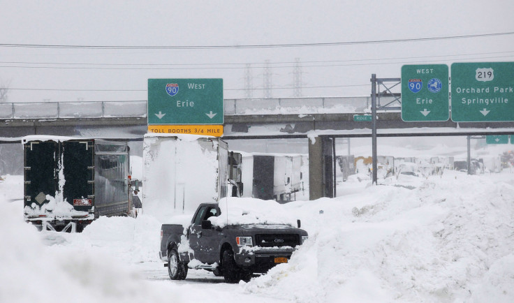
A "very large winter storm" in the Northern Plains and Upper Midwest is expected to make travel impossible and result in power outages in affected areas, with Minnesota and Wisconsin forecasted to see up to 24 inches of snow accumulations.
"A major storm system was moving from the central plains towards the Upper Midwest this afternoon and causing widespread heavy snow and blizzard conditions in the northern/Central Plains and wintry mixed precipitation in the Upper Midwest," the National Weather Service (NWS) said Wednesday.
The Weather Prediction Center (WPC) also noted the storm could result in "near zero visibility" and may cause "scattered power outages, and harsh livestock conditions."
A very large winter storm continues to produce widespread snow and blizzard conditions across portions of the Northern Plains and Midwest. The storm will next take aim on the Central Appalachians and Northeast with locally significant ice and snow expected to end out the week. pic.twitter.com/vP3cz5HjaL
— NWS Weather Prediction Center (@NWSWPC) December 14, 2022
In some parts of Minnesota and Wisconsin, up to 24 inches of snow is forecasted, according to a snowfall forecast by the NWS valid through 7 p.m. Saturday.
Heavy snow, blizzard conditions, and areas of freezing rain and sleet continue to make travel difficult to impossible in the north/central Plains. Freezing rain shifts into the Mid-Atlantic, and heavy snow spreads across the Northeast on Thursday. pic.twitter.com/LstN1UwKth
— National Weather Service (@NWS) December 15, 2022
In Minnesota, the NWS in Twin Cities said it is expecting the heaviest snowfall to occur through late Thursday evening in the following areas: Hayward, Ladysmith, Rice Lake, Morris, Brainerd, Hinckley, Alexandria, Madison and Eau Claire.
The second half of our winter storm is set to begin tonight and last through Friday. The heaviest snowfall will occur between midnight and 9am as the snow wraps around from east to west. This will lead to travel impacts for the Thursday morning commute. #mnwx #wiwx pic.twitter.com/Okobi2md5C
— NWS Twin Cities (@NWSTwinCities) December 14, 2022
While lower snow accumulations are expected in Wisconsin, the NWS in Milwaukee reiterated that Wednesday night will produce heavy, wet snow of up to six inches in Porta, Dells, Fond du Lac, Berlin and Montello.
💧➡️❄️ Rain transitioning to snow this evening
— NWS Milwaukee (@NWSMilwaukee) December 14, 2022
🌨️Burst of heavy, wet snow tonight
📏2-6 inches w/ locally higher amounts possible
☃️Heaviest snow north I-94 & west of I-43
⚠️Ending around 7 AM Thu morning.#wiwx pic.twitter.com/BCAKLHQtP3
In South Dakota, lighter snow is forecasted to fall on and off throughout Wednesday night, but "a strong round of snow and wind" is expected by mid-morning Thursday, the NWS in Sioux Falls said.
Officially the 6pm observation at the Sioux Falls airport measured 1.0" of new snow.
— NWS Sioux Falls (@NWSSiouxFalls) December 15, 2022
Light snow may continue on and off through the night.
Watch out for a stronger round of snow and wind beginning mid-morning Thursday.
In neighboring North Dakota, the NWS in Grand Forks said reduced visibility should be expected, resulting in hazardous travel conditions.
Areas of light to moderate snow continue south of US Highway 2. Hazardous travel conditions are expected to continue due to accumulating snow and reduced visibility. New snowfall accumulations of 1-3" are possible, with some areas potentially reaching 4". pic.twitter.com/olGMwJnBTM
— NWS Grand Forks (@NWSGrandForks) December 15, 2022
Over in Nebraska, the NWS in North Platte warned of "difficult if not impossible" travel in some areas, with road closures implemented due to blowing and drifting snow.
Here are the updated winter weather headlines. Many areas still under a Blizzard Warning with roads closures across much of western and northwest Nebraska. Travel will continue to be difficult if not impossible in some areas tonight. #NEwx pic.twitter.com/BUsSvWKqcK
— NWS North Platte (@NWSNorthPlatte) December 15, 2022
In Michigan, officials at the NWS in Grand Rapids noted that wind gusts of up to 50 mph might result in isolated power outages.
A wintry mix of precipitation will develop overnight across central lower Michigan where hazardous travel conditions are likely to develop. In addition, wind gusts will reach the 40 to 50 mph range after midnight across our area and result in isolated power outages. pic.twitter.com/RuPdq7x5SC
— NWS Grand Rapids (@NWSGrandRapids) December 15, 2022
Winter alerts in Minnesota
Winter Storm Warnings effective through 6 p.m. Thursday:
- Big Stone and Traverse
- North Itasca and Koochiching
- North and Central St. Louis
- Northern Cooke and Northern Lake (up to 20 inches possible in higher terrain)
- North and South Cass, Crow Wing, Northern Aitkin, Pine
- Mille Lacs, Morrison, Isanti, Chisago, Kanabec, Washington
- Hennepin, Dakota, Ramsey, Anoka
Winter Storm Warnings effective through 9 p.m. Thursday:
- East and West Becker, East and West Otter Tail, East Polk, Hubbard, Grant, Mahnomen, Lake of the Woods, North and South Clearwater, North and South Beltrami, Roseau, Pennington, Red Lake, Wadena
- West Polk, West Marshall, Wilkin, Norman, Kittson, Clay (wind gusts of up to 40 mph possible)
- Todd, Swift, Wright, Yellow Medicine, Stearns, Pope, Stevens, Lac Qui Parle, Douglas, Meeker, Chippewa, Kandiyohi
Blizzard Warnings effective through 6 p.m. Thursday:
- Southern Cook and Southern Lake (up to 22 inches possible)
- South St. Louis and Carlton (up to 20 inches in higher terrain possible)
Winter alerts in Wisconsin
Winter Storm Warnings effective through 9 a.m. Thursday:
- Vilas, Menominee, Northern and Southern Oconto County, Northern and Southern Marinette County, Oneida, Shawano, Langlade, Lincoln, Florence, Forest
- Marathon, Waupaca, Wood, Portage
- Door, Outagamie, Brown, Adams, Jackson, Buffalo, Monroe, Juneau, Trempealeau
- Clark and Taylor
Winter Storm Warnings effective through 6 p.m. Thursday:
- Bayfield and Douglas (up to 18 inches possible)
- Washburn, Price, Ashland, Iron, Sawyer
- Rusk, St. Croix, Barron, Polk
Winter alerts in South Dakota
Winter Storm Warnings effective through 5 p.m. Thursday:
- Corson and Dewey (wind gusts of up to 50 mph possible)
- Faulk, Campbell, Edmunds, Potter, McPherson, Walworth
- Brown, Codington, Grant, Clark, Day, Deuel, Marshall, Hamlin, Roberts (wind gusts of up to 45 mph possible)
- Spink, Hughes, Buffalo, Sully, Hyde, Hand (wind gusts of up to 50 mph possible)
- Aurora, Jerauld, Douglas, Beadle, Davison, Hutchinson, Hanson, Sanborn, Miner, Brookings, Moody, Lake, Kingsbury, McCook
Blizzard Warnings effective through 5 a.m. Thursday:
- Northern Meade Co Plains, Ziebach, Harding, Perkins, Butte (wind gusts of up to 50 mph possible)
- Northern Foot Hills, Piedmont Foot Hills, Sturgis, Pennington Co Plains, Haakon, Southern Meade Co Plains, Todd, Mellette, Trip, Oglala Lakota, Jackson, Bennett
Blizzard Warnings effective through 5 p.m. Thursday:
- Lyman, Stanley and Jones
- Gregory, Brule and Charles Mix
Winter alerts in North Dakota
Winter Storm Warning effective through 6 a.m. Thursday:
- Golden Valley, Adams, Billings, Burke, Bowman, Dunn, Divide, Mountrail, Stark, McKenzie, Stark, Williams
Winter Storm Warnings effective through 6 a.m. Friday:
- Bottineau, Burleigh, Emmons, Dickey, Grant, Foster, La Moure, Kidder, McHenry, Logan, McLean, McIntosh, Morton, Mercer, Oliver, Renville, Pierce, Sheridan, Stutsman, Sioux, Wells, Ward (heavy snow expected)
- Western Walsh County, Eddy, Barnes, Griggs, Benson, Cavalier, Ramsey, Nelson, Sargent, Ransom, Towner
Winter alerts in Nebraska
Winter Storm Warning effective through 6 a.m. Thursday:
- Blaine, Logan and Rock (wind gusts of up to 45 mph possible)
Winter Storm Warning effective through 6 p.m. Thursday:
- Boyd and Holt
Blizzard Warnings effective through 6 a.m. Thursday:
- Arthur, Eastern and Western Cherry, Deuel, Grant, Garden, Sheridan, and Hooker
- Brown, Keya Paha, McPherson, Thomas
Blizzard Warning effective through 5 p.m. Thursday:
- Box Butte, North and South Sioux, Dawes (wind gusts of up to 55 mph possible)
Winter alerts in Michigan
Winter Storm Warning effective through 11 a.m. Thursday:
- Gogebic, Menominee, Dickinson and Iron
Wind Advisory effective through 7 a.m. Thursday:
- Van Buren, Muskegon, Ottawa, Barry, Allegan, Clinton, Calhoun, Ingham, Eaton, Jackson, Ionia, Kent, Kalamazoo, Kent (wind gusts of up to 50 mph possible)
Winter alert in Montana
Winter Storm Warning effective through 5 a.m. Thursday:
- Custer, Fallon, Carter, Powder River, Sheridan, Eastern and Western Roosevelt, McCone, Dawson, Prairie, Wibaux, Richland
© Copyright IBTimes 2025. All rights reserved.
- MOST POPULAR IN National


