

Hurricane Irene Just 955 Miles of North Carolina
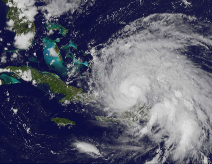
With maximum sustained winds of 110 miles (175 kilometers) per hour, hurricane Irene is heading toward the Carolina states in the U.S. and is just 955 miles (1,535 kilometers) of North Carolina, according to the latest public advisory issued by U.S. National Weather Service’s (NWS) National Hurricane Center (NHC) on Aug. 24 at 5 a.m. (EDT).
The hurricane warning remains in effect for Turks and Caicos Islands as well as the southeastern, central and northwestern Bahamas.
NHC said that the maximum sustained winds of hurricane Irene have increased to near 110 miles per hour with even higher gusts.
Irene is a category two hurricane and as per the forecast, the strengthening Irene could become a major hurricane within the next day or so, NHC said on early Wednesday.
Irene is the first hurricane of the 2011 Atlantic Hurricane Season. It formed over Puerto Rico in the Caribbean Sea on Aug. 20, with maximum sustained winds of 75 miles per hour (120 kilometers per hour). Large-scale damage was caused to trees, and about 800,000 homes were left without power on the island.
“The eye of the hurricane has been wobbling over the past few hours,” NHC said, adding that Irene is moving generally west-northwest and a gradual turn toward the northwest is expected on Wednesday.
“On the forecast track, the core of Irene will move across the southeastern and central Bahamas today and over the northwestern Bahamas on Thursday.”
Also Read:
© Copyright IBTimes 2025. All rights reserved.
- MOST POPULAR IN Science


