Subtropical Storm Beryl Landfall Uncertain But Promises Wet, Windy Memorial Day
Subtropical Storm Beryl brought coastal winds and looming showers Sunday to the Atlantic coast from Florida to South Carolina, and promises to bring heavy rains and dangerous surf by Memorial Day.
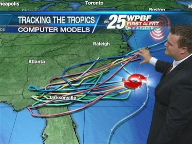
At 2 p.m. EDT, Beryl was packing sustained winds of 65 miles per hour and located about 110 miles east of Jacksonville, Fla., the U.S. National Hurricane Center said. It was moving west toward the coast at 10 mph with tropical storm force winds extending about 90 miles from the center.
It expected to continue along that path until making landfall, the turning north by Monday afternoon, the center said, bringing with it storm surges of 1 to 3 feet and rain accumulations of 3 to 6 inches.
The Hurricane Center issued a Tropical Storm Warning for the area spanning the Volusia-Brevard County line in Florida to Edisto Beach, S.C.
Forecasters said the storm will eventually turn back toward the Atlantic, according to Reuters.
Beryl is categorized as subtropical because of the breadth and reach of the showers and thunderstorms, which are further from the center than in a classic tropical storm. It also makes it tougher to predict.
There is still great uncertainly as to just what the wind strength and structure will be like at landfall, the National Weather Service said on its website. In all likelihood, the strongest winds will be confined to the coastal areas and could occur anywhere in the warning area.
Beryl is the second named storm of the hurricane season, which officially starts June 1. The National Oceanic and Atmospheric Administration predicts a near normal hurricane season with about 15 named storms.
© Copyright IBTimes 2026. All rights reserved.
- MOST POPULAR IN Science