Arctic Blast Barrels Into U.S. Northeast, Threatening Record Lows
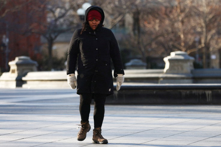
A powerful arctic blast swept into the U.S. Northeast on Friday, threatening to push temperatures to record lows in many spots, including New Hampshire's Mount Washington, where the wind chill could drop to -110 degrees Fahrenheit (-79 Celsius), forecasters said.
The National Weather Service said in an advisory that the mass of frigid air would keep temperatures at life-endangering levels through Saturday, warning of "extremely dangerous" conditions from the "short-lived blast."
Boston and Worcester, the two largest cities in New England, were among the school districts to close on Friday as administrators worried about the risk of hypothermia and frostbite as children waited for buses or walked to school.
The bitter cold in the forecast forced a rare closing of a floating museum that presents a daily re-enactment of the 1773 Boston Tea Party, when a band of colonists disguised as Native Americans tossed crates of tea taxed by the king into the harbor.
"It's too cold for that, we're closed," a receptionist at the museum said on Friday.
Early on Friday, the core of the cold air mass, driven from Arctic Canada into the United States by high-altitude air currents, was centered over the U.S. Plains, said weather service forecaster Bob Oravec. International Falls, Minnesota, was the coldest spot as of 7 a.m., with temperatures hovering around -36 F (-38 C). Dry air meant snowfall would be limited, he said.
"It's moving into the Northeast" and temperatures will drop throughout the day on Friday, he said. "That's the biggest story of the day."
In Mount Washington State Park, atop the Northeast's highest peak, temperatures were expected to fall to a record low of -50 F (-46 C) later Friday, officials for the New Hampshire park service said. By comparison, air temperatures in Eureka, Canada's northernmost Arctic weather station, were hovering at -41 F (-41 C) on Friday morning.
The wind chill, which describes the combined effect of wind and cold temperatures on exposed skin, could register at -110 F (-79 C) at Mount Washington's peak, typically one of the coldest places in the country.
Boston was about 22 above zero F (-6 C) on Friday morning, with temperatures expected to plummet throughout the day and hit -3 F (-19 C) by midnight. In Worcester, Massachusetts, 40 miles (64 km) to the west, temperatures were expected to drop to -14 F (-25 C)before starting to moderate on Saturday.
In a frigid Biddeford, Maine, about 95 miles (150 km)north of Boston, Katie Pinard, owner of a coffee and book shop, said business was brisk as customers came in from the cold, with some opting to work from her shop, Elements: Books Coffee Beer, rather than commute.
"Yeah, Mainers are pretty hardy, but talk to me tomorrow and we'll see if we're busy or not," she said, looking ahead to Saturday morning, when temperatures were expected to drop to -18 F (-28 C). "I think people are out and doing what they need to get done before the real cold hits."
While the Northeast was hunkering down, Texas and parts of the South were starting to warm up in the aftermath of a deadly winter ice storm that brought days of freezing rain, sleet and ice, causing massive power outages and dangerously icy roads.
More than 300,000 homes and businesses in Texas, Arkansas, Mississippi and Tennessee remained without power on Friday, according to Poweroutage.us, after ice toppled power lines and trees.
But the weather was warming up, with temperatures in Austin, Texas expected to hit 52 F (11 C) on Friday and 71 F (22 C) by Monday, forecasts say.
© Copyright Thomson Reuters 2024. All rights reserved.
- MOST POPULAR IN National