

Closer Than Ever To The Water’s Edge
Ten years after Hurricane Katrina ravaged the Gulf Coast, Louisiana is more vulnerable than ever to the growing threats of climate change.
A decade after Hurricane Katrina ravaged the Gulf Coast, overwhelming flood defenses, the storm registers as the worst natural disaster in American history. Over 1,800 people lost their lives, some 400,000 residents were rendered effectively homeless, and the tally of damage exceeded $100 billion.
Yet far from a tragedy confined to the past, Katrina is best seen as a warning about the future, climate scientists intone: Ten years after the levees broke with catastrophic effect, New Orleans is -- like many coastal American communities -- more vulnerable than ever to storms of mounting ferocity. Climate change has elevated sea levels and intensified rainfall, sending water surging toward land. Coastal erosion has stripped away natural buffers, leaving the terrain exposed to the fury of incoming storms.
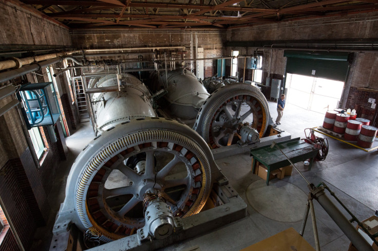
Even after $14.5 billion worth of improvements made to the network of levees, floodwalls and pumps tasked with protecting the city, New Orleans is today no less susceptible to natural disaster than it was the day Katrina arrived, say experts. Man-made storm barriers, elevated houses and more robust drainage systems can be expected to spare Louisianans and their property, to a point. But these measures are likely to be swamped -- literally and figuratively -- by the worsening effects of a warming planet.
“We know that water is coming to New Orleans again."
“It’s not sufficient for what we’re facing in the future,” says Mark Davis, who directs the Institute on Water Resources Law & Policy at Tulane University. “We know that water is coming to New Orleans again. It has always come in the past. It was a delusion to think the levees were going to keep it from happening again.”
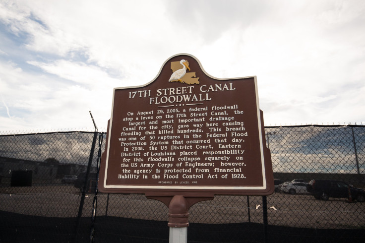
Davis cited as a landmark the 1927 Mississippi River flood that inundated New Orleans and other Mississippi River delta communities. Unrelenting rainfall over the central United States engorged the river, sending violently churning waters over Louisiana’s levees and causing floods more disastrous than those that followed Katrina. In response, the U.S. Army Corps of Engineers built a mammoth network of flood protections designed to protect New Orleans from a 200-year storm, meaning a storm with a 0.5 percent chance of striking in any given year.
Katrina exposed that system’s faulty designs and inadequate construction. The Army Corps says its new flood defenses are stronger, higher and more resilient, yet the system will afford protection against only a weaker 100-year storm, the minimum level needed for New Orleans residents to receive federal flood insurance. Under pressure to build quickly, and with scant financial support from the George W. Bush administration, the engineers designed what they consider an interim step in an ongoing flood protection effort.
Scientists have achieved a consensus that human-induced climate change is causing sea levels to rise, as higher temperatures accelerate the melting of glaciers while expanding the ocean. Evaporation of water from land and sea is yielding extra rainfall and adding fuel to ever-intensifying storms. This trend could drastically alter the world’s coastlines unless countries all but eliminate their greenhouse gas emissions in the next few decades.
“An increase in sea level is the most likely and most costly consequence of climate change for the low-lying coast,” says Virginia Burkett, a Louisiana-based climate scientist with the U.S. Geological Survey, who contributed to the reports of the U.N. climate change panel, which won the Nobel Peace Prize in 2007.
Land Whittled Into Islands
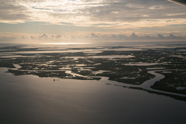
The sea level rise is being felt with special intensity along the Louisiana coastline, where soft, mucky wetlands are sinking.
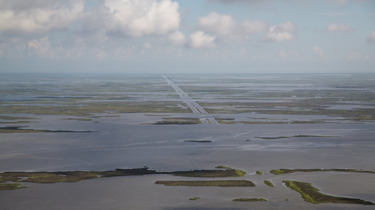
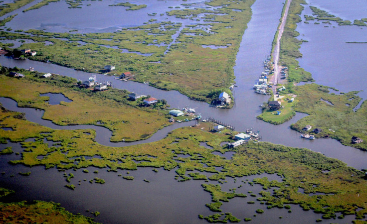
Over the last century, levees along the Mississippi River and rig canals dredged by offshore oil and gas companies have permanently disrupted the geology, starving the marshes of river sediment and allowing corrosive saltwater to invade. Coastal Louisiana has lost roughly 2,000 square miles of wetlands since 1932. A fresh football field’s worth of land disappears every hour. If nothing is done to fix the problem, enough land to fill Los Angeles could erode over the next 15 years.
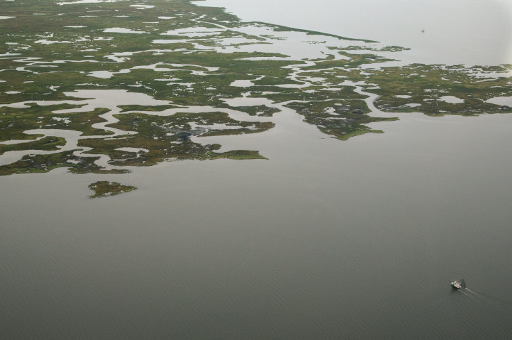
As water overpowers land in the coastal zone, houses, fishing camps and industrial sites once surrounded by sturdy soil now appear as castaways in the middle of the Gulf. From 1,000 feet above Plaquemines Parish, which borders New Orleans, an aerial view reveals white rooftops and pickup trucks glimmering from scattered patches of dirt. In Grand Bayou Village, a community of mostly subsistence fishermen, the only way around is by boat. Houses perched on 16-foot-high stilts used to back up to thick marshland. Now, the water is arriving at their back doors as the blue salty water erodes grasses and trees.
“People down here live storm to storm,” says Richie Blink, coastal zone program manager for the Plaquemines Parish government. Overlooking the withering landscape from the backseat of a single-engine Cessna airplane, Blink, 28, says he permanently stores his most valuable items, like family photos and legal documents, in heavy plastic Tupperware bins -- the easier to throw into the car when the waters roll in.
When, inevitably, another surge of water assails the land, communities living at the edge will be the first to feel the consequences, but the strains are likely to be felt far and wide. The Gulf Coast region supplies about 70 percent of the oysters and shrimp consumed across the United States. Not least, Louisiana is home to about one-third of the nation’s oil and natural gas supplies, and more than one-fourth of U.S. waterborne exports move through the state’s five major ports. Prolonged flooding poses risks of a broad economic shock.
Blink points out the airplane window at the sprawling Alliance oil refinery rising out of the swamp. He taps the glass as a grain-carrying barge glides down the muddy brown Mississippi River. Fishing boats wend through the wetlands. Offshore oil platforms stand like fortresses in the water.
“People live below sea level because there’s an economic need,” he says.
Worldwide, sea levels have already risen by about eight inches since the late 1800s, with many of the gains made in recent decades. On the U.S. coast, sea levels are expected to rise another 1.5 feet to 4.5 feet by 2100, federal scientists estimate. Southeast Louisiana could see even greater increases -- as much as five feet -- by the end of this century, more than any other region in the country.
Rising Seas, Rising Dangers
But if the dynamic is especially perilous for Louisiana and the Gulf Coast, it is playing out with similar dangers on almost every stretch of populated American coast.
As global temperatures rise, hurricanes stronger than Katrina are sweeping in off the Atlantic Ocean with greater frequency and intensity, say climate scientists. Rising sea levels amplify the effect of waves and heavy rains, making even moderate storms capable of generating a catastrophic deluge. In waterfront cities from New York to Miami to Seattle -- all vulnerable -- city leaders are watching New Orleans’ response to Katrina in search of insights on how to protect their own backyards.
The strongest hurricanes -- those classified Categories 4 and 5, which have the highest sustained wind speeds -- have been increasing in number and strength since the early 1980s. By 2100, the number of these powerful storms is expected to rise exponentially. Hurricanes will carry higher wind speeds and unleash bigger storm surges while dropping 20 percent more rainfall. They will last longer than today’s cyclones, according to the projections of multiple climate models.
Warming oceans are largely to blame for intensifying tropical storms: Since 1901, surface temperatures have risen at an average rate of 0.13 degrees Fahrenheit per decade. The warmer water increases evaporation over the ocean. Storm systems absorb the extra water, which condenses and releases heat energy, supplying fuel for hurricanes, explains David Easterling, who heads a division of NOAA’s National Centers for Environmental Information.
While the total number of hurricanes is projected to decline in coming decades, more of the storms that do strike will be Categories 4 and 5, he adds.
Hurricane Katrina itself was merely a Category 3 storm when it made landfall 10 years ago between Grand Island, Louisiana, and the mouth of the Mississippi River. Wind speeds reached nearly 130 miles an hour. The storm surge peaked at 28 feet, breaching the levees southeast of New Orleans. Canals and floodwalls in the city and its suburbs failed in at least 50 places.
The Army Corps of Engineers initially blamed the levy failure on the force of the hurricane, asserting that the storm surge had been too massive for the structure to contain. But investigations by civil engineers and hurricane experts later pinned responsibility on the Corps’ faulty flood protection system, not Katrina’s might.
'A Work In Progress'
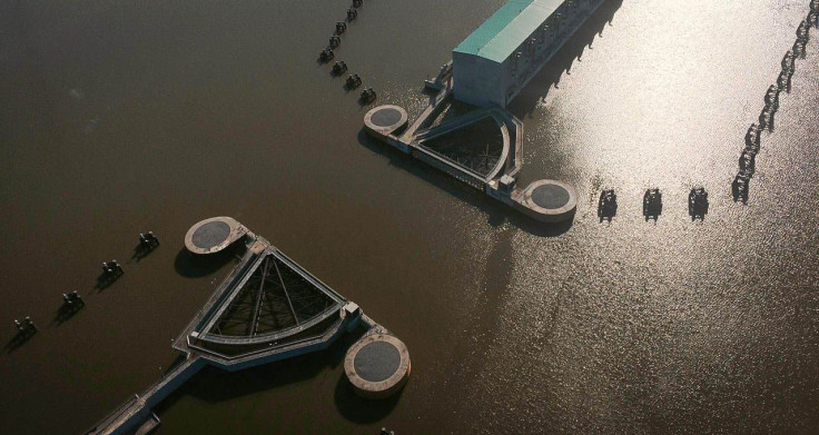
Regardless of human-made barriers, a healthier, thicker wetland zone would have diminished the force of the deadly storm surge. With this idea in mind, two years after Katrina, Louisiana launched a $50 billion Coastal Master Plan to help rebuild part of what’s been lost. The sweeping strategy outlines more than 100 projects for coastal restoration, including building rocky barriers to block saltwater intrusion, dumping replenishing river sediment on the banks of streams and building artificial oyster reefs to reduce erosion from waves and slow the spread of storm surge.
Dozens of smaller projects have been completed so far, including a $45 million effort to rebuild six miles of the rapidly depleting shoreline of Cameron Parish, the heel of Louisiana’s boot-shaped state. In Lake Hermitage, south of New Orleans, a $50 million marsh creation project restored 650 acres of land earlier this year. What was once an open expanse of brackish water now resembles a barren prairie, speckled with newly planted vegetation.
Coastal scientists acknowledge their quest to rebuild Louisiana will never keep pace with the ever-increasing threats of climate change, which also includes hotter, drier weather. Wetlands are growing brittle as Louisiana’s maximum air temperatures rise. The warmer air boosts “evapotranspiration” -- plant sweat, essentially -- and causes marshes to crack and dissolve. Declining precipitation in the region will further dry out the wetlands, and the rain that does fall will pour down in buckets, causing erosion.
“That’s a double whammy on soil moisture,” Burkett, the U.S. Geological Survey scientist, says. “It stresses the marshes, which are stressed by sea level rise as well.”
If state and local officials could sweep aside such dire predictions a decade ago, Hurricane Katrina has made it impossible for authorities to plead ignorance.
Yet even as New Orleans remains vulnerable to nature’s whims, and even as efforts to safeguard the city are widely deemed insufficient, some experts say they feel more optimistic about the region’s shot at survival than they did 10 years ago.
“We as a community, a station, a nation, were in deep denial about what we were facing and what it would take to face it,” says Mark Davis, the Tulane water policy expert. “We’ve got a long way to go, but we’re no longer living in abject denial.”
“It’s always going to be a work in progress,” he adds. “That may be the best it can ever be.”
© Copyright IBTimes 2025. All rights reserved.
- MOST POPULAR IN National


