

NASA Satellite Captures Bomb Cyclone Blanketing The US [Photos]
KEY POINTS
- The images were taken by NASA's Aqua satellite
- It showed snow and clouds covering the northeastern U.S. states, as well as Canada's Ontario
- The images were taken Sunday using the satellite's MODIS equipment
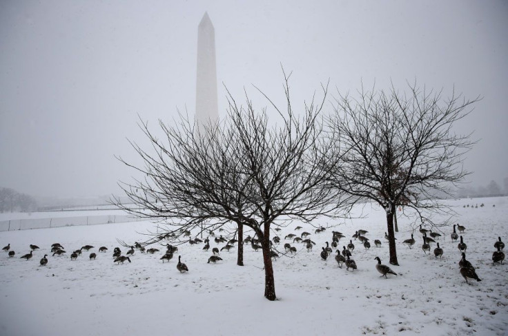
The holiday season was marred by intense blizzards and the bomb cyclone blanketing the U.S. A NASA satellite has captured the snowstorm from space.
"As winds howled and snow piled up from what some forecasters called a 'once-in-a-generation' storm, so did the traffic accidents, power outages, and transportation woes," NASA officials wrote in a statement.
The situation turned grave with blizzards, thick snow, and freezing rain.
Images taken by NASA's Aqua satellite show snow and clouds covering the northeastern U.S. states, as well as Canada's province of Ontario.
The Arctic cold front sweeping across the Great Lakes has delivered fierce winds and potent lake-effect snow. https://t.co/VtlKFomZU8 pic.twitter.com/n9MSRiyYnO
— NASA Earth (@NASAEarth) December 27, 2022
The images were taken Sunday using the satellite's Moderate Resolution Imaging Spectroradiometer (MODIS). One image is in natural color, and the other one has been taken in a combination of visible and shortwave infrared light to make out the clouds (white) from snow and ice (blue). The ripples observed in the clouds were likely due to wave clouds, as per NASA.
This false-color version of the image uses a combination of visible and shortwave infrared light to distinguish clouds (white) from snow and ice (blue). pic.twitter.com/370V5yMgIl
— NASA Earth (@NASAEarth) December 27, 2022
"Wave clouds typically form when air gets forced upward by hills and mountains, in this case, the Appalachians. When gravity causes the air to fall back down, it begins to oscillate, creating the waves. Clouds generally form on the cool crests of waves when there is enough moisture in the air," the space agency wrote in the statement.
The wind speeds were around 50 mph in several states, according to National Weather Service statistics quoted by NASA. At the extreme end was Lackawanna, New York, just south of the city of Buffalo, where winds blew at as high as 79 mph.
A sudden drop in pressure by a minimum of 24 millibars within 24 hours is referred to as a bomb cyclone, according to Space.com. The combined effect of the cyclone and blizzard conditions led to a lot of snow alongside the Great Lakes.
"The bands of clouds streaming off the lakes, which form when cold air passes over open water, can produce lake-effect snow," NASA noted.
While snowfall stayed below five inches in most areas, lake-effect snow led to 50 inches of storm surge in areas east of Lake Ontario and Lake Erie, especially Buffalo. These areas are known for receiving large amounts of snow.
Previously, NASA had shared satellite imagery showing the eruption of Indonesia's Mount Semeru.
"These billowing avalanches of superheated ash, tephra, soil, and other debris race at high speeds and can destroy most things in their path," NASA Earth Observatory noted about the volcanic plume and the thick pyroclastic flow from the eruption. The photo was taken by the Operational Land Imager 2 (OLI-2) instrument on the Landsat 9 satellite.
© Copyright IBTimes 2026. All rights reserved.
- MOST READ


