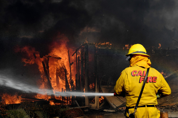
Thomas Fire Update: School Closures, Evacuation Details As Ventura Fire Spreads

Thousands of residents living in Ventura, California, were forced to evacuate as a fast-moving wildfire, dubbed Thomas Fire, ravaged through more than 50,000 acres Tuesday destroying hundreds of homes. As of Tuesday, evening the Thomas Fire, which began Monday, remained zero percent contained.
California Gov. Jerry Brown declared a state of emergency in the Ventura County, allowing state funds and resources to assist the more than 1,000 firefighters battling to save homes. Authorities reportedly said extremely high winds, low humidities and dry fuel were making conditions worse.
“This fire is very dangerous and spreading rapidly, but we’ll continue to attack it with all we’ve got,” Brown said in a statement. “It’s critical residents stay ready and evacuate immediately if told to do so.”
The Ventura County Office of Education said late Tuesday nearly all Ventura County K-12 public schools would remain closed Wednesday. More than 250,000 homes were without power and all schools in the Ventura Unified School District were closed Tuesday as the fire continued to spread at a high speed.
“Due to the intensity of the fire, crews are having trouble making access and there are multiple reports of structures on fire,” officials said on Ventura County’s emergency management website.
The Thomas Fire spread rapidly after it started Monday evening above Steckel Park, which is located at 8080 Mistletoe Road. By midnight, the fire was estimated to have reached 10,000 acres.
“Realistically, people have no idea what’s going on or how bad this is,” Kat Jones, 38, who evacuated her home in the Ojai Valley in the early hours of Tuesday morning told the New York Times. “The fire has moved so fast, it is so big and it really hard to predict, I think it is overwhelming to everyone.”
Harrowing photos and videos of the fire blazing were shared on social media with people praying for the safety of the residents.
I have never felt more at home then living inside the magical Ojai valley. Bless the beautiful and kind people of our town. Bless the firefighters who are out there laying it down, fighting for us. Please stay safe. Fight hard. #ThomasFire #ojaivalley #SantaPaula #VenturaStrong pic.twitter.com/99L4KkWwcs
— Jon Bernthal (@jonnybernthal) December 5, 2017
The Ventura Botanical Garden...Gone! #ThomasFire pic.twitter.com/Kdws7ogIA9
— Senerey DeLosSantos (@SenereyD) December 5, 2017
School closures:
ACE Charter High School
Conejo Valley Unified School District
Fillmore Unified School District
Hueneme Elementary School District
Mesa Union Elementary School District
Moorpark Unified School District
Mupu Elementary School District
Ocean View Elementary School District
Ojai Unified School District
Oxnard Elementary School District
Oxnard Union High School District
Pleasant Valley School District
Rio Elementary School District
Santa Clara Elementary School District
Santa Paula Unified School District
Simi Valley Unified School District
VCOE Career Education Center sites
VCOE-Operated School Sites and classrooms
Ventura Unified School District
Evacuation list:
Residents in Santa Paula east of Dickenson Road, north of Monte Vista Drive along Highway 150 and South of Thomas Aquinas College to the area of Say Road.
Residents in Santa Paula west of Dickenson Road to Atmore Road, north of Foothill Road and west to Wheeler Canyon Road.
Residents in Upper Ojai north of Highway 150 from Koenigstein Road west to the Dennison Grade, north to Reeves Road, east to McAndrew Road and north to Grand Avenue.
Residents in Santa Paula and Ventura north of Foothill Road west to Wheeler Canyon Road, north to Canada Larga Road and east to Barlow Canyon Road.
Residents in Ventura, CA south of Highway 33, east of Main St, north of Foothill Road and Hall Canyon Road and west of Canada Larga Road.
Voluntary evacuations for residents in Fillmore north of 2nd Street, east of Island View, north of 4th Street, north of Wood Grove, north of Country Court and east of “A” Street.
© Copyright IBTimes 2025. All rights reserved.


