

Weather: Heavy Snow And Strong Winds Affecting 5 States Prompt Blizzard Warning In Montana

KEY POINTS
- Temperatures are expected to be at 15-20 degrees below average in the Northern Plains
- Heavy snow is expected in Washington's South Washington Cascades
- Officials said residents should expect wind gusts of up to 60 mph in Montana
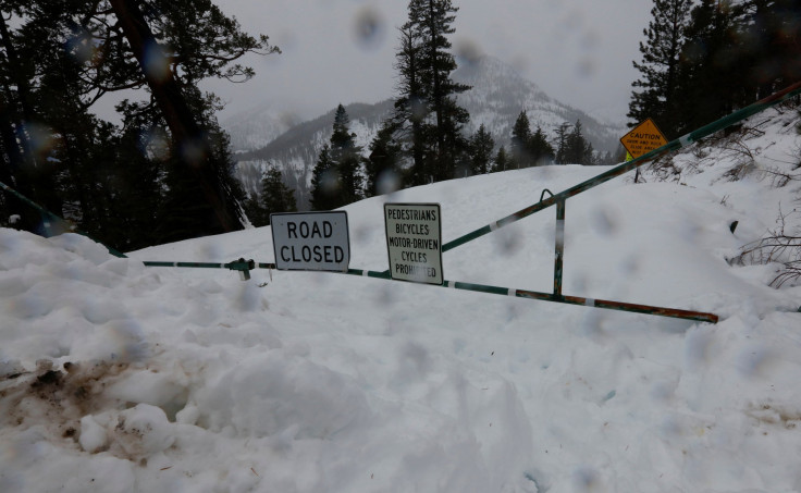
Winter alerts have been issued in Montana and some of its neighboring states amid heavy snow and strong wind gusts. A Blizzard Warning has also been issued for Montana as officials strongly discouraged travel through Wednesday evening.
Officials are expecting "accumulating snows across the Northern Plains and through portions of the Northern and Central Rockies," the National Weather Service (NWS) said in its Short Range Forecast Discussion report released Tuesday.
The Northern Plains include Montana, Wyoming, Colorado, Nebraska, South Dakota and North Dakota, while the Rockies include Arizona, Idaho, Nevada, New Mexico and Utah.
The NWS also noted that residents in the west of the Rockies and "across the Northern Plains" should expect below average temperatures over the next few days due to the Arctic air that will "keep temperatures 15-20 degrees below average" through Thursday.
The NWS in Great Falls, Montana, said a "brisk wind" combined with cold temperatures will result in "cold wind chill temperatures" Tuesday evening through Wednesday.
Cold overnight temperatures will combine with a brisk wind to result in cold wind chill temperatures tonight into Wednesday across the Hi-Line. Be sure to wear appropriate clothes for the cold conditions. #MTwx pic.twitter.com/VIfyBvdpun
— NWS Great Falls (@NWSGreatFalls) December 6, 2022
The office also noted that hypothermia and frostbite could possibly affect humans and animals due to the cold wind chill.
A Blizzard Warning has also been issued as forecasters expect light and fluffy snow to be easily blown around. Residents should expect strong gusty winds as high as 60 mph and reduced visibility in affected states, officials said.
Blizzard Warnings and Winter Weather Advisories have been issued for blowing snow across much of North-central Montana tonight into Wednesday. Consider delaying travel in these areas, as travel will become quite difficult due to blowing and drifting snow. #MTwx pic.twitter.com/u6pjrJLad2
— NWS Great Falls (@NWSGreatFalls) December 6, 2022
In some parts of Oregon, officials at the NWS in Portland are expecting up to 4 inches of snow and ice accumulations that could affect the Wednesday morning commute, according to a notice issued Tuesday.
Over in Washington, officials are expecting up to 11 inches of snow accumulations in the South Washington Cascades from midnight Wednesday through noon Thursday.
The NWS in San Francisco Bay Area, California, said "hazardous temperatures" are possible "for unsheltered populations," with near-freezing temperatures expected in the eastern Santa Clara County.
Colder weather arrives tonight into tomorrow morning with freezing temps for parts of the North Bay. More cold weather for Wednesday night as well. Remember to protect people, pets, plants, and pipes from the cold! #cawx pic.twitter.com/aqWh2dV6zk
— NWS Bay Area 🌉 (@NWSBayArea) December 6, 2022
Officials at the NWS in Sacramento also released snow accumulation data from the past 24 hours, wherein it was revealed that the Boreal and Soda Springs areas saw the highest amounts, with 22 inches in accumulations.
Heavy snow has been reported over area mountains over the past several days. Here are some snow reports from the past 24 hours and storm totals from Dec 4-6 for interior NorCal. #CAwx #snow pic.twitter.com/fsd6MY68I8
— NWS Sacramento (@NWSSacramento) December 6, 2022
In Nevada, officials at the NWS in Reno warned of strong winds affecting the Sierra ridgelines from Thursday, ahead of a stronger wind and snow event during the weekend in the state.
Enjoy the brief break in stormy weather thru Wed. Another fast-moving cold front will bring moderate snow to the Sierra Thu PM. A more robust, weekend storm may bring heavy snow to the Sierra. Significant travel delays possible this weekend.
— NWS Reno (@NWSReno) December 6, 2022
Details - https://t.co/ITkXlvXly3 pic.twitter.com/UhWchwj59Q
Montana Weather Alerts
Blizzard Warning effective from midnight Tuesday through 5 p.m. Wednesday:
- Continental Divide – East Glacier Park Region and Southern Rocky Mountain Front
- Northern High Plains
Wind Chill Advisories effective from midnight Tuesday through 11 a.m. Wednesday:
- Northern High Plains
- Eastern Glacier – Western Toole and Central Pondera
- Hill County – Northern Blaine
- Judith Gap – Cascade County below 5,000 feet, Eastern Teton, Eastern Pondera, Judith Basin County, Bears Paw Mountains, Western and Central Chouteau County, Southern Blaine, Fergus County below 5,000 feet, Daniels, Sheridan, Western and Eastern Roosevelt, Northern Valley, Snowy Mountains and Judith Mountain
Oregon Weather Alerts
Winter Weather Advisory effective from 4 a.m. Wednesday through 6 p.m. Thursday:
- Lane County – Cascade Foothills and Northern Oregon Cascade Foothills
Winter Weather Advisories effective from 10 p.m. Wednesday through 10 p.m. Thursday:
- Central Douglas County – Eastern Curry County, Josephine County, Eastern Douglas County Foothills and Jackson County
- Southern Oregon Cascades – Siskiyou Mountains, South Central Oregon Cascades
- Klamath Basin – Northern and Eastern Klamath County, Western Lake County along Winter Rim
Washington Weather Alerts
Wind Advisory effective from 10 p.m. Wednesday through 10 a.m. Thursday:
- San Juan County – Admiralty Inlet Area and Western Whatcom County
Freezing Fog Advisory effective through noon Wednesday:
- Yakima Valley – Lower Columbia Basin of Washington
California Weather Alert
Freeze Warning effective from 1 a.m. through 9 a.m. Wednesday:
Nevada Weather Alert
Winter Weather Advisory effective through 1 p,m. Wednesday:
- Esmeralda – Central Nye County
© Copyright IBTimes 2025. All rights reserved.
- MOST POPULAR IN National


