

Extreme Weather 2020: Developing La Niña System Could Lead To Intense Storms, As US Battles Coronavirus
While the U.S. battles the coronavirus, serious weather patterns may potentially wreak additional havoc in the coming months.
A potential La Niña system in the Pacific Ocean could lead to a particularly severe hurricane season. This type of weather pattern, the opposite of the well-known El Niño, occurs when ocean surface temperatures in the eastern Pacific near the Equator dip below average. The system is predicted to arrive by the late summer or fall.
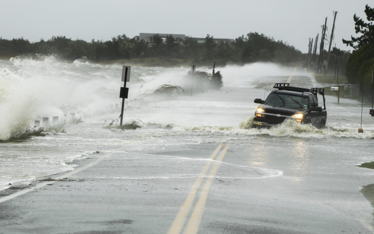
La Niña systems can tend to reduce wind shear in the tropical Atlantic Ocean. As a result, more tropical storms and hurricanes can then develop in the area, since wind shear often acts as a deterrent to the development of low-pressure systems. The Atlantic Hurricane season begins on June 1 and last through Nov. 30.
According to meteorologist Michael Ventrice, this system has the potential to be one of the strongest of its kind since 2010. The National Oceanic and Atmospheric Administration is currently predicting a 35-40% chance that the system develops by the fall.
The last significant La Niña event, as mentioned by Ventrice, began in July 2010 and lasted until April 2012. As a result of this system, the Atlantic Hurricane seasons in 2010, 2011, and 2012 were considerably stronger. This included Hurricane Igor in 2010, the strongest tropical event to ever hit Newfoundland, and most infamously, Hurricane Sandy. Sometimes called “Superstorm Sandy,” the hurricane wreaked havoc across the entire east coast of the U.S. and caused $65 billion worth of damage.
© Copyright IBTimes 2026. All rights reserved.
- MOST READ


