

'False Summer' Ends In Minnesota; Heavy Storm With Snow, Gusty Winds Hits Great Lakes

KEY POINTS
- 'Wind-driven snow' will affect parts of Minnesota through Monday afternoon
- Up to 19 inches of snow totals is possible in Wisconsin's Black River Falls
- Some snow showers could linger in Michigan through Tuesday
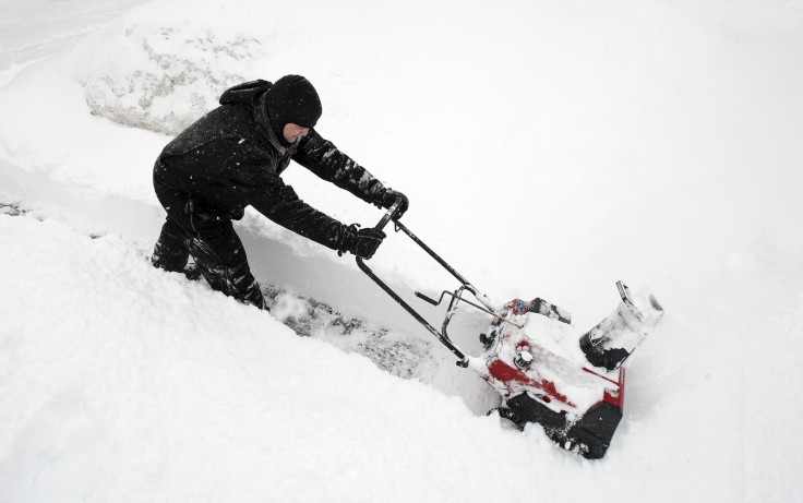
Minnesota residents may be getting fooled by "false summer" as the state and some of its neighbors in the Great Lakes region are expected to experience wind chills along with some snow early in the week.
"Wind-driven snow" is expected to affect parts of Minnesota and some of its neighbors in the Great Lake regions through Monday afternoon, KMSP chief meteorologist Ian Leonard said on Sunday night. Leonard noted that while some residents who experienced some sunny days in the past week may have thought that summer is in, "April has a big time high and low trend, and right now we're getting into the low trend."
Aside from the new storm system that entered the Great Lakes Sunday, officials previously expressed concerns of possible flooding at the Minnesota River this week as snow melt and a wintry mix could contribute to the rise in flood water, according to the West Central Tribune.
Some drizzle or light rain could possibly mix in with snow in some parts of Minnesota, while other areas may see some icing.
The Weather Prediction Center (WPC) said Sunday that a "strong low pressure system over the northern Great Lakes region Sunday evening" will affect western Wisconsin, the western Upper Peninsula of Michigan and the Arrowhead of Minnesota through Monday evening.
Gusty winds, wind chills and accumulating snow are possible in the mentioned areas, and dangerous travel conditions are possible in areas where there will be heavy wet snow of up to 12 inches and reduced visibility. Conditions are predicted to taper off Tuesday.
Weather officials at the NWS Twin Cities warned of significant snow in parts of the Eau Claire area and some of its neighbors. Up to 13 inches of snow is possible in Ladysmith, up to 14 inches is expected in Eau Claire and La Crosse, and up to 19 inches is projected for Black River Falls.
Significant snow for central/western WI tonight and tomorrow: Up to a foot and very gusty winds will cause dangerous travel. Travel east on I-94 not recommended.
— NWS Twin Cities (@NWSTwinCities) April 16, 2023
For Eau Claire area: Just a 25-mile shift in storm track could mean difference between 4" or 14" so monitor closely. pic.twitter.com/h0rS9Akric
Over in Wisconsin, the NWS in Milwaukee warned of accumulating snow to affect parts of the state through Monday morning. The highest snow accumulations are expected west and northwest of Madison. Snow is projected to end by Monday afternoon in Wisconsin.
A spring snow storm is on the way for southern Wisconsin. Timing/accumulation details remain on track, with the Winter Storm Warning being expanded to Lafayette County, and the Winter Weather Advisory being expanded to include Green Lake County. #wiwx pic.twitter.com/EJ1mJNmEmE
— NWS Milwaukee (@NWSMilwaukee) April 16, 2023
Gusty winds are expected to be at their highest from midnight through 9 a.m. Monday. Dodgeville and Monroe may see up to 38 mph, while Wisconsin Dells, Watertown, Beaver Dam, and Madison may see up to 37 mph.
In addition to the snow, gusty winds and falling temperatures will accompany the storm. #wiwx pic.twitter.com/3tqaWRhTTB
— NWS Milwaukee (@NWSMilwaukee) April 16, 2023
In Michigan, the NWS in Grand Rapids said residents should expect "snow and rain showers" Monday, with a few snow showers possibly lingering through Tuesday. Another system is expected to bring periods of showers and thunderstorms from Wednesday evening through Thursday night.
Expect snow and rain showers on Mon; a few snow showers may linger into Tue AM. Settled weather is expected from Tue aftn into most of Wed. The next system is likely to bring periods of showers/t-storms from Wed eve into Thu night. More forecast info at https://t.co/aKbQQoms2Y pic.twitter.com/zFosbrzR9i
— NWS Grand Rapids (@NWSGrandRapids) April 16, 2023
Alerts in Minnesota
Blizzard warning effective through 7 p.m. Monday:
- North Shore and southern Cook (wind gusts as high as 55 mph possible)
Winter storm warning effective through 7 p.m. Monday:
- Northern and Southern Lake, northern Cook
Winter weather advisories effective through noon Monday:
- Carlton, central and South St. Louis
- Pine County
Flood warnings for Mississippi River effective until further notice:
- Lake City
- Wabasha
- Winona
- La Crosse
- Highway 610 at Brooklyn Park
- Highway 169 at Champlin
- Savage
Flood warning for Minnesota River effective until further notice:
- New Ulm
Flood warning for South Fork Crow River effective until further notice:
- Mayer
Alerts in Wisconsin
Blizzard warning effective through 7 p.m. Monday:
- Ashland, Bayfield, Douglas and Iron
Winter storm warnings effective through 10 a.m. Monday:
- Chippewa, Eau Claire and Rusk (wind gusts of up to 45 mph possible)
- Iowa, Lafayette and Sauk
- Buffalo, Crawford, Grant and Richland
Winter storm warnings effective through 1 p.m. Monday:
- Adams, Clark, Jackson, Juneau, La Cross, Monroe, Taylor, Trempealeau and Vernon (up to 15 inches of snow totals possible)
- Marathon, Portage and Wood
Winter storm warnings effective through 7 p.m. Monday:
- Price, Sawyer and Washburn
- Lincoln, Oneida and Vilas
Alerts in Michigan
Blizzard warning effective through 7 p.m. Monday:
- Gogebic (up to 17 inches of snow totals possible)
Winter storm warning effective through 8 p.m. Monday:
- Ontonagon (up to 17 inches of snow totals possible)
© Copyright IBTimes 2025. All rights reserved.
- MOST POPULAR IN National


