

Hurricane Ian: After Wrecking Florida, Storm Expected To Bring ‘Life-threatening Flooding’ In Carolinas

KEY POINTS
- Downgraded into a tropical storm Wednesday, Ian turned into a hurricane again a day later
- Heavy rain is expected to bring flooding in North and South Carolina through Friday
- Tropical storm conditions are also expected to have an impact on Georgia
After leaving a trail of destruction in Florida, Hurricane Ian is expected to bring "life-threatening flooding" to North and South Carolina on Friday, as per the National Weather Service (NWS).
"Ian is expected to cause life-threatening flooding, storm surge and strong winds in the Carolinas tomorrow," the NWS said in its latest public advisory about Hurricane Ian on Thursday. The storm was located about 185 miles from Charleston, South Carolina late Thursday evening.
Hurricane #Ian Advisory 29A: Ian Taking Aim At the Carolinas and Georgia With Life-Threatening Flooding, Storm Surge and Strong Winds. https://t.co/tW4KeFW0gB
— National Hurricane Center (@NHC_Atlantic) September 29, 2022
Tropical storm conditions are expected to spread into North Carolina coasts through Friday morning and could bring up to 12 inches of rain at maximum in the northeastern part of South Carolina, while up to 8 inches of rain is expected across the northwestern part of North Carolina, the agency said.
The NWS also warned of a potential for a few tornadoes to "begin late Friday morning along a portion of the coastal Carolinas." Tree damage is expected during high winds, the agency warned.
1115 PM EDT Sep 29 Update: Air Force Hurricane Hunters find Ian is a little stronger. For the latest: https://t.co/cy01fLQcOw pic.twitter.com/IwwOYoeald
— National Hurricane Center (@NHC_Atlantic) September 30, 2022
The National Hurricane Center (NHC) said its Air Force Hunters found Ian "a little stronger" late Thursday evening, as the storm now has maximum winds of nearly 85 mph, up from 80 mph earlier in the day.
"Ian could strengthen a little more" before making another landfall Friday morning, the NWS said. The storm is only expected to "rapidly weaken over the southeastern United States late Friday into Saturday."
Ian strengthened to become a hurricane again earlier on Thursday after it weakened Wednesday into a Tropical Storm. Its impacts are also expected to reach central Georgia, the NWS in Atlanta said.
[9/29 5 PM EDT Update] #Ian has become a #hurricane again over the Atlantic and is expected to impact the South Carolina coast on Friday. Impacts for north and central Georgia are expected to stay the same as mentioned in our earlier tweet. #gawx pic.twitter.com/vBN28lv6c5
— NWS Atlanta (@NWSAtlanta) September 29, 2022
The following storm-related warnings and watches have been issued for the Carolinas and Georgia and are effective until further notice:
Tropical Storm Warnings in North Carolina:
- Iredell, including Statesville
- Davie, including Mocksville
- Catawba, including Hickory and Newton
- Rowan, including Salisbury
- Lincoln
- Gaston
- Mecklenburg, including Matthews, Huntersville and Charlotte
- Cabarrus, including Kannapolis and Concord
- Robeson, including Lumberton and Maxton
- Martin, including Robersonville, Williamston and Oak City
- Bladen, including Bladenboro and Elizabethtown
- Columbus, including Whiteville and Tabor City
- Union, including Monroe
- Inland Pender, including Burgaw and Rocky Point
- Pitt, including Farmville, Greenville and Grifton
- Washington, including Creswell, Wenona and Plymouth
- Tyrrell, including Gum Neck, Columbia and Kilkenny
- Greene, including Hookerton, Snow Hill and Walstonburg
- Beaufort, including Belhaven and Aurora
- Mainland Dare, including Manns Harbor, East Lake and Stumpy Point
Hurricane Warning in North Carolina:
- Coastal Brunswick, including Southport, Calabash and Holden Beach
Hurricane Watches in North Carolina:
- Coastal Pender, including Hampstead and Surf City
- Coastal New Hanover, including Carolina Beach and Wrightsville Beach
Tropical Storm Warnings in South Carolina:
- York, including Rock Hill and Fort Mill
- Chester
- Marlboro, including Bennettsville
- Darlington, including Hartsville
- Dillon
- Florence, including Lake City
- Marion, including Mullins
Hurricane Warnings in South Carolina:
- Williamsburg, including Hemingway and Kingstree
- Coastal Horry, including Surfside Beach, Myrtle Beach and North Myrtle Beach
- Inland Georgetown, including Andrews
- Coastal Georgetown, including Murrells Inlet and Georgetown
- Central Horry, including Longs and Conway
- Northern Horry, including Green Sea, Aynor and Loris
- Charleston, including Edisto Island and McClellanville
- Tidal Berkeley, including Daniel Island, Red Bank Landing and Cainhoy
Tropical Storm Warnings in Georgia:
- Effingham, including Springfield, Rincon and Clyo
- Inland Bryan, including Pembroke, Keller and Richmond Hill
- Coastal Bryan, including Fort McAllister
- Long, including Ludowici and Donald
- Lincoln, including Lincolnton
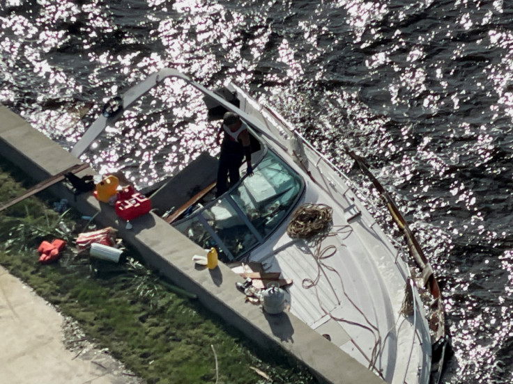
Hurricane Ian made its first landfall in southwestern Florida on Wednesday. It landed as a Category 4 Storm but was later downgraded into a Category 1 storm. Still, the aftermath of Ian's onslaught in the state was reflected in photos showing submerged cars, blown-off roofs, bent trees and downed power lines.
© Copyright IBTimes 2026. All rights reserved.
- MOST READ


