

Oregon Standoff: How The Occupied Land Went From Native American To Federal Territory [Map]

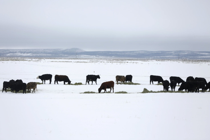
Oregon standoff spokesman Robert “LaVoy” Finicum was killed and leaders of the Malheur National Wildlife Refuge takeover were arrested on Tuesday after the FBI and state police stopped vehicles north of Burns, Oregon. The armed group has been occupying the refuge near Burns for weeks to protest the federal government’s claim to lands the group believes should be handed back to local ranchers.
Members of the local Burns Paiute tribe have condemned the occupiers, saying they have no claim to that land, which they say was taken from them by white settlers more than 100 years ago.
University of Georgia historian Claudio Saunt has now shown exactly how the Burns Paiute tribe, along with many other Native American nations, went from owning all of modern-day Oregon to only about 864,000 acres, or 1.3 percent of its current size.
Saunt took a set of maps made in 1899 by the Bureau of American Ethnology and digitized the borders in the documents in order to make an interactive map of the transfer of land from American Indians to settlers between 1776 and 1887.
International Business Times has created a graphic that goes through the history and shows how the Native Americans of Oregon, through treaties and executive orders, lost the majority of their land by 1892. This is the same land that the armed protesters are claiming for local ranchers.
Indian Loss of Land in Oregon, Washington and Northern California
In September 1872, an executive order by President Ulysses S. Grant set aside 1.7 million acres to established the Malheur Indian Reservation for the Burns Paiute tribe, along with the Snake and Shoshone tribes.
However, pressure from white settlers led to another executive order in 1876 to reserve a smaller patch of land further north for the tribes and cede part of the Malheur reservation to the settlers.
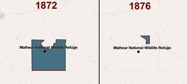
After the Bannock Indian War in 1878, however, the Paiutes were forced off their lands, and the Malheur reservation was permanently closed. The tribe now owns about 13,700 acres of land in Harney County, Oregon.
The armed takeover of the Malheur National Wildlife Refuge has brought this history back in the spotlight.
“It belongs to the native peoples who continue to live there,” Burns Paiute tribal chairwoman Charlotte Roderique said. “The Malheur refuge is an important place for us. We have no sympathy for those who are trying to take their land from its rightful owners.”
The tribe’s indignation escalated when the occupiers last week uploaded a video showing group members rummaging through Burns Paiute historical artifacts housed in the refuge. Tribal leaders sent a letter to U.S. Fish and Wildlife Service asking that the occupiers be prosecuted if they damage any of the over 4,000 artifacts kept in the building.
© Copyright IBTimes 2025. All rights reserved.
- MOST POPULAR IN National


