Puerto Rico: Interactive Map Shows Aerial Photos Of Hurricane Maria Damage

Less than one week after Hurricane Maria devastated Puerto Rico, the National Oceanic and Atmospheric Administration has aerial data on the destruction caused by the storm. As it has for the two hurricanes that came before Maria, NOAA has collected photos from the sky of areas that were hit hard in order to aid in the assessment and recovery processes.
Maria made landfall on Wednesday and left much of the territory destroyed and without power after it passed over the island. The storm was a Category 4 when it hit, the strongest storm in the last 85 years to hit. The damage was significant and a lack of resources and power made traveling to rescue people or assess the extent of it all was difficult. Early photos of the damage showed collapsed structures, flooded roadways and down power lines.
The damage can also be seen on an interactive map created by NOAA in the wake of the storm. The photos were taken by NOAA’s Remote Sensing Division with the goal of assessing the impacts of natural disasters and to help create preparedness plans in the future. The data on the map as of Monday was taken during five different flights from Sept 22 to 24.
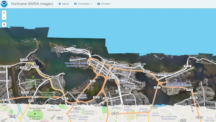
Comparisons of the aerial images taken after the storm to baseline records of the same areas allow response agencies to check whether necessary infrastructure is damaged and how extensive that damage is. This helps response organizations determine how best to restore key navigation routes if necessary. The images were collected by remote-sensing on board camera on NOAA craft. The King Air 350 was primarily used for this round and flew at a height of 1,500 to 5,000 feet.
The images currently used to make the map show damage at the Fernando Luis Ribas Dominicci Airport, the smaller airport on the island had some visible damage to it the photos showed.
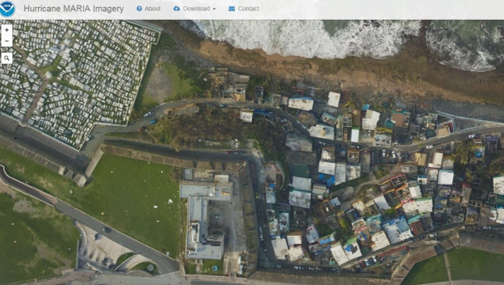
The land behind the Institute of Neurobiology has visible debris scattered about it. This too was visible in the photos taken from the air. The Institute is near old San Juan and the Castillo San Felipe del Morro, a 16th century citadel and popular tourist attraction.
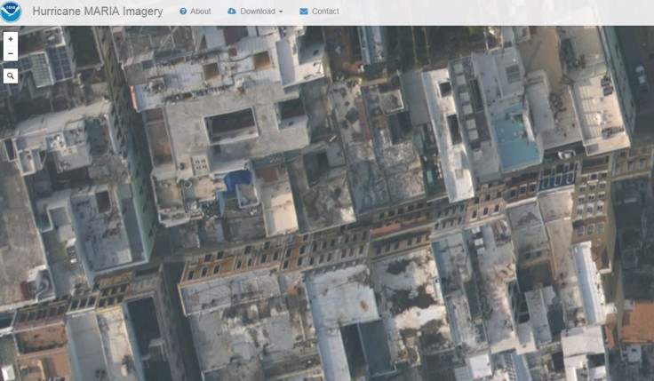
Other buildings in the city just blocks from Old San Juan had visible damage to the roofs.
The aerial images mostly cover the Northern Coast of the island as well as the Eastern Coast and the Arecibo Observatory inland toward the West. The damage is expected to take months if not years for the territory to recover from. The governor of Puerto Rico said the island still needs more help from the United States and the mayor of San Juan said she knows that officials won't be able to rescue everyone stuck in their homes in time to keep them alive, reported the Washington Post.
© Copyright IBTimes 2026. All rights reserved.
- MOST POPULAR IN Technology