

Soggy California Drenched Anew As Nor’easter Buries New England, New York
The latest in a series of atmospheric river storms spread across California on Tuesday, bringing another deluge of rain to the already-saturated state, while a Nor'easter swirling over New York and New England buried parts of the region in white.
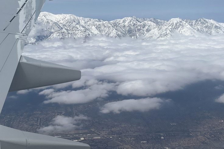
Up to 10 inches of rain were forecast in some areas of California, while in higher elevations of 5,000 feet and above, where snow accumulations were already rooftop-high, up to 3 feet of feet of fresh powder was expected to drop, according to the National Weather Service (NWS).
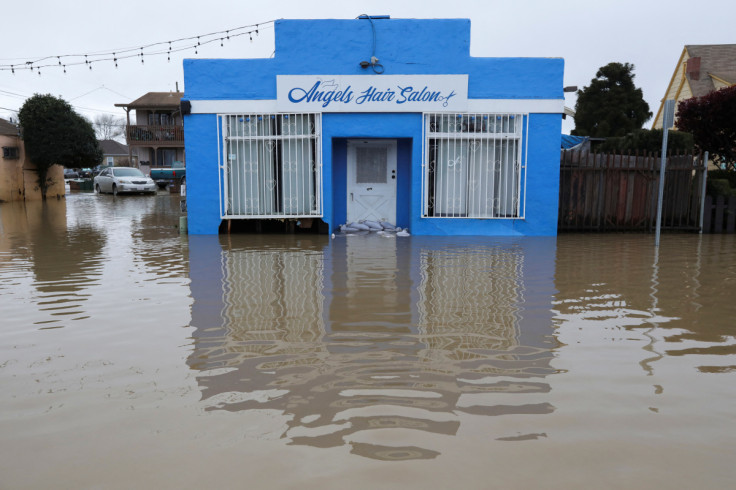
Along California's coast and in lower elevations inland, the heavy rain combined with melting snow from the mountains raised the risk of more flooding as rivers and streams overflow their banks and compromised levees. Wind gusts up to 70 mph could uproot trees downing power lines.
"Lives and property are in great danger from Tuesday into Wednesday," the weather service said in its California forecast, warning residents to expect flash flooding in areas that do not normally experience it.
In anticipation of the approaching "atmospheric river" -- a narrow current of air laden with dense tropical moisture from the ocean -- emergency crews have stepped up sand-bagging operations in recent days and mounted round-the-clock patrols of levees and rain-swollen riverbanks.
Nine atmospheric rivers already lashed California in rapid succession from late December through mid-January, triggering widespread flooding, levee failures, mudslides and punishing surf. At least 20 people perished.
A levee failure this weekend on the Pajaro River in Monterey County triggered massive flooding and prompted hundreds of evacuations and dozens of water rescues.
The NWS posted flood watches for much of the state, with the greatest risks expected from the Central Coast toward the southern foothills of the Sierra Nevada range.
"The impact of this is really ramping up today," said Marc Chenard, a meteorologist with the NWS Weather Prediction Center in College Park, Maryland. Most of the heavy weather would occur on Tuesday and Wednesday, he said, but flooding will persist.
Mandatory evacuation orders remained in effect for residents in 10 California counties on Tuesday, according to the Federal Emergency Management Agency.
Chenard said that at elevations higher than 5,000 feet, the snow pack will absorb the rain like a sponge. But the real risk is at lower elevations where rain will run off the snow, melting much of it along the way, bringing floods and mudslides.
'IMPOSSIBLE' TRAVEL IN NORTHEAST
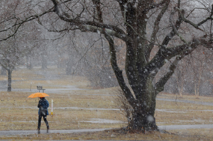
In the Northeast and New England, a Nor'easter storm had already dumped 20 inches of snow in the Berkshires in western Massachusetts and northwestern Connecticut, and 8 inches of snow had fallen in Albany, New York. Forecasters expected as much as 2 more feet of snow to fall on Tuesday.
More than 240,000 homes and businesses were without power in the Northeast, including New York, Massachusetts, New Hampshire, Vermont and Connecticut, according to data from PowerOutage.us.
Heavy snow could fall at a rate of 2 inches an hour in some areas of upstate New York with high winds that could make travel impossible, the NWS said.
As the day progresses, the storm will continue to move east and by Tuesday evening, 4 or 5 inches of snow could fall on Boston, according to Chenard. New York City might see snow and rain, but he said no accumulation was expected.
© Copyright Thomson Reuters {{Year}}. All rights reserved.
- MOST READ


