

Weather: 3 Storms To Hit West Coast With Focus On Deluged California

KEY POINTS
- Heavy rain will continue to fall in northern California before the series of storms arrives
- Heavy snowfall will also bring up to five feet of snow through Tuesday
- Several flood alerts have been issued ahead of the weekend storm
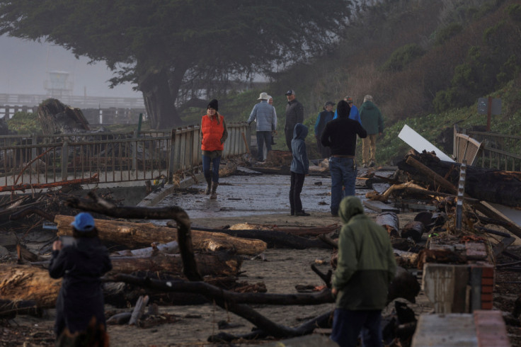
Three low pressure systems are headed toward the West Coast starting Saturday, with heavy rain expected to be focused on flood-engulfed California. The state has been suffering through a series of atmospheric rivers that ushered in heavy rain and floods over the past two weeks.
"A series of three low pressure systems are expected to impact the West Coast" from Jan. 14 through Jan. 18, the National Weather Service's Weather Prediction Center said in a medium-range Hazards Outlook report published Wednesday.
During the said period, heavy rain "will focus over California" before it shifts into the Pacific northwest early next week. "Heavy rain will be a possibility each day of the period in northern California, which could result in significant flooding concerns, the agency noted.
In higher elevations across the Sierra Nevada and southern Cascades, heavy snow is expected throughout the said period.
Ahead of the weekend storms, heavy rain will continue to fall across parts of northern California on Friday evening, the WPC said in a Short Range Forecast Discussion report Wednesday.
"The associated heavy rain will create mainly localized areas of flash flooding, with urban areas, roads, small streams, and burn scars the most vulnerable," the report warned.
The first round of heavy rain Friday is expected to arrive at around 5 a.m., the NWS in the Bay Area said. Another round will hit the state Saturday morning, followed by additional rains Sunday.
Apart from the three systems to enter the West Coast during the weekend, heavy snow is also expected starting Friday afternoon through Tuesday afternoon in California, the NWS in Sacramento said.
Multiple rounds of heavy snow could create dangerous travel conditions Friday afternoon - next Tuesday. Mountain travel is highly discouraged this weekend! If you must travel, plan to be at your destination before 4pm Friday. Little break in snow is expected until Tuesday. #CAwx pic.twitter.com/UD2Mh23rzE
— NWS Sacramento (@NWSSacramento) January 11, 2023
Up to five feet of snow is possible during the said period, along with wind gusts of up to 50 mph. The winter weather is expected to cause major travel delays and significant visibility reduction.
California has been battered by heavy rain since Dec. 26, with several areas posting unprecedented rainfall amounts. In particular, downtown San Francisco logged an astounding 13.6 inches (34.5 cm) of rain from Dec. 26 through Wednesday.
So far, only a few flood-related watches have been issued for the weekend storms, but weather officials urged residents to keep up with updates should new alerts be released during the rainy period.
Rain continues into this evening with new flooding possible in the North Bay. Another impactful system Friday into the weekend with renewed flooding concerns area-wide. Keep up with forecast updates and stay safe! #cawx pic.twitter.com/UFcK7boDle
— NWS Bay Area 🌉 (@NWSBayArea) January 11, 2023
Flood watch effective through noon Sunday:
- Northern Humboldt Coast – Eel River at Fernbridge (river expected to near flood stage of 20 feet Sunday morning)
Flood watch effective through 6 p.m. Sunday:
- Southwestern Mendocino Interior – Navarro River at Navarro (river expected to reach flood stage of 23 feet by late Saturday evening)
Flood watch effective through 10 p.m. Sunday:
- Motherlode, mountains from southwestern Shasta County to western Colusa County, Sacramento Valley, Lassen Park, northeast Foothills, western Plumas County
Flood warning effective until further notice:
- Monterey – Salinas River near Spreckels (river expected to exceed flood stage of 23 feet to 26 feet by Friday afternoon)
Flood warning effective until further notice:
- Sonoma – Mark West Creek, Santa Rosa Creek, Laguna de Santa Rosa, Green Valley Creek and other tributaries feeding into the Russian River
Flood warning effective until further notice:
- Mariposa and Merced
High surf advisory effective through 10 a.m. Saturday:
- San Francisco Peninsula Coast, coastal North Bay including Point Reyes National Seashore, Big Sur Coast, northern and southern Monterey Bay and San Francisco (large breaking waves of up to 20 feet possible)
© Copyright IBTimes 2025. All rights reserved.
- MOST POPULAR IN National


