

Alaska Weather: Flood Warnings Still In Effect After 'Rare And Historic' Bering Sea Storm

KEY POINTS
- The storm caused some residents of Kotzebue to leave their homes due to flooding
- Flood warnings are in effect in areas like the Western Arctic Coast and Selawik Valley
- An atmospheric river is expected to bring heavy rain in two areas through Wednesday
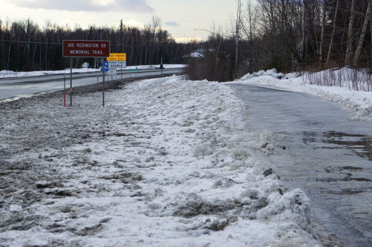
Several flood warnings are still in effect across Alaska following the "rare and historic" Bering Sea storm that pummelled the state throughout the weekend. The National Weather Service (NWS) in Anchorage warned of heavy rainfall to continue through late Wednesday.
The worst has passed and water levels in critical areas are expected to recede through Tuesday afternoon, as per officials, the Alaska Public Media reported.
Talking about the storm that was a remnant of Typhoon Merbok, NWS meteorologist Virginia Rux said, "Merbok was a rare and historic storm for the Bering Sea and Western Alaska," adding that many "coastal communities are still recovering" from the storm's onslaught.
The NWS in Alaska likened the weekend storm to an "uncle that comes over for a few days" and "won't leave" after making a mess.
The storm is the uncle that comes over for a few days, makes a mess, & won't leave. It will sleep on the couch along the northwest coast a few more days, but the worst is over & impacts will continue to fade.
— NWS Alaska Region (@NWSAlaska) September 18, 2022
The brightening on this imagery is the auroa over it last night. 😎 pic.twitter.com/d84LRhL5nX
Officials carried out the damage assessments across the state, and while there were no reports of injuries or deaths related to the storm, the remnants of Merbok left a trail of destruction, as reported by Anchorage Daily News.
Over the weekend, there were reports of telecom outages and damages to infrastructures such as docks, village runways, roads, and buildings, the outlet reported.
In some parts of Fairbanks, the water levels remained high Sunday afternoon, as reported by the NWS.
Water levels remain very high in many communities, but have peaked everywhere except for Point Lay to Utqiagvik where impacts are not expected. The table below shows when we expect water will drop back below the normal high tide line. Winds have also peaked and are calming. #akwx pic.twitter.com/FFx7p3cGjG
— NWS Fairbanks (@NWSFairbanks) September 18, 2022
Merbok was forecasted to be "the strongest storm in over a decade" in Alaska, NWS Fairbanks meteorologist Jonathan Chriest said Friday.
Officials revealed that some residents in Kotzebue had to leave their homes and find shelter elsewhere Saturday evening and into Sunday morning due to flooding. The city of Kotzebue is located in a low-lying area and is the seat of the state's Northwest Arctic Borough.
The following flood-related warnings and watches are still in effect:
Wind Advisory effective through Tuesday morning:
- Eastern Alaska Range
Coastal Flood Warning effective through Monday morning:
- Baldwin Peninsula
- Selawik Valley
Coastal Flood Warning effective through Monday morning:
- Northern Seward Peninsula
- Interior Seward Peninsula
Coastal Flood Warning effective through Monday morning:
- Southern Seward Peninsula Coast
Coastal Flood Warning effective through Monday:
- Eastern Norton Sound
- Nulato Hills
Coastal Flood Warning effective through Monday:
- St. Lawrence Island
- Bering Strait Coast
Coastal Flood Warning effective through noon Monday:
- Chukchi Sea Coast
Coastal Flood Warning effective through Monday afternoon:
- Western Arctic Coast
A Flood Watch has been issued for Eastern Prince William Sound and the Copper River Basin as an atmospheric river is forecast to bring heavy rainfall to the region late Mon night through late Wed night. Stay tuned for updates! #akwx pic.twitter.com/A6EYp46baD
— NWS Anchorage (@NWSAnchorage) September 19, 2022
Meanwhile, the NWS in Anchorage issued a Flood Watch for the Eastern Prince William Sound and the Copper River Basin that takes effect from late Monday through late Wednesday as an atmospheric river is expected to bring heavy rainfall in the said areas.
According to the National Oceanic and Atmospheric Administration (NOAA), atmospheric rivers are "like rivers in the sky" that carry water vapor levels equivalent to "the flow of water at the mouth of the Mississippi River."
Atmospheric rivers often release water vapors in the form of snow or rain, the NOAA said.
© Copyright IBTimes 2025. All rights reserved.
- MOST POPULAR IN National


