

Extreme Weather 2019: Nestor Drops Heavy Rain On North Carolina
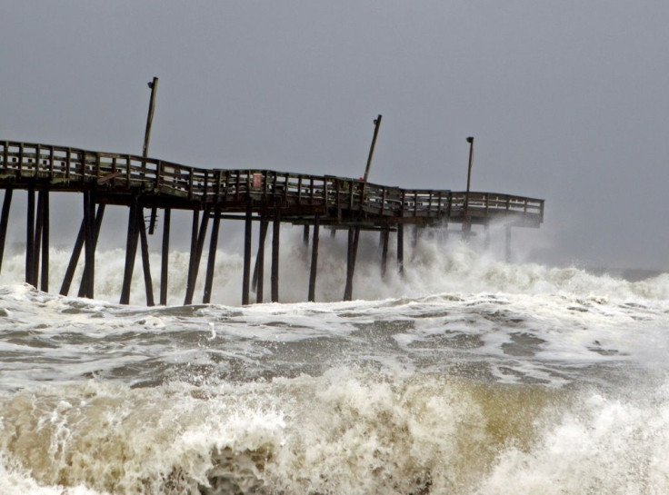
Former Tropical Storm Nestor moved through central North Carolina overnight, dropping heavy rains as it moved east. No significant damage was reported but roads were said to be hazardous.
Nestor on Sunday morning moved east out of the Carolinas and into the Atlantic Ocean. North Carolina is expected to see some rain as the day wears on with sun breaking by midday, according to WTVD, an ABC affiliate in Durham, North Carolina.
Nestor was downgraded from a Tropical Storm on Saturday. This came after a tornado spawned in central Florida and damaged several houses. There were also reports of uprooted trees and overturned vehicles as it made its way from the Florida Panhandle to the Gulf of Mexico.
The National Hurricane Center reported the change after Nestor lost its shape, reclassifying it as a post-tropical cyclone.
Wind speeds reached 25-30 miles per hour in the early morning hours, with stronger winds near the coast. Rainfall was forecast to reach 1-3 inches.
Brief tornadoes were also predicted as a small possibility, but as of Sunday afternoon none have been reported.
Damage to the Florida Panhandle comes after Hurricane Michael wreaked havoc on the region in October 2018.
© Copyright IBTimes 2025. All rights reserved.
- MOST POPULAR IN National


